
| Memorials | : | 1 |
| Location | : | Carr Township, Jackson County, USA |
| Coordinate | : | 38.8325005, -86.2102966 |
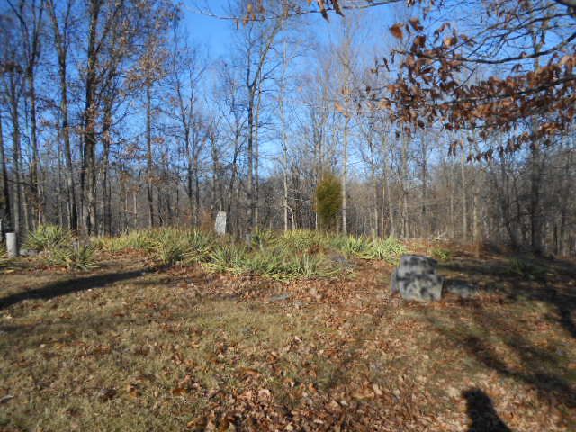
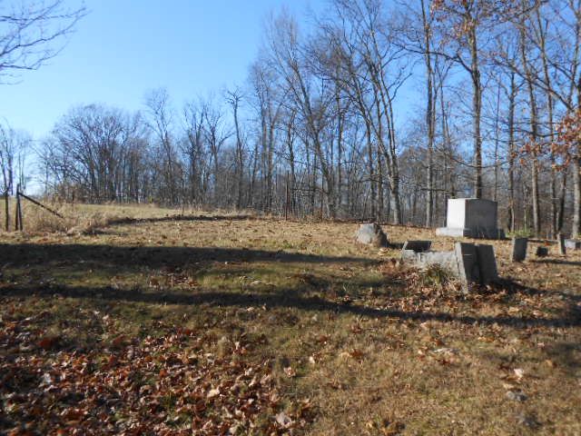
| Description | : | The cemetery is located in Carr Township (SE quadrant of the SW quadrant of the SE quadrant of Section 30 Township 5N Range 3E) about 500 feet east of Brick Plant Road (S County Road 940 W) about 300 feet north of its intersection with W County Road 300 S. Indiana Cemetery Locations, Volume 4, published by the Indiana Genealogical Society (April 2009), gives the primary cemetery name as Hinderlider Cemetery #1 with an alternate name of Rucker Cemetery. The cemetery is listed in the Cemetery and Burial Grounds Registry of the Indiana Department of Natural Resources (DNR)... Read More |
frequently asked questions (FAQ):
-
Where is Hinderlider Cemetery?
Hinderlider Cemetery is located at Brick Plant Road (S County Road 940 W) Carr Township, Jackson County ,Indiana , 47260USA.
-
Hinderlider Cemetery cemetery's updated grave count on graveviews.com?
0 memorials
-
Where are the coordinates of the Hinderlider Cemetery?
Latitude: 38.8325005
Longitude: -86.2102966
Nearby Cemetories:
1. Wright Cemetery
Medora, Jackson County, USA
Coordinate: 38.8371000, -86.2112000
2. Shoemaker Cemetery
Medora, Jackson County, USA
Coordinate: 38.8269005, -86.2078018
3. Weddleville Lutheran Cemetery
Weddleville, Jackson County, USA
Coordinate: 38.8392240, -86.2184750
4. Peck Cemetery #1
Jackson County, USA
Coordinate: 38.8414000, -86.2186000
5. Weddleville Cemetery
Weddleville, Jackson County, USA
Coordinate: 38.8377230, -86.2235890
6. Round Top Cemetery
Medora, Jackson County, USA
Coordinate: 38.8132100, -86.2050800
7. Lanning Spur Cemetery
Medora, Jackson County, USA
Coordinate: 38.8236008, -86.1808014
8. Holmes Cemetery
Medora, Jackson County, USA
Coordinate: 38.8325005, -86.1763992
9. Gallion Cemetery
Brownstown, Jackson County, USA
Coordinate: 38.8602680, -86.2116620
10. Old Pleasantville Cemetery
Weddleville, Jackson County, USA
Coordinate: 38.8623000, -86.2102000
11. Brown Cemetery
Jackson County, USA
Coordinate: 38.8115150, -86.2563070
12. White River Valley Cemetery
Medora, Jackson County, USA
Coordinate: 38.8543500, -86.1550000
13. Goss Cemetery
Medora, Jackson County, USA
Coordinate: 38.8541985, -86.1536026
14. Zollman Cemetery
Medora, Jackson County, USA
Coordinate: 38.8546982, -86.1530991
15. Wrays Church Cemetery
Brownstown, Jackson County, USA
Coordinate: 38.8819300, -86.2198000
16. Heighton Hill Cemetery
Medora, Jackson County, USA
Coordinate: 38.8539009, -86.1519012
17. Beem Heighten Hill Cemetery
Medora, Jackson County, USA
Coordinate: 38.8546982, -86.1511002
18. Stewart Cemetery
Sparksville, Jackson County, USA
Coordinate: 38.7813988, -86.2238998
19. George Canner Cemetery
Medora, Jackson County, USA
Coordinate: 38.8823050, -86.1862510
20. Lindley Cemetery
Brownstown, Jackson County, USA
Coordinate: 38.8821700, -86.1847500
21. Granny White Cemetery
Leesville, Lawrence County, USA
Coordinate: 38.8473060, -86.2803500
22. Sparks Cemetery
Sparksville, Jackson County, USA
Coordinate: 38.7829000, -86.2459000
23. Leesville Cemetery
Leesville, Lawrence County, USA
Coordinate: 38.8437670, -86.2826470
24. Proctor Cemetery
Fort Ritner, Lawrence County, USA
Coordinate: 38.8019257, -86.2783356