
| Memorials | : | 1 |
| Location | : | Libby, Aitkin County, USA |
| Coordinate | : | 46.7872600, -93.3204100 |
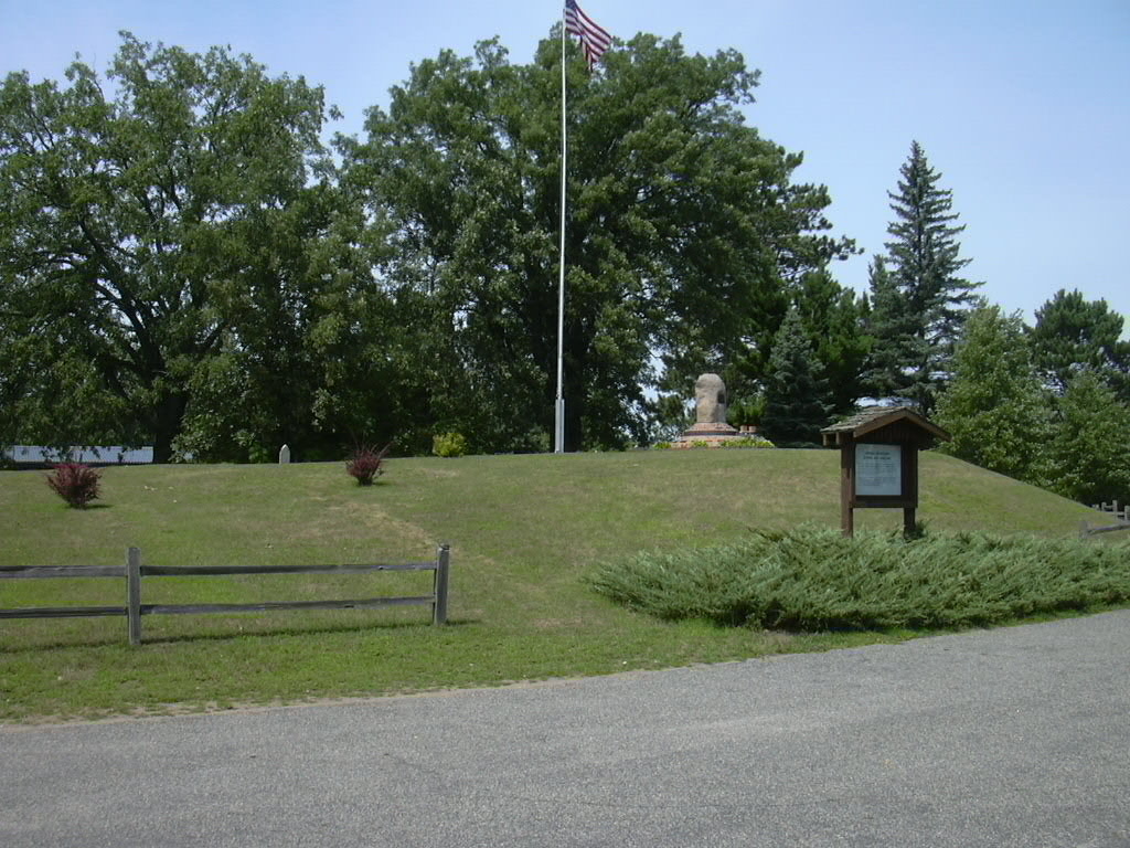
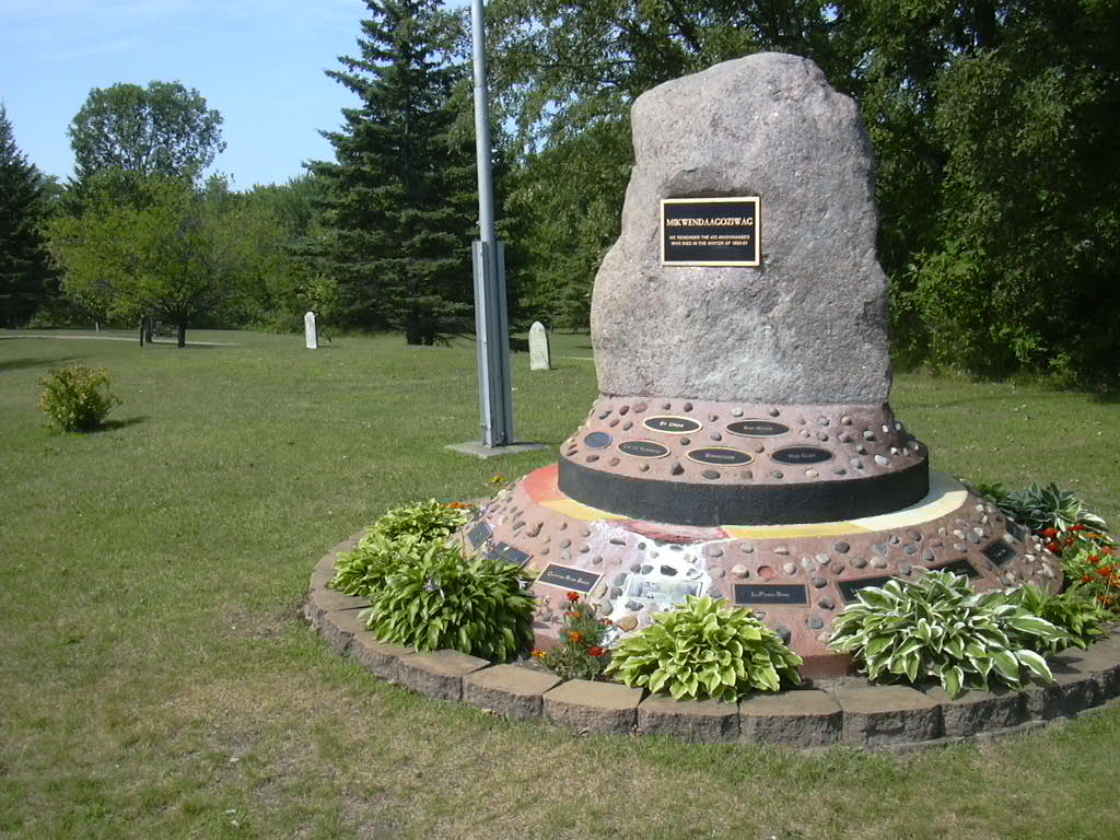
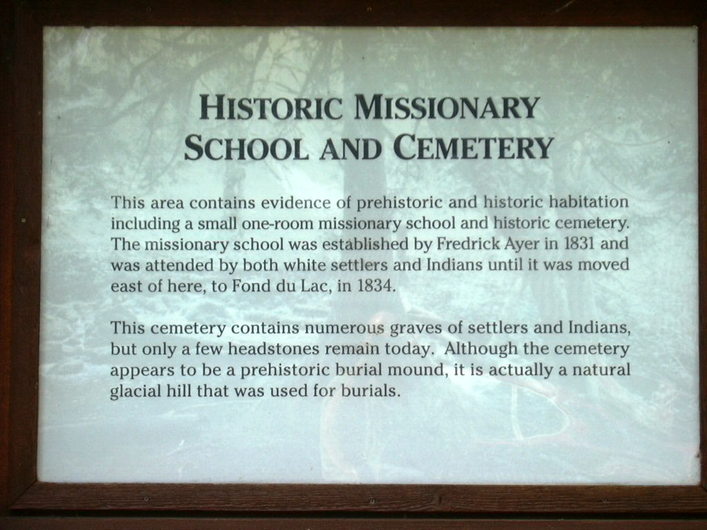
| Description | : | Enter at the south entrance to Big Sandy Lake Recreation Area. The cemetery is just before you get to the dam and is across from the office. The cemetery contains just two markers, but also includes a large Memorial to the 400 Ojibwe Indians, who died in the winter of 1850-1851. For more information about this tragedy go to that Memorial listed in this cemetery. |
frequently asked questions (FAQ):
-
Where is Historic Missionary Cemetery and Indian Memorial?
Historic Missionary Cemetery and Indian Memorial is located at Office of the Big Sandy Lake Recreation Area Libby, Aitkin County ,Minnesota ,USA.
-
Historic Missionary Cemetery and Indian Memorial cemetery's updated grave count on graveviews.com?
1 memorials
-
Where are the coordinates of the Historic Missionary Cemetery and Indian Memorial?
Latitude: 46.7872600
Longitude: -93.3204100
Nearby Cemetories:
1. Pine Needle Cemetery
McGregor, Aitkin County, USA
Coordinate: 46.7119580, -93.2962760
2. Lakeview Cemetery
Aitkin County, USA
Coordinate: 46.7099991, -93.3516998
3. Verdon Cemetery
Aitkin County, USA
Coordinate: 46.8888900, -93.3736100
4. Round Lake Cemetery
Aitkin County, USA
Coordinate: 46.7040000, -93.2064000
5. Hebron Cemetery
Aitkin County, USA
Coordinate: 46.8260994, -93.5168991
6. Pine Grove Cemetery
Aitkin County, USA
Coordinate: 46.6940002, -93.5270004
7. Ball Bluff Cemetery
Ball Bluff, Aitkin County, USA
Coordinate: 46.9550018, -93.2689972
8. Grayling Cemetery
Aitkin County, USA
Coordinate: 46.6227989, -93.2149963
9. Lansford Cemetery
Aitkin County, USA
Coordinate: 46.6091995, -93.3953018
10. Union Woodland Cemetery
McGregor, Aitkin County, USA
Coordinate: 46.5988998, -93.3007965
11. Tamarack Cemetery
Tamarack, Aitkin County, USA
Coordinate: 46.6372500, -93.1513500
12. Fairview Cemetery
Tamarack, Aitkin County, USA
Coordinate: 46.6371994, -93.1513977
13. Carr Memorial Annex
McGregor, Aitkin County, USA
Coordinate: 46.5971985, -93.2992020
14. Waukenabo Cemetery
Waukenabo, Aitkin County, USA
Coordinate: 46.7393990, -93.6035995
15. Fleming Lake Cemetery
Aitkin County, USA
Coordinate: 46.6314011, -93.5056000
16. Prairie Lake Cemetery
St. Louis County, USA
Coordinate: 46.7811012, -92.9989014
17. Sheriff Lake Cemetery
Aitkin County, USA
Coordinate: 46.5856018, -93.1844025
18. Macville Cemetery
Swatara, Aitkin County, USA
Coordinate: 46.8958015, -93.6128006
19. Shovel Lake Cemetery
Palisade, Aitkin County, USA
Coordinate: 46.5751000, -93.4568000
20. Salo Cemetery
Aitkin County, USA
Coordinate: 46.5772018, -93.1746979
21. Lakeside Cemetery
Wright, Carlton County, USA
Coordinate: 46.6377983, -93.0475006
22. Wright Public Cemetery
Wright, Carlton County, USA
Coordinate: 46.6702500, -93.0091600
23. Saint Mary's Catholic Cemetery
Wright, Carlton County, USA
Coordinate: 46.6736100, -93.0015700
24. Violet Cemetery
Wright, Carlton County, USA
Coordinate: 46.6794014, -92.9953003