
| Memorials | : | 0 |
| Location | : | Posey Township, Franklin County, USA |
| Coordinate | : | 39.4677320, -85.2849030 |
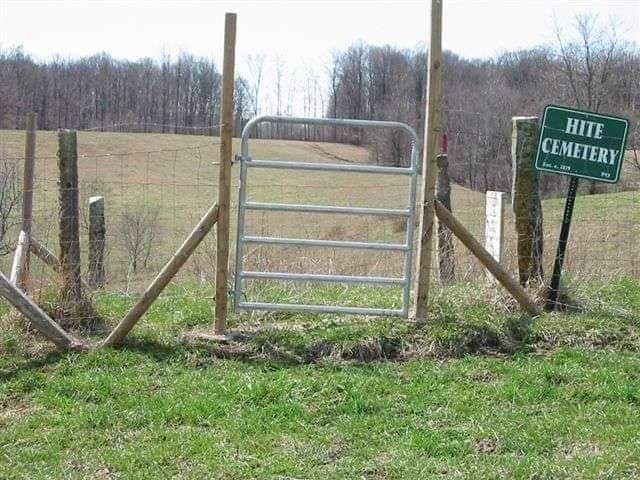
| Description | : | The cemetery is located in Posey Township about 200 feet south of W Chapel Road about 0.3 miles east of its intersection with Buena Vista Road. The cemetery is located on private property, The cemetery was restored by the Cemetery Commission in 2008. Indiana Cemetery Locations, Volume 4, published by the Indiana Genealogical Society (April 2009), gives the primary cemetery name as Hite Cemetery. The cemetery is listed in the Cemetery and Burial Grounds Registry of the Indiana Department of Natural Resources (DNR) and in the State Historical Architectural and Archaeological Research Database (SHAARD) with Cemetery Record Number CR-24-150 (Hite). The cemetery (Hite... Read More |
frequently asked questions (FAQ):
-
Where is Hite Cemetery?
Hite Cemetery is located at 27044 W Chapel Road Posey Township, Franklin County ,Indiana , 46173USA.
-
Hite Cemetery cemetery's updated grave count on graveviews.com?
0 memorials
-
Where are the coordinates of the Hite Cemetery?
Latitude: 39.4677320
Longitude: -85.2849030
Nearby Cemetories:
1. Chapel Cemetery
Midway, Franklin County, USA
Coordinate: 39.4674500, -85.2586490
2. Faurote Cemetery
Lake View, Franklin County, USA
Coordinate: 39.4708000, -85.2550000
3. Hopewell Cemetery
Richland, Rush County, USA
Coordinate: 39.4743004, -85.3173676
4. Bowler-Jolliff-Miller-Pugh Cemetery
Clarksburg, Decatur County, USA
Coordinate: 39.4457817, -85.3062820
5. Holley Cemetery
Buena Vista, Franklin County, USA
Coordinate: 39.4378000, -85.2797000
6. Old Brick Cemetery
Andersonville, Franklin County, USA
Coordinate: 39.4996986, -85.2791977
7. Pruet Cemetery
Buena Vista, Franklin County, USA
Coordinate: 39.4412790, -85.2596160
8. African American Cemetery
Fugit Township, Decatur County, USA
Coordinate: 39.4478000, -85.3250000
9. Little Salt Creek Cemetery
Rush County, USA
Coordinate: 39.5121994, -85.2992020
10. Simpson Cemetery
Midway, Franklin County, USA
Coordinate: 39.4466000, -85.2284000
11. Stipps Hill Cemetery
Franklin County, USA
Coordinate: 39.4364014, -85.2253036
12. Clarksburg Cemetery
Clarksburg, Decatur County, USA
Coordinate: 39.4338989, -85.3450928
13. Hilltop Cemetery
Orange, Fayette County, USA
Coordinate: 39.5314000, -85.2558000
14. Richland Cemetery
Richland, Rush County, USA
Coordinate: 39.4968910, -85.3683167
15. Coulter Cemetery
Metamora, Franklin County, USA
Coordinate: 39.4368500, -85.2009500
16. Carpenter Cemetery
Orange, Fayette County, USA
Coordinate: 39.5416380, -85.2722640
17. Jenks Cemetery
Laurel, Franklin County, USA
Coordinate: 39.4827995, -85.1892014
18. Memorial Cemetery
Decatur County, USA
Coordinate: 39.3964005, -85.3206024
19. Old Richland Methodist Cemetery
Richland, Rush County, USA
Coordinate: 39.4981003, -85.3775024
20. Bowman Cemetery
Salt Creek Township, Franklin County, USA
Coordinate: 39.4127998, -85.2136002
21. Coon Cemetery
Orange, Fayette County, USA
Coordinate: 39.5475160, -85.2777310
22. Coshow Cemetery
Orange, Fayette County, USA
Coordinate: 39.5453500, -85.2532200
23. Saint Raphael Cemetery
Laurel, Franklin County, USA
Coordinate: 39.5042750, -85.1878510
24. Pinhook Cemetery
Noble Township, Rush County, USA
Coordinate: 39.5477090, -85.3171080