
| Memorials | : | 0 |
| Location | : | Mount Jefferson, Lee County, USA |
| Coordinate | : | 32.7018100, -85.3695000 |
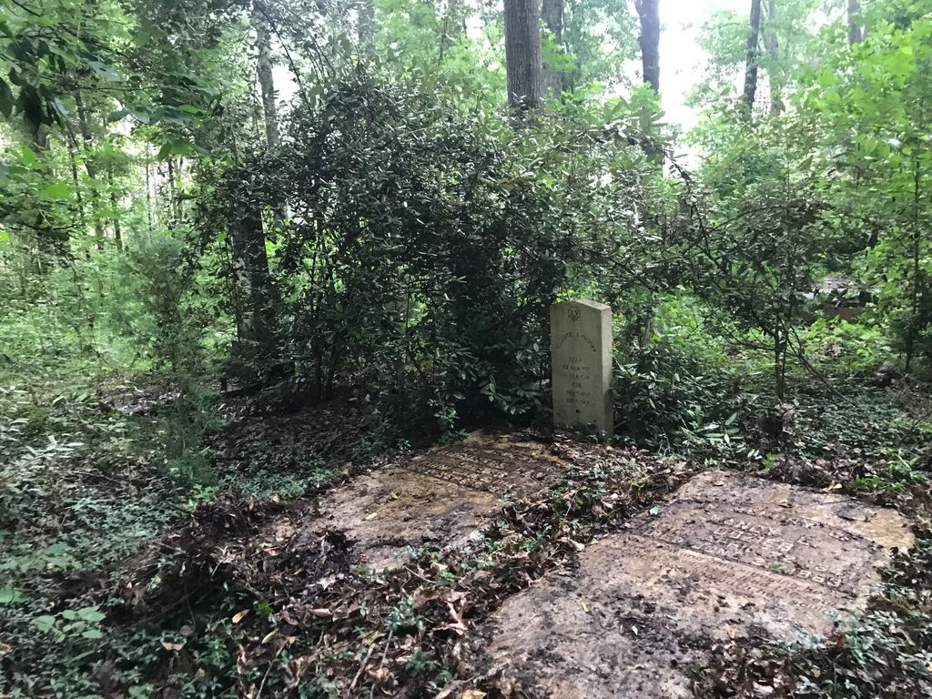
| Description | : | SW 1/4 SW 1/4 Section 20, Township 20N Range 27 E - 3.8 miles north of Opelika and .25 miles south, southeast of Mt Jefferson Junction. Recorded May 30, 1995 by R McNutt and E Ward. This Cemetery is in a large grove of hardwood trees and in 1995 was surrounded by a pasture. It was in poor condition due to undergrowth of briars and bushes plus cattle having access to the area of shade. It receives no care. This was the plantation cemetery of John Hodges and contains many unmarked graves. Two African American Churches, St Mark and Union Hill, members... Read More |
frequently asked questions (FAQ):
-
Where is Hodge Cemetery?
Hodge Cemetery is located at Mount Jefferson, Lee County ,Alabama ,USA.
-
Hodge Cemetery cemetery's updated grave count on graveviews.com?
0 memorials
-
Where are the coordinates of the Hodge Cemetery?
Latitude: 32.7018100
Longitude: -85.3695000

Nearby Cemetories:
1. Scott Cemetery
Lee County, USA
Coordinate: 32.7069016, -85.3589020
2. Union Hill CME Church Cemetery
Opelika, Lee County, USA
Coordinate: 32.7376660, -85.3861730
3. Graham Cemetery
Lee County, USA
Coordinate: 32.6686950, -85.3430200
4. Ross Cemetery
Opelika, Lee County, USA
Coordinate: 32.6680984, -85.3964005
5. Liberty Baptist Church Cemetery
Lee County, USA
Coordinate: 32.6758003, -85.3242035
6. Bethel #1 Missionary Baptist Church Cemetery
Opelika, Lee County, USA
Coordinate: 32.6725700, -85.3260900
7. Caldwell Cemetery
Chambers County, USA
Coordinate: 32.7569008, -85.3794022
8. Robertson Cemetery
Chambers County, USA
Coordinate: 32.7606010, -85.3664017
9. Galilee Missionary Baptist Church Cemetery
Chambers County, USA
Coordinate: 32.7591600, -85.3524530
10. Flint Hill Cemetery
Chambers County, USA
Coordinate: 32.7578783, -85.3463010
11. Flat Rock Baptist Church Cemetery
Lee County, USA
Coordinate: 32.7159010, -85.4380880
12. Allen Cemetery
Opelika, Lee County, USA
Coordinate: 32.7425000, -85.4233330
13. Fitten Chapel AME Zion Church Cemetery
Lee County, USA
Coordinate: 32.6934210, -85.4416610
14. Shady Grove Community Cemetery
Opelika, Lee County, USA
Coordinate: 32.6939011, -85.2917023
15. Dowdell Cemetery
Oak Bowery, Chambers County, USA
Coordinate: 32.7464964, -85.4294964
16. Mount Zion AME Church Cemetery
Opelika, Lee County, USA
Coordinate: 32.6947215, -85.2887321
17. Rosemere Cemetery
Opelika, Lee County, USA
Coordinate: 32.6343994, -85.3882980
18. Evergreen Cemetery
Opelika, Lee County, USA
Coordinate: 32.6330986, -85.3955994
19. Saint Luke CME Church Cemetery
Lafayette, Chambers County, USA
Coordinate: 32.7480720, -85.4368260
20. City Cemetery
Opelika, Lee County, USA
Coordinate: 32.6285210, -85.3934030
21. Oak Bowery Cemetery
Chambers County, USA
Coordinate: 32.7453003, -85.4436035
22. Old Lebanon Methodist Church Cemetery
Opelika, Lee County, USA
Coordinate: 32.6253250, -85.3672350
23. Pleasant Grove Baptist Church Cemetery
Opelika, Lee County, USA
Coordinate: 32.6286011, -85.3375015
24. Garden Hills Cemetery
Opelika, Lee County, USA
Coordinate: 32.6264000, -85.3957977