
| Memorials | : | 0 |
| Location | : | Leroy, Bradford County, USA |
| Coordinate | : | 41.0671529, -76.7036090 |
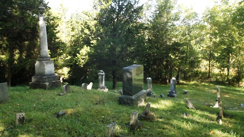
| Description | : | Holcomb Cemetery is governed by the Leroy Township Supervisors. Directions to the site are: From Leroy, turn onto Mill Street, which is the street next to Leroy General Store. Follow Mill Street until reaching the intersection of Southside Road [SR 3008], turn left and the cemetery is situated about one hundred yards ahead, and on the left side of the highway. It is set back, alongside a creek, and may appear to be in a private back yard, but a right of way exists back to the cemetery. There are unmarked graves and some marked only with field stones. A number of stones with... Read More |
frequently asked questions (FAQ):
-
Where is Holcomb Cemetery?
Holcomb Cemetery is located at Southside Road (State Route 3008) Leroy, Bradford County ,Pennsylvania , 17724USA.
-
Holcomb Cemetery cemetery's updated grave count on graveviews.com?
0 memorials
-
Where are the coordinates of the Holcomb Cemetery?
Latitude: 41.0671529
Longitude: -76.7036090
Nearby Cemetories:
1. Washingtonville Lutheran Cemetery
Washingtonville, Montour County, USA
Coordinate: 41.0544701, -76.6760330
2. Washingtonville Old Methodist Cemetery
Washingtonville, Montour County, USA
Coordinate: 41.0515099, -76.6737747
3. Limestone Mennonite Cemetery
Milton, Northumberland County, USA
Coordinate: 41.0501990, -76.7379100
4. Beaver Run Mennonite Cemetery
Montour County, USA
Coordinate: 41.0626000, -76.7458000
5. Strawberry Ridge Cemetery
Strawberry Ridge, Montour County, USA
Coordinate: 41.0753000, -76.6516000
6. Madden Cemetery
Montour County, USA
Coordinate: 41.0277824, -76.6882401
7. Saint James Episcopal Church Cemetery
Exchange, Montour County, USA
Coordinate: 41.1126000, -76.6916000
8. Billmeyer Cemetery
Washingtonville, Montour County, USA
Coordinate: 41.0217018, -76.7225037
9. Paradise Cemetery
Northumberland County, USA
Coordinate: 41.0519000, -76.7780000
10. Montour Amish Cemetery
Turbotville, Northumberland County, USA
Coordinate: 41.1198840, -76.7415080
11. Oak Grove Cemetery
Montour County, USA
Coordinate: 41.0076000, -76.7188000
12. Derry Presbyterian Cemetery
White Hall, Montour County, USA
Coordinate: 41.0984344, -76.6320877
13. Turbotville Cemetery
Turbotville, Northumberland County, USA
Coordinate: 41.1086400, -76.7668570
14. Union Church Lutheran Reformed Church Cemetery
Turbotville, Northumberland County, USA
Coordinate: 41.1021996, -76.7761002
15. Fisher’s Cemetery
Derry Township, Montour County, USA
Coordinate: 41.0674670, -76.6170670
16. Saint James Cemetery
Montour County, USA
Coordinate: 41.1286011, -76.6710968
17. Hendrickson Cemetery
Danville, Montour County, USA
Coordinate: 41.0228000, -76.6323000
18. Follmer Lutheran Church Cemetery
Milton, Northumberland County, USA
Coordinate: 41.0292000, -76.7822000
19. White Hall Cemetery
Montour County, USA
Coordinate: 41.1186000, -76.6390000
20. Upper West Chillisquaque Cemetery
Mexico, Montour County, USA
Coordinate: 41.0148773, -76.7729797
21. Chillisquaque Cemetery
Mexico, Montour County, USA
Coordinate: 41.0121994, -76.7733002
22. Fort Freeland Cemetery
Turbotville, Northumberland County, USA
Coordinate: 41.1023720, -76.7963640
23. Mooresburg United Methodist Church Cemetery
Mooresburg, Montour County, USA
Coordinate: 40.9844971, -76.7057724
24. Mooresburg Presbyterian Church Cemetery
Danville, Montour County, USA
Coordinate: 40.9833920, -76.7076680