
| Memorials | : | 0 |
| Location | : | Canton de Luxembourg, Luxembourg |
| Coordinate | : | 49.5990010, 6.1140530 |
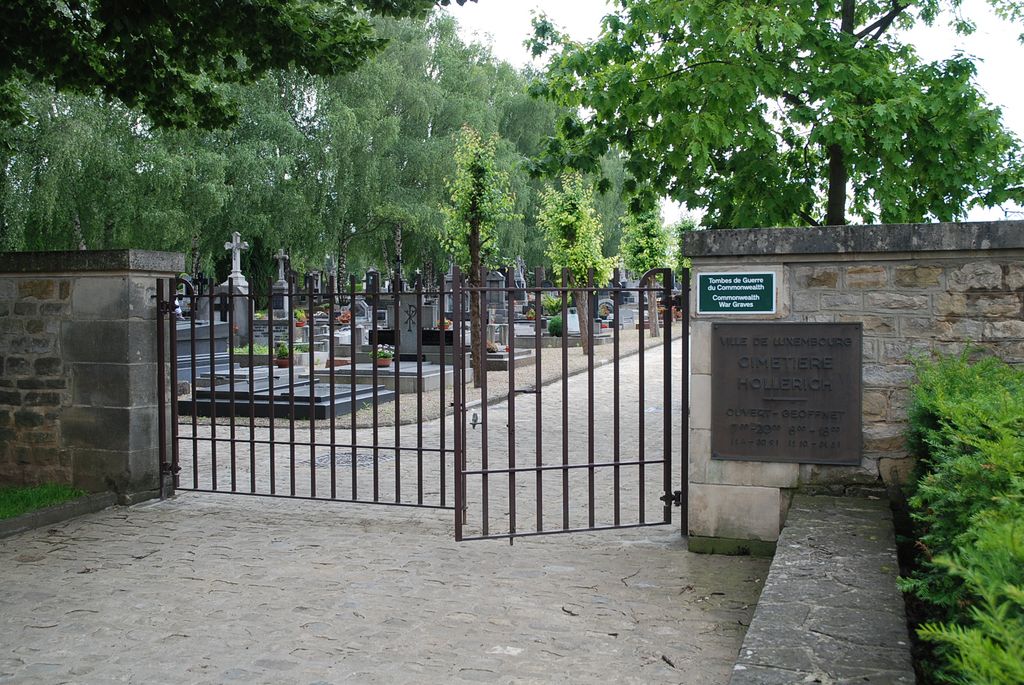
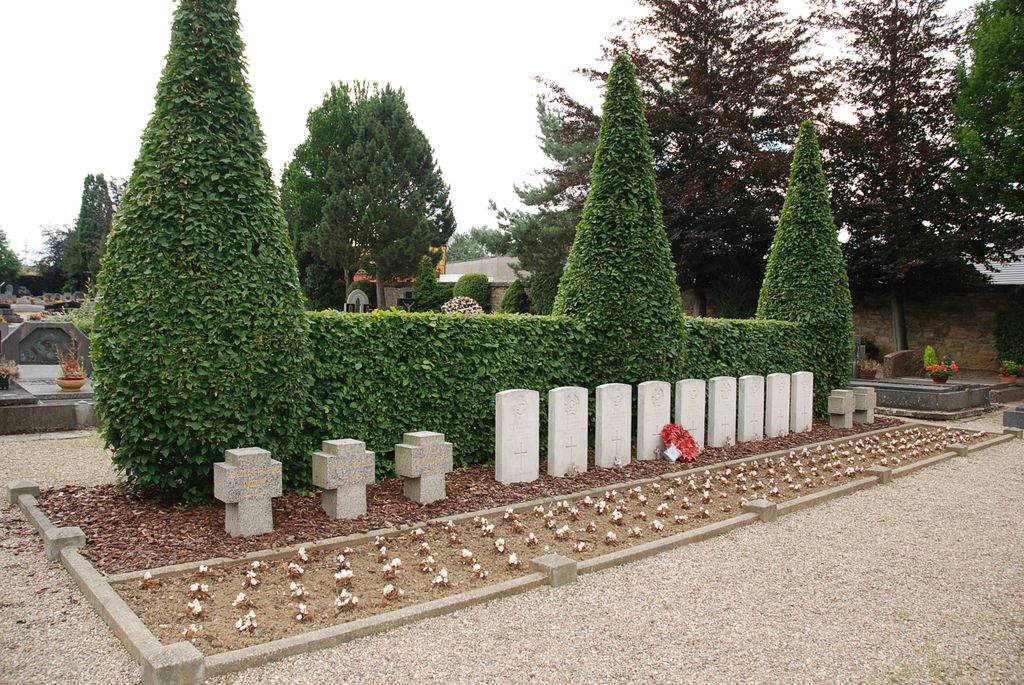
| Description | : | Hollerich is about 2 kilometres west of Luxembourg station, on the road to Bettembourg. The cemetery is about 450 metres north-west of Hollerich church, on Rue de Bouillon, opposite a large road junction. The Commonwealth war graves are located in the north-west part of the cemetery. |
frequently asked questions (FAQ):
-
Where is Hollerich Communal Cemetery?
Hollerich Communal Cemetery is located at south-western Luxembourg City, Canton de Luxembourg ,Luxembourg ,Luxembourg.
-
Hollerich Communal Cemetery cemetery's updated grave count on graveviews.com?
0 memorials
-
Where are the coordinates of the Hollerich Communal Cemetery?
Latitude: 49.5990010
Longitude: 6.1140530
Nearby Cemetories:
1. Cathedral of Our Lady
Luxembourg, Canton de Luxembourg, Luxembourg
Coordinate: 49.6095350, 6.1315830
2. Cimetiere de Merl
Luxembourg, Canton de Luxembourg, Luxembourg
Coordinate: 49.6123400, 6.0975700
3. Cimetière de Notre Dame
Canton de Luxembourg, Luxembourg
Coordinate: 49.6156600, 6.1204700
4. Cimetière des Bons Malades
Canton de Luxembourg, Luxembourg
Coordinate: 49.6208310, 6.1328820
5. Cimetière Malakoff
Canton de Luxembourg, Luxembourg
Coordinate: 49.6171600, 6.1445300
6. Strassen
Strassen, Canton de Luxembourg, Luxembourg
Coordinate: 49.6175120, 6.0700370
7. Saints-Pierre-et-Paul
Bertrange, Canton de Luxembourg, Luxembourg
Coordinate: 49.6109427, 6.0577169
8. Cimetiere de Hamm
Hamm, Canton de Luxembourg, Luxembourg
Coordinate: 49.6140023, 6.1774296
9. Luxembourg American Cemetery and Memorial
Hamm, Canton de Luxembourg, Luxembourg
Coordinate: 49.6114300, 6.1857600
10. Sandweiler German War Cemetery
Sandweiler, Canton de Luxembourg, Luxembourg
Coordinate: 49.6093200, 6.2050010
11. Cimetière de Bridel
Bridel, Canton de Capellen, Luxembourg
Coordinate: 49.6555900, 6.0765800
12. Mamer
Mamer, Canton de Capellen, Luxembourg
Coordinate: 49.6251120, 6.0138990
13. Kehlen
Kehlen, Canton de Capellen, Luxembourg
Coordinate: 49.6713150, 6.0443040
14. Cimetiere de Nospelt
Nospelt, Canton de Capellen, Luxembourg
Coordinate: 49.6739662, 6.0074374
15. Schouweiler
Schouweiler, Canton de Capellen, Luxembourg
Coordinate: 49.5828520, 5.9558340
16. Cimeteière d'Aspelt
Aspelt, Canton d'Esch-sur-Alzette, Luxembourg
Coordinate: 49.5214779, 6.2229488
17. Garnich
Garnich, Canton de Capellen, Luxembourg
Coordinate: 49.6128790, 5.9486460
18. Cimetière de Dalheim
Dalheim, Canton de Remich, Luxembourg
Coordinate: 49.5414918, 6.2601705
19. Cimetière de Dudelange
Dudelange, Canton d'Esch-sur-Alzette, Luxembourg
Coordinate: 49.4838670, 6.0814950
20. Cimetière de Waldbredimus
Waldbredimus, Canton de Remich, Luxembourg
Coordinate: 49.5553071, 6.2833588
21. Cimetiere de Koerich
Koerich, Canton de Capellen, Luxembourg
Coordinate: 49.6683130, 5.9502520
22. Ancien cimetière Altwies
Altwies, Canton de Remich, Luxembourg
Coordinate: 49.5109686, 6.2546205
23. Gonderange
Gonderange, Canton de Grevenmacher, Luxembourg
Coordinate: 49.6921080, 6.2475330
24. Greisch Cemetery
Greisch, Canton de Capellen, Luxembourg
Coordinate: 49.7086980, 5.9888040