
| Memorials | : | 0 |
| Location | : | Fullers Crossroads, Crenshaw County, USA |
| Coordinate | : | 31.8334400, -86.3112800 |
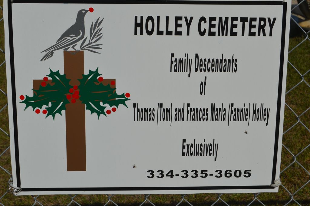
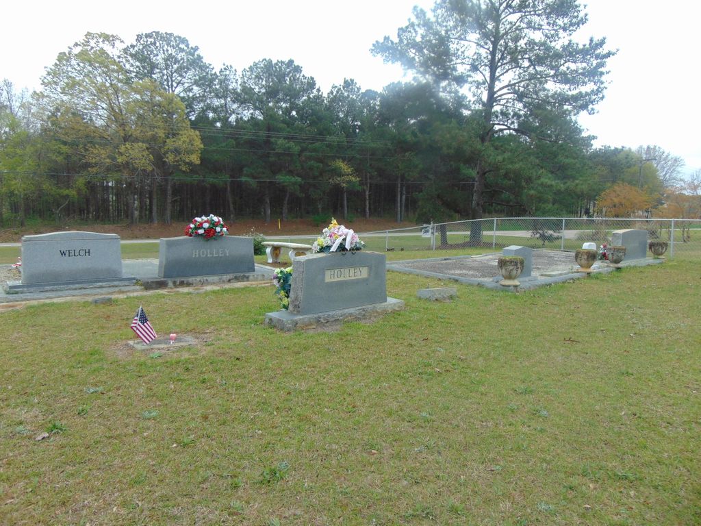
| Description | : | Holley Family Cemetery is located on Hwy.331 North of Luverne,Alabama. and adjacent to the Mt. Pleasant Church of Christ in Crenshaw Co AL.,on the North side of the Church |
frequently asked questions (FAQ):
-
Where is Holley Family Cemetery?
Holley Family Cemetery is located at Fullers Crossroads, Crenshaw County ,Alabama ,USA.
-
Holley Family Cemetery cemetery's updated grave count on graveviews.com?
0 memorials
-
Where are the coordinates of the Holley Family Cemetery?
Latitude: 31.8334400
Longitude: -86.3112800


Nearby Cemetories:
1. Mount Pleasant Cemetery
Fullers Crossroads, Crenshaw County, USA
Coordinate: 31.8321991, -86.3114014
2. Thompson Cemetery
Fullers Crossroads, Crenshaw County, USA
Coordinate: 31.8460999, -86.3011017
3. Old Providence Cemetery
Fullers Crossroads, Crenshaw County, USA
Coordinate: 31.8412830, -86.2762720
4. Lowery Cemetery
Saville, Crenshaw County, USA
Coordinate: 31.8272300, -86.3528500
5. Sweetwater Church Cemetery
Saville, Crenshaw County, USA
Coordinate: 31.8328991, -86.3543015
6. Mitchell Cemetery
Saville, Crenshaw County, USA
Coordinate: 31.8689003, -86.3371964
7. Longs Chapel Cemetery
Rutledge, Crenshaw County, USA
Coordinate: 31.7962780, -86.3357060
8. Old Saville Churchyard Cemetery
Saville, Crenshaw County, USA
Coordinate: 31.8717390, -86.3356370
9. Springhill Church Of Christ Cemetery
Garnersville, Crenshaw County, USA
Coordinate: 31.8764750, -86.2817840
10. Daniel Family Cemetery
Saville, Crenshaw County, USA
Coordinate: 31.8650520, -86.3637050
11. Live Oak Cemetery
Live Oak, Crenshaw County, USA
Coordinate: 31.8113995, -86.2510986
12. Arlena Church Cemetery
Garnersville, Crenshaw County, USA
Coordinate: 31.8678260, -86.2591240
13. Mount Zion United Methodist Cemetery Old Lodge
Honoraville, Crenshaw County, USA
Coordinate: 31.8401940, -86.3771030
14. Rock Hill Church of Christ Church Cemetery
Rutledge, Crenshaw County, USA
Coordinate: 31.7736670, -86.3322280
15. Vernledge Cemetery
Vernledge, Crenshaw County, USA
Coordinate: 31.7724991, -86.2932968
16. Buck's Graveyard
Sardis, Crenshaw County, USA
Coordinate: 31.8967300, -86.3128900
17. Pleasant Hill AME Church Cemetery
Vernledge, Crenshaw County, USA
Coordinate: 31.7719002, -86.2910995
18. Gravel Hill Baptist Church Cemetery
Center Ridge, Crenshaw County, USA
Coordinate: 31.8039290, -86.3817390
19. Sipper Family Graveyard
Center Ridge, Crenshaw County, USA
Coordinate: 31.8030800, -86.3818100
20. Sardis Cemetery
Magnolia Shores, Crenshaw County, USA
Coordinate: 31.9013996, -86.3153000
21. El Bethel Christian Church Cemetery
Bradleyton, Crenshaw County, USA
Coordinate: 31.8954080, -86.2769350
22. Centenary Assembly of God Church Cemetery
Crenshaw County, USA
Coordinate: 31.7747002, -86.3649979
23. Lightfoot Cemetery
Rutledge, Crenshaw County, USA
Coordinate: 31.7518997, -86.3210983
24. El Bethel Pentecostal Church Cemetery
Centenary, Crenshaw County, USA
Coordinate: 31.7768060, -86.3820840