| Memorials | : | 108 |
| Location | : | Knox County, USA |
| Coordinate | : | 42.7731018, -97.7489014 |
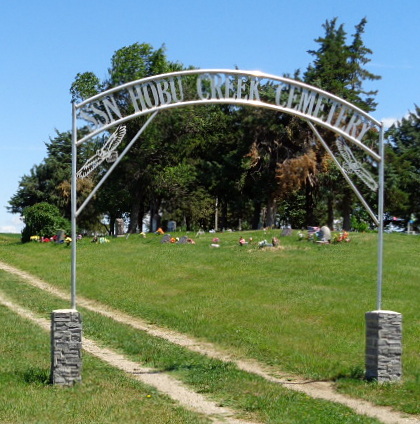
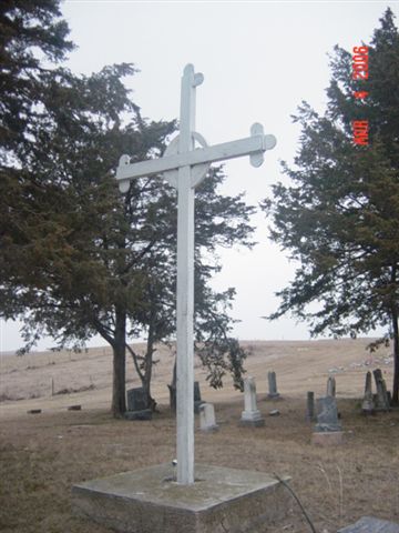
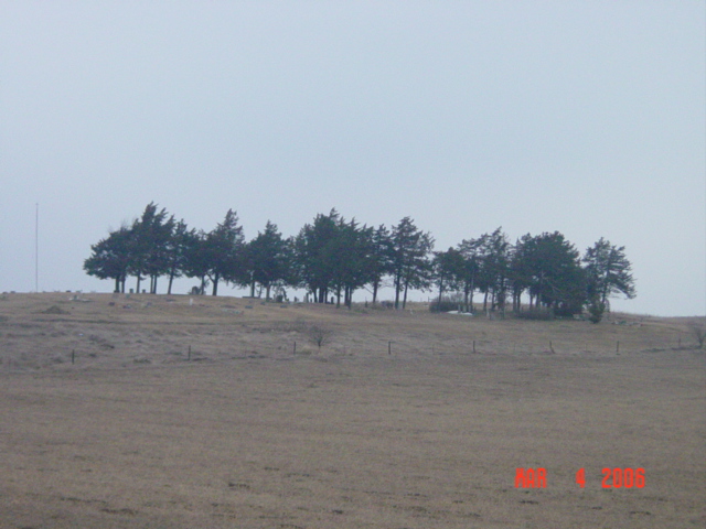
| Description | : | Holy Faith Episcopal Cemetery is known and referred to locally as Hobu Creek Cemetery as the Hobu Creek flows close by. This cemetery is in Knox County three miles north and ½ mile west of Lindy Nebraska. In 1895 the United States granted deed for 158.10 acres to the Domestic and Foreign Missionary Society of the Protestant Episcopal Church "for long as the same shall be occupied and used by such society for Educational and Missionary work among said Indians", and is signed by President Benjamin Harrison. (Knox County deeds, Book U, page 55.) |
frequently asked questions (FAQ):
-
Where is Holy Faith Cemetery?
Holy Faith Cemetery is located at Knox County ,Nebraska ,USA.
-
Holy Faith Cemetery cemetery's updated grave count on graveviews.com?
108 memorials
-
Where are the coordinates of the Holy Faith Cemetery?
Latitude: 42.7731018
Longitude: -97.7489014
Nearby Cemetories:
1. Webb Cemetery
Crofton, Knox County, USA
Coordinate: 42.8145300, -97.6924300
2. Barber Cemetery
Crofton, Knox County, USA
Coordinate: 42.7944000, -97.6416000
3. Santee Catholic Cemetery
Santee, Knox County, USA
Coordinate: 42.8373000, -97.8287400
4. Weigand Cemetery
Crofton, Knox County, USA
Coordinate: 42.7762100, -97.6224100
5. Santee Mission Cemetery
Knox County, USA
Coordinate: 42.8408000, -97.8378200
6. Bon Homme Hutterite Colony Cemetery
Bon Homme Colony, Bon Homme County, USA
Coordinate: 42.8629000, -97.7100900
7. Congregational Cemetery
Santee, Knox County, USA
Coordinate: 42.8330000, -97.8523000
8. Howe Creek Cemetery
Lindy, Knox County, USA
Coordinate: 42.6810000, -97.8127000
9. Bon Homme Cemetery
Springfield, Bon Homme County, USA
Coordinate: 42.8788986, -97.7797012
10. Beaver View Cemetery
Crofton, Knox County, USA
Coordinate: 42.7355995, -97.5847015
11. Bazile Creek Cemetery
Bazile Mills, Knox County, USA
Coordinate: 42.7377500, -97.9311500
12. Ptak National Cemetery
Tabor, Bon Homme County, USA
Coordinate: 42.9150009, -97.6746979
13. Frankfort Cemetery
Knox County, USA
Coordinate: 42.8018990, -97.5428009
14. Springfield Cemetery
Springfield, Bon Homme County, USA
Coordinate: 42.8732986, -97.9132996
15. Saint Vincents Cemetery
Springfield, Bon Homme County, USA
Coordinate: 42.8744011, -97.9132996
16. Elm Grove Cemetery
Yankton County, USA
Coordinate: 42.8974991, -97.6055984
17. Saint Rose Cemetery
Crofton, Knox County, USA
Coordinate: 42.7280998, -97.5192032
18. Hvezda Zapadu Cemetery
Tabor, Bon Homme County, USA
Coordinate: 42.9403000, -97.6549988
19. Bloomfield Cemetery
Bloomfield, Knox County, USA
Coordinate: 42.6007996, -97.6605988
20. Gnewuch Gravesite
Center, Knox County, USA
Coordinate: 42.5973000, -97.8267800
21. Lakeport Cemetery
Lakeport, Yankton County, USA
Coordinate: 42.9150009, -97.5824966
22. Saint Wenceslaus Catholic Cemetery
Tabor, Bon Homme County, USA
Coordinate: 42.9500300, -97.6584400
23. Emanuel Cemetery
Springfield, Bon Homme County, USA
Coordinate: 42.8400002, -97.9903030
24. Beaver Creek Cemetery
Crofton, Knox County, USA
Coordinate: 42.7999992, -97.4850006


