
| Memorials | : | 0 |
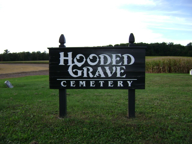
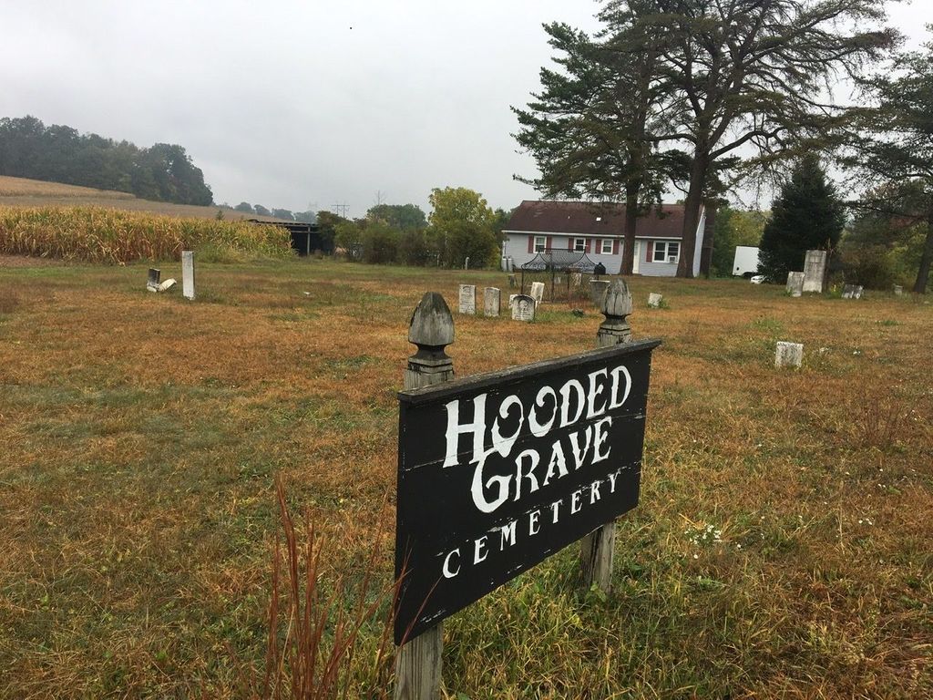
| Location | : | Catawissa, Columbia County, USA |
| Coordinate | : | 40.9318840, -76.4678490 |
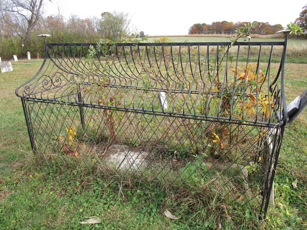
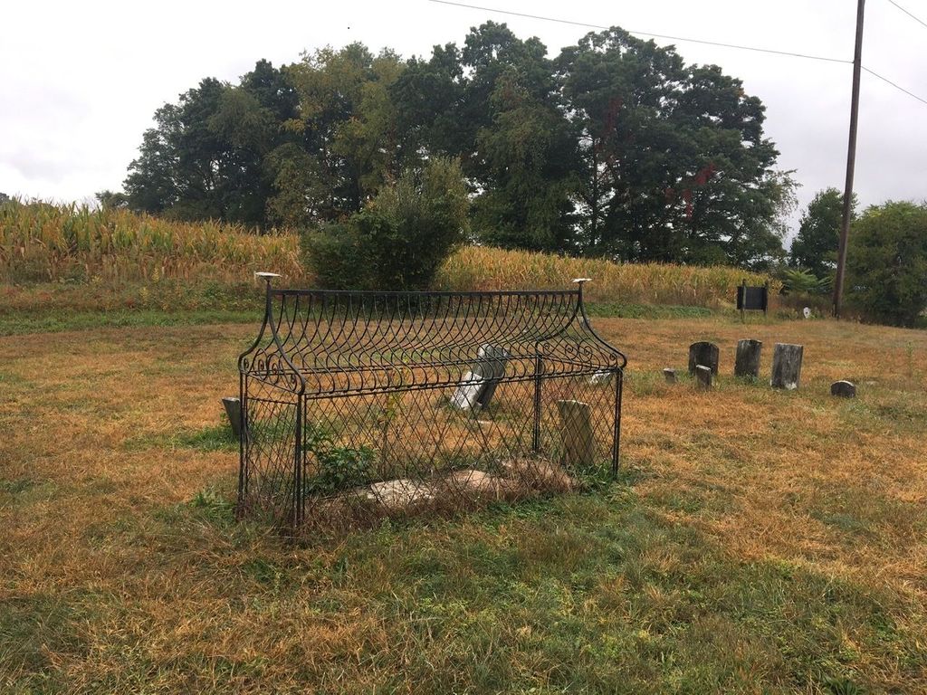
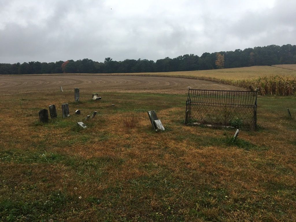
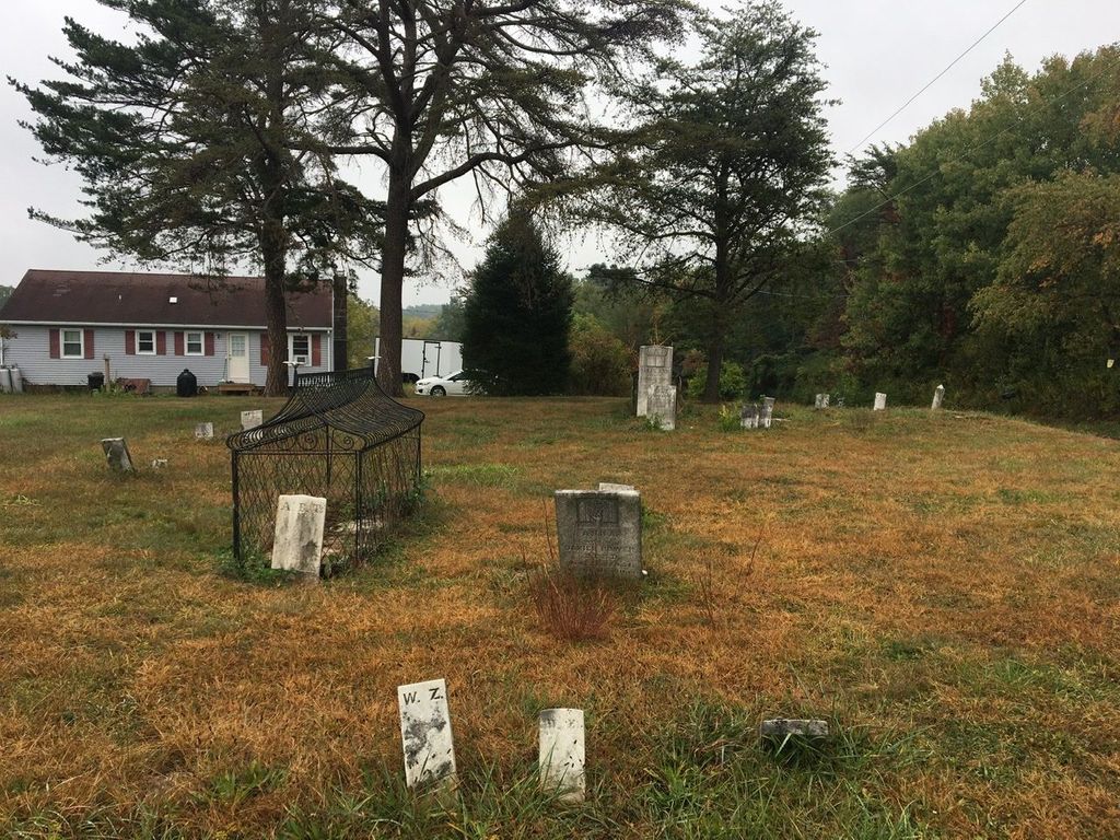
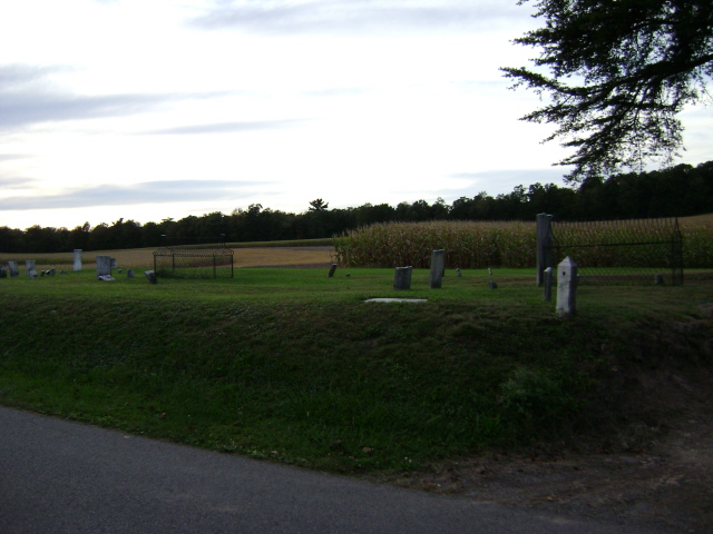
| Description | : | Once known as the Mt. Zion Cemetery prior to 1874, this cemetery hosts two unique “caged burials” also known as mortsafes. A third cage was removed around 1930. The remaining two belong to Sarah Ann Boone and Asenath Thomas. Some believe that the elaborate and ornate cages were built as a show of wealth. The family of the deceased were active in the iron ore business. The second possible reason was to deter grave robbers. During the mid 19th century corpses were in high demand by medical schools. Although mortsafes were once prevalent in Scotland, these are the only two existing... Read More |
frequently asked questions (FAQ):
-
Where is Hooded Grave Cemetery?
Hooded Grave Cemetery is located at Catawissa, Columbia County ,Pennsylvania ,USA.
-
Hooded Grave Cemetery cemetery's updated grave count on graveviews.com?
0 memorials
-
Where are the coordinates of the Hooded Grave Cemetery?
Latitude: 40.9318840
Longitude: -76.4678490
Nearby Cemetories:
1. Greenwood Cemetery
Catawissa, Columbia County, USA
Coordinate: 40.9503480, -76.4624830
2. Quaker Cemetery
Catawissa, Columbia County, USA
Coordinate: 40.9506630, -76.4617760
3. Union Cemetery
Catawissa, Columbia County, USA
Coordinate: 40.9509659, -76.4571609
4. Hillside Cemetery
Catawissa, Columbia County, USA
Coordinate: 40.9513168, -76.4540482
5. McIntyre Cemetery
Catawissa, Columbia County, USA
Coordinate: 40.9221000, -76.4403000
6. Saint Pauls United Methodist Church Cemetery
Catawissa, Columbia County, USA
Coordinate: 40.9075000, -76.4637000
7. Mount Zion Cemetery
Catawissa, Columbia County, USA
Coordinate: 40.9304930, -76.5005290
8. Bethel United Methodist Church Cemetery
Catawissa, Columbia County, USA
Coordinate: 40.8940790, -76.4934670
9. Our Lady Of Mercy Cemetery
Slabtown, Columbia County, USA
Coordinate: 40.9043999, -76.4152985
10. Roaring Creek Cemetery
Slabtown, Columbia County, USA
Coordinate: 40.9039001, -76.4152985
11. Saint Peters Lutheran Cemetery
Grovania, Columbia County, USA
Coordinate: 40.9663500, -76.5220100
12. Freewill Cemetery
Columbia County, USA
Coordinate: 40.9225000, -76.3969000
13. Roaring Creek Quaker Cemetery
Numidia, Columbia County, USA
Coordinate: 40.8981000, -76.3986000
14. Sharp Ridge Cemetery
Montour County, USA
Coordinate: 40.9166985, -76.5481033
15. Saint Johns Evangelical Lutheran Church Cemetery
Danville, Montour County, USA
Coordinate: 40.9045000, -76.5483000
16. Saint Pauls Lutheran Church Cemetery
Numidia, Columbia County, USA
Coordinate: 40.8817000, -76.3996000
17. Old Lutheran Cemetery (Defunct)
Bloomsburg, Columbia County, USA
Coordinate: 41.0043600, -76.4572430
18. Old Rosemont Cemetery
Bloomsburg, Columbia County, USA
Coordinate: 41.0046000, -76.4575000
19. Numidia Bible Fellowship Cemetery
Numidia, Columbia County, USA
Coordinate: 40.8810000, -76.3981000
20. Trinity Cemetery
Numidia, Columbia County, USA
Coordinate: 40.8697014, -76.4064026
21. New Rosemont Cemetery
Espy, Columbia County, USA
Coordinate: 41.0046997, -76.4175034
22. Fisherdale United Methodist Cemetery
Columbia County, USA
Coordinate: 40.8509000, -76.4428000
23. Ridgeville Reformed Cemetery
Danville, Montour County, USA
Coordinate: 40.9696000, -76.5666000
24. Bear Gap Cemetery
Columbia County, USA
Coordinate: 40.8459000, -76.5013000