
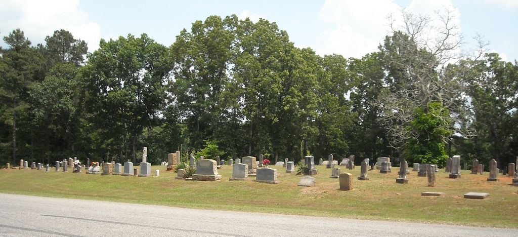
| Memorials | : | 0 |
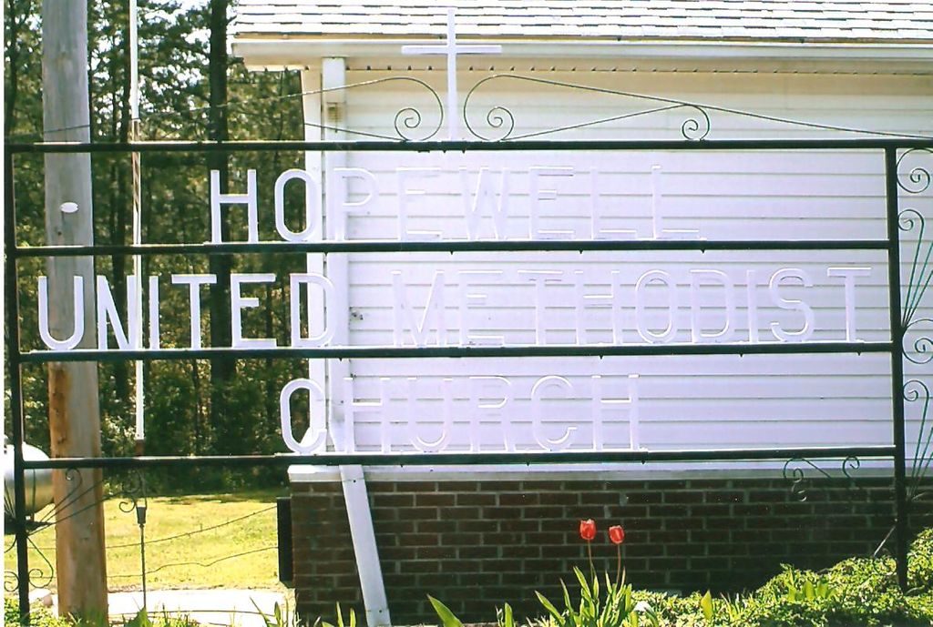
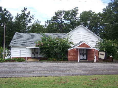
| Location | : | Farmington, Alcorn County, USA |
| Coordinate | : | 34.9097170, -88.4021170 |
| Description | : | About 7 Miles east on Farmington Road (Cr 200). |
frequently asked questions (FAQ):
-
Where is Hopewell United Methodist Church Cemetery?
Hopewell United Methodist Church Cemetery is located at 4660 County Road 200 Farmington, Alcorn County ,Mississippi ,USA.
-
Hopewell United Methodist Church Cemetery cemetery's updated grave count on graveviews.com?
0 memorials
-
Where are the coordinates of the Hopewell United Methodist Church Cemetery?
Latitude: 34.9097170
Longitude: -88.4021170
Nearby Cemetories:
1. Brigman Hill Church Cemetery
Corinth, Alcorn County, USA
Coordinate: 34.9007700, -88.3948150
2. Jerusalem Church of Christ Cemetery
Farmington, Alcorn County, USA
Coordinate: 34.9256500, -88.4018900
3. Choate #2 Cemetery
Farmington, Alcorn County, USA
Coordinate: 34.9226920, -88.4231190
4. Belmonte Pet Cemetery
Corinth, Alcorn County, USA
Coordinate: 34.9307400, -88.4218440
5. Pleasant Ridge Cemetery
Glen, Alcorn County, USA
Coordinate: 34.8863983, -88.4393997
6. Strickland Baptist Church Cemetery
Corinth, Alcorn County, USA
Coordinate: 34.8780390, -88.4418980
7. Glendale Baptist Church Cemetery
Glen, Alcorn County, USA
Coordinate: 34.8667300, -88.4226200
8. Whitehurst Cemetery
Burnsville, Tishomingo County, USA
Coordinate: 34.8744011, -88.3636017
9. Dowd Cemetery
Glen, Alcorn County, USA
Coordinate: 34.8656100, -88.3797800
10. Choate's Acre Cemetery
Strickland, Alcorn County, USA
Coordinate: 34.8675530, -88.4352850
11. Stevens Family Cemetery
Strickland, Alcorn County, USA
Coordinate: 34.8709790, -88.4417310
12. Wiley Grove Church Cemetery
Alcorn County, USA
Coordinate: 34.9085999, -88.4644012
13. Farmington Baptist Church Cemetery
Farmington, Alcorn County, USA
Coordinate: 34.9367490, -88.4552190
14. Fraley’s Chapel Church of Christ Cemetery
Kendrick, Alcorn County, USA
Coordinate: 34.9614060, -88.4126310
15. Lambs Chapel Cemetery
Tishomingo County, USA
Coordinate: 34.9385986, -88.3467026
16. Greenhaw Cemetery
Kendrick, Alcorn County, USA
Coordinate: 34.9599991, -88.3760986
17. Shady Grove Baptist Church Cemetery
Burnsville, Tishomingo County, USA
Coordinate: 34.8900630, -88.3396910
18. Grissom Chapel Cemetery
Burnsville, Tishomingo County, USA
Coordinate: 34.8905850, -88.3391060
19. Indian Springs Cemetery
Indian Springs, Alcorn County, USA
Coordinate: 34.8545940, -88.4150720
20. Dogwood Cemetery
Farmington, Alcorn County, USA
Coordinate: 34.9446730, -88.4619780
21. Chapel Hill Cemetery
Burnsville, Tishomingo County, USA
Coordinate: 34.8739014, -88.3419037
22. Haynie Cemetery
Strickland, Alcorn County, USA
Coordinate: 34.8580300, -88.4446600
23. Riddle Cemetery
Tishomingo County, USA
Coordinate: 34.9516716, -88.3456879
24. Blackard Cemetery
Tishomingo County, USA
Coordinate: 34.9536018, -88.3458023