
| Memorials | : | 0 |
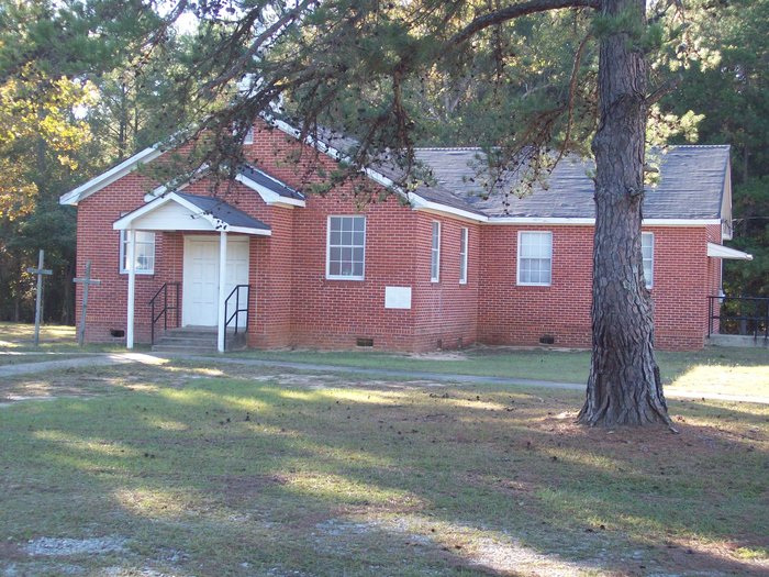
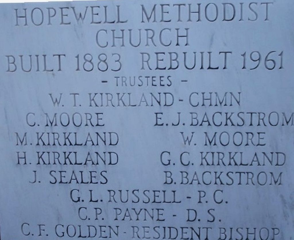
| Location | : | Philadelphia, Neshoba County, USA |
| Coordinate | : | 32.7767000, -89.0697000 |
frequently asked questions (FAQ):
-
Where is Hopewell United Methodist Church Cemetery?
Hopewell United Methodist Church Cemetery is located at Philadelphia, Neshoba County ,Mississippi ,USA.
-
Hopewell United Methodist Church Cemetery cemetery's updated grave count on graveviews.com?
0 memorials
-
Where are the coordinates of the Hopewell United Methodist Church Cemetery?
Latitude: 32.7767000
Longitude: -89.0697000
Nearby Cemetories:
1. Bethlehem Cemetery
Philadelphia, Neshoba County, USA
Coordinate: 32.7683850, -89.0597570
2. Greenfield Baptist Church Cemetery
Philadelphia, Neshoba County, USA
Coordinate: 32.7906120, -89.0760110
3. Eastlawn Cemetery
Philadelphia, Neshoba County, USA
Coordinate: 32.7663160, -89.0979070
4. Old North Bend Methodist Church Cemetery
North Bend, Neshoba County, USA
Coordinate: 32.7993960, -89.0934560
5. Cedarlawn Cemetery
Philadelphia, Neshoba County, USA
Coordinate: 32.7661018, -89.1100006
6. Backstrom Cemetery
Philadelphia, Neshoba County, USA
Coordinate: 32.7874390, -89.1140990
7. Donald Rest Cemetery
Philadelphia, Neshoba County, USA
Coordinate: 32.7877998, -89.1196976
8. Longino Community Cemetery
Longino, Neshoba County, USA
Coordinate: 32.8124180, -89.1009240
9. Holy Cross Catholic Church Cemetery
Philadelphia, Neshoba County, USA
Coordinate: 32.8229670, -89.0718700
10. Ocobla Cemetery
Philadelphia, Neshoba County, USA
Coordinate: 32.7567420, -89.0173670
11. Jones Cemetery
Philadelphia, Neshoba County, USA
Coordinate: 32.8088989, -89.0168991
12. Corinth Baptist Church Cemetery Indian
Tucker, Neshoba County, USA
Coordinate: 32.7175450, -89.0668830
13. Sandtown Cemetery
Sandtown, Neshoba County, USA
Coordinate: 32.7943993, -89.0002975
14. Spring Creek Baptist Church Cemetery
Spring Creek, Neshoba County, USA
Coordinate: 32.8336105, -89.0402832
15. Bloomfield Cemetery
Bloomfield, Neshoba County, USA
Coordinate: 32.7324982, -89.0175018
16. Center Hill Cemetery
Tucker, Neshoba County, USA
Coordinate: 32.7160988, -89.0516968
17. Spring Hill Cemetery
Tucker, Neshoba County, USA
Coordinate: 32.7089005, -89.0903015
18. Mount Zion United Methodist Church Cemetery
Philadelphia, Neshoba County, USA
Coordinate: 32.7688370, -88.9855270
19. Hembree Cemetery
Neshoba County, USA
Coordinate: 32.7482380, -89.1476820
20. Holy Rosary Church Cemetery
Philadelphia, Neshoba County, USA
Coordinate: 32.7029131, -89.0536691
21. Scott Cemetery (Indian)
Tucker, Neshoba County, USA
Coordinate: 32.6988800, -89.0726730
22. Burnside Cemetery
Burnside, Neshoba County, USA
Coordinate: 32.8544050, -89.1055050
23. Henry's Chapel Cemetery
Philadelphia, Neshoba County, USA
Coordinate: 32.8069000, -89.1624985
24. Burnside Baptist Church Cemetery
Burnside, Neshoba County, USA
Coordinate: 32.8563290, -89.1035090