
| Memorials | : | 0 |
| Location | : | Millboro, Bath County, USA |
| Coordinate | : | 37.9441580, -79.6949090 |
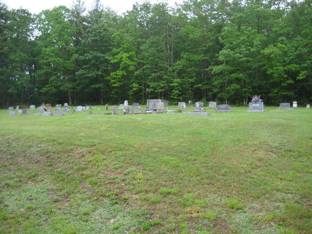
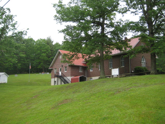
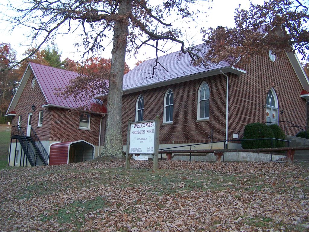
| Description | : | Horeb Baptist Church Cemetery is located adjacent to and maintained by the Horeb Baptist Church which was organized in 1876. The first churchhouse, a wooden structure, was dedicated in 1887. That building was destroyed by a hurricane in 1928. The present brick structure dates from 1930. |
frequently asked questions (FAQ):
-
Where is Horeb Baptist Church Cemetery?
Horeb Baptist Church Cemetery is located at 5742 Cowpasture River Highway (Rt. 42) Millboro, Bath County ,Virginia , 24460USA.
-
Horeb Baptist Church Cemetery cemetery's updated grave count on graveviews.com?
0 memorials
-
Where are the coordinates of the Horeb Baptist Church Cemetery?
Latitude: 37.9441580
Longitude: -79.6949090
Nearby Cemetories:
1. Porter Cemetery
Millboro, Bath County, USA
Coordinate: 37.9720790, -79.6764560
2. Oak Grove Advent Christ Church Cemetery
Millboro, Bath County, USA
Coordinate: 37.9601025, -79.7541402
3. Tunnel Hill Cemetery
Millboro, Bath County, USA
Coordinate: 37.9617000, -79.6139600
4. Peters Family Cemetery
Millboro, Bath County, USA
Coordinate: 37.8932500, -79.7521700
5. Calvary Baptist Church Cemetery
Millboro Springs, Bath County, USA
Coordinate: 37.9887000, -79.6194400
6. Windy Cove Presbyterian Church Cemetery
Millboro Springs, Bath County, USA
Coordinate: 38.0023070, -79.6331210
7. Windy Cove Cemetery
Millboro Springs, Bath County, USA
Coordinate: 37.9978100, -79.6253200
8. Puckett Cemetery
Griffith, Alleghany County, USA
Coordinate: 37.8721000, -79.7386000
9. Millboro Christian Church Cemetery
Millboro, Bath County, USA
Coordinate: 37.9779290, -79.5996980
10. Mount Zion Baptist Church Cemetery
Millboro, Bath County, USA
Coordinate: 38.0013200, -79.5904400
11. Woodland Union Church Cemetery
Millboro, Bath County, USA
Coordinate: 38.0512860, -79.6956180
12. William Keyser Family Cemetery
Warm Springs, Bath County, USA
Coordinate: 37.9688500, -79.8369400
13. Bratton Cemetery
Bath County, USA
Coordinate: 37.9975014, -79.5616989
14. Burnsville Cemetery
Bath County, USA
Coordinate: 38.0588455, -79.7361450
15. Rehobeth Community Church Cemetery
Millboro, Bath County, USA
Coordinate: 38.0341420, -79.5901400
16. Warm Springs Cemetery
Warm Springs, Bath County, USA
Coordinate: 38.0503006, -79.7810974
17. Central Advent Christian Church Cemetery
Clifton Forge, Alleghany County, USA
Coordinate: 37.8286018, -79.7602997
18. Healing Springs Baptist Church Cemetery
Hot Springs, Bath County, USA
Coordinate: 37.9630340, -79.8607840
19. Walton Memorial Church Cemetery
Clifton Forge, Alleghany County, USA
Coordinate: 37.8342460, -79.7889610
20. Pinehurst Cemetery
Switch Back, Bath County, USA
Coordinate: 38.0141570, -79.8415650
21. West Warm Springs Cemetery
West Warm Springs, Bath County, USA
Coordinate: 38.0565970, -79.8062930
22. Sharon Baptist Church Cemetery
Nicelytown, Alleghany County, USA
Coordinate: 37.8045370, -79.7428246
23. Union Chapel Cemetery
Healing Springs, Bath County, USA
Coordinate: 37.9295703, -79.8833874
24. Lyle Chapel Cemetery
Millboro, Bath County, USA
Coordinate: 38.0448300, -79.5548860