
| Memorials | : | 3 |
| Location | : | Manchester, Clay County, USA |
| Coordinate | : | 37.1174330, -83.7488540 |
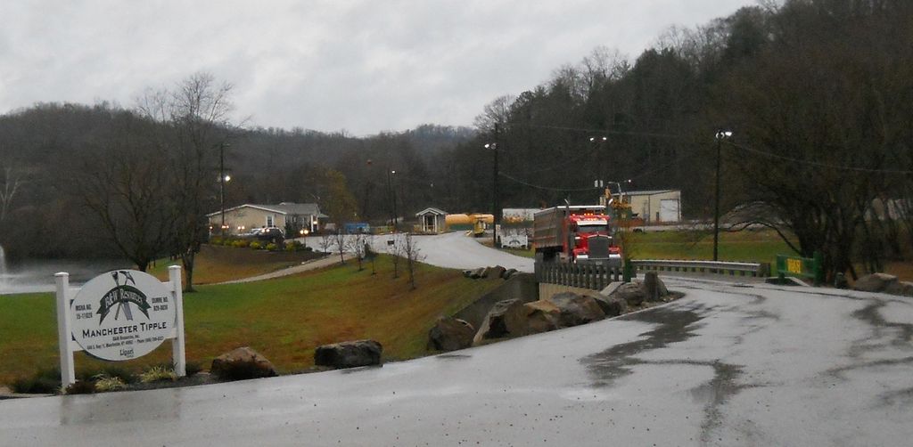
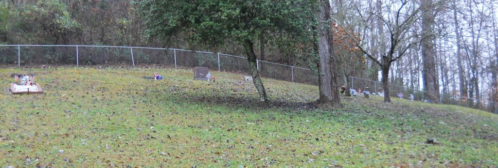
| Description | : | This cemetery is located on 'B & W Resoures' property. You have to drive straight back from the main entrance to the railroad tracks stopping at the office first to obtain permission. Going left by the tracks then crossing them taking the gravel road around the base of the mountain. You will go about 200 to 300 yards to a dirt path on the right. Up the path about 50 yards on the right is the fenced cemetery. Change the map to Satellite image and enlarge to see the gravel road back to the cemetery. |
frequently asked questions (FAQ):
-
Where is Horton Cemetery?
Horton Cemetery is located at 849 S. Highway 11 Manchester, Clay County ,Kentucky , 40962USA.
-
Horton Cemetery cemetery's updated grave count on graveviews.com?
3 memorials
-
Where are the coordinates of the Horton Cemetery?
Latitude: 37.1174330
Longitude: -83.7488540
Nearby Cemetories:
1. Hugh White Cemetery
Manchester, Clay County, USA
Coordinate: 37.1177460, -83.7518030
2. Norman Harris Family Cemetery
Garrard, Clay County, USA
Coordinate: 37.1236115, -83.7463913
3. Cody Family Cemetery
Garrard, Clay County, USA
Coordinate: 37.1257300, -83.7472000
4. Garrard Family Cemetery
Garrard, Clay County, USA
Coordinate: 37.1265600, -83.7472200
5. Jeremiah Smith Cemetery
Garrard, Clay County, USA
Coordinate: 37.1195500, -83.7370300
6. Engine Cemetery
Bluehole, Clay County, USA
Coordinate: 37.1105995, -83.7592010
7. France Cemetery #2
Hima, Clay County, USA
Coordinate: 37.1232860, -83.7652680
8. Hooker Cemetery
Bluehole, Clay County, USA
Coordinate: 37.1021990, -83.7571320
9. Smith Cemetery #2
Garrard, Clay County, USA
Coordinate: 37.1038400, -83.7366400
10. Smith Cemetery #3
Garrard, Clay County, USA
Coordinate: 37.1010300, -83.7436200
11. Paces Creek Mennonite Church Cemetery
Garrard, Clay County, USA
Coordinate: 37.1324700, -83.7387400
12. Smith Cemetery #1
Garrard, Clay County, USA
Coordinate: 37.1040400, -83.7351700
13. Oscar Sizemore Cemetery
Garrard, Clay County, USA
Coordinate: 37.1025100, -83.7343700
14. Caudill Cemetery
Garrard, Clay County, USA
Coordinate: 37.1055270, -83.7301630
15. Williams Cemetery
Garrard, Clay County, USA
Coordinate: 37.1002200, -83.7375900
16. Smith Cemetery #10
Garrard, Clay County, USA
Coordinate: 37.1368110, -83.7448570
17. Caudill Cemetery
Garrard, Clay County, USA
Coordinate: 37.1036500, -83.7306300
18. Hubbard-Stacy Cemetery
Garrard, Clay County, USA
Coordinate: 37.1191300, -83.7236500
19. Carr Family Cemetery
Garrard, Clay County, USA
Coordinate: 37.1377360, -83.7442890
20. Jim Crow Smith Cemetery
Garrard, Clay County, USA
Coordinate: 37.1143900, -83.7225200
21. Gregory Cemetery
Hima, Clay County, USA
Coordinate: 37.1179600, -83.7763600
22. Blair Cemetery
Garrard, Clay County, USA
Coordinate: 37.1057430, -83.7249990
23. Paces Creek Cemetery
Garrard, Clay County, USA
Coordinate: 37.1315500, -83.7266370
24. Gregory-White Cemetery
Hima, Clay County, USA
Coordinate: 37.1190100, -83.7787700