
| Memorials | : | 0 |
| Location | : | Mammoth Cave, Edmonson County, USA |
| Coordinate | : | 37.2062900, -86.2396900 |
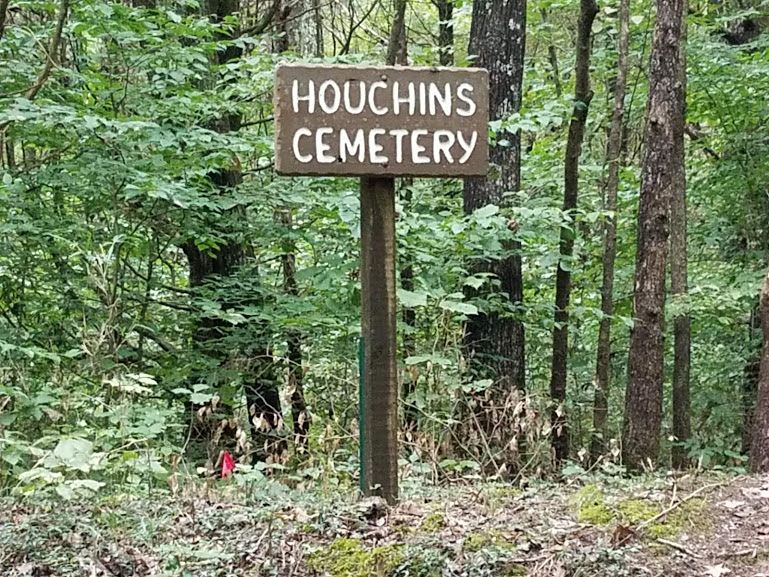
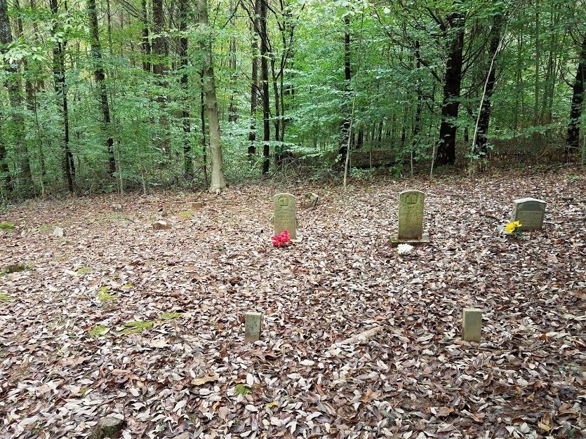
| Description | : | Houchins Cemetery is a family cemetery containing ten burials, the earliest of which is from around 1890. The markers are all unmarked fieldstones. The cemetery is wooded and the landscape includes numerous cedars. The boundaries are not clearly marked. The government made improvements to the road, so that, although it is gravel and one lane, it is easily traveled in good weather. The Houchins Cemetery sign is clearly visible from the road but to get to the cemetery itself you will have to climb the about 5 foot almost vertical berm on the side of the road. Not impossible... Read More |
frequently asked questions (FAQ):
-
Where is Houchins Cemetery?
Houchins Cemetery is located at Mammoth Cave, Edmonson County ,Kentucky ,USA.
-
Houchins Cemetery cemetery's updated grave count on graveviews.com?
0 memorials
-
Where are the coordinates of the Houchins Cemetery?
Latitude: 37.2062900
Longitude: -86.2396900
Nearby Cemetories:
1. Dry Branch Cemetery
Brownsville, Edmonson County, USA
Coordinate: 37.2050400, -86.2296295
2. James Madison Cemetery
Edmonson County, USA
Coordinate: 37.2116500, -86.2502170
3. James Family Cemetery
Edmonson County, USA
Coordinate: 37.2018480, -86.2559490
4. Temple Hill Cemetery
Mammoth Cave, Edmonson County, USA
Coordinate: 37.2188988, -86.2275009
5. Booker-James Cemetery
Brownsville, Edmonson County, USA
Coordinate: 37.1914330, -86.2534870
6. Old Poplar Springs Church Cemetery
Edmonson County, USA
Coordinate: 37.2234620, -86.2504990
7. Old Rube Webb Farm Cemetery
Mammoth Cave, Edmonson County, USA
Coordinate: 37.2261790, -86.2471120
8. Brownsville Missionary Baptist Church Cemetery
Brownsville, Edmonson County, USA
Coordinate: 37.1880300, -86.2543500
9. Alexander Cemetery
Brownsville, Edmonson County, USA
Coordinate: 37.2008018, -86.2671967
10. Old Brownsville Cemetery
Brownsville, Edmonson County, USA
Coordinate: 37.1956900, -86.2675700
11. Poplar Springs Church Cemetery
Mammoth Cave, Edmonson County, USA
Coordinate: 37.2311096, -86.2606964
12. Fairview Cemetery
Brownsville, Edmonson County, USA
Coordinate: 37.1766090, -86.2474213
13. Raymond Peger Farm Cemetery
Lindseyville, Edmonson County, USA
Coordinate: 37.2320520, -86.2604300
14. Crump Family Cemetery
Edmonson County, USA
Coordinate: 37.1979294, -86.1999283
15. Luttrell Cemetery
Edmonson County, USA
Coordinate: 37.2016500, -86.2815300
16. Brooks Cemetery
Mammoth Cave, Edmonson County, USA
Coordinate: 37.1940500, -86.1985800
17. Hogan Cemetery
Brownsville, Edmonson County, USA
Coordinate: 37.2368550, -86.2634250
18. Pleasant Union Church Cemetery
Brownsville, Edmonson County, USA
Coordinate: 37.2100630, -86.2900540
19. Davis-Miles Cemetery
Mammoth Cave, Edmonson County, USA
Coordinate: 37.2001800, -86.1829200
20. Oak Grove United Baptist Church Cemetery
Edmonson County, USA
Coordinate: 37.1620400, -86.2583500
21. Light Cemetery
Rhoda, Edmonson County, USA
Coordinate: 37.1596900, -86.2286000
22. Oak Hill Cemetery
Brownsville, Edmonson County, USA
Coordinate: 37.1641083, -86.2685471
23. Vincent Cemetery #1
Mammoth Cave, Edmonson County, USA
Coordinate: 37.2534200, -86.2146800
24. Belle Key Church and Cemetery
Rhoda, Edmonson County, USA
Coordinate: 37.1562170, -86.2257130