
| Memorials | : | 0 |
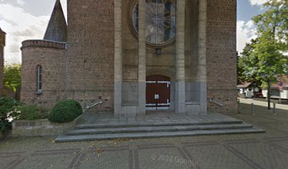
| Location | : | Hout-Blerick, Venlo Municipality, Netherlands |
| Coordinate | : | 51.3573600, 6.1281400 |
| Description | : | Hout Blerick is a village 5 kilometres south-west of the town of Venlo, on the west side of the road to Maaseik in Belgium. |
frequently asked questions (FAQ):
-
Where is Hout Blerick Roman Catholic Churchyard?
Hout Blerick Roman Catholic Churchyard is located at Hout-Blerick, Venlo Municipality ,Limburg ,Netherlands.
-
Hout Blerick Roman Catholic Churchyard cemetery's updated grave count on graveviews.com?
0 memorials
-
Where are the coordinates of the Hout Blerick Roman Catholic Churchyard?
Latitude: 51.3573600
Longitude: 6.1281400
Nearby Cemetories:
1. Venlo Algemene Begraafplaats
Venlo, Venlo Municipality, Netherlands
Coordinate: 51.3538800, 6.1566900
2. Sint Antonius van Padua Kerkhof
Blerick, Venlo Municipality, Netherlands
Coordinate: 51.3660814, 6.1546907
3. Nieuwe Joodse begraafplaats Ganzenpad
Venlo Municipality, Netherlands
Coordinate: 51.3555200, 6.1712240
4. Oude Joodse Begraafplaats Broekhofpad
Venlo, Venlo Municipality, Netherlands
Coordinate: 51.3569440, 6.1722220
5. Natuurbegraafplaats Maasbree
Venlo, Venlo Municipality, Netherlands
Coordinate: 51.3578618, 6.0560217
6. Maasbree Roman Catholic Cemetery
Maasbree, Peel en Maas Municipality, Netherlands
Coordinate: 51.3590600, 6.0498800
7. Friedhof Kaldenkirchen
Kaldenkirchen, Kreis Viersen, Germany
Coordinate: 51.3126200, 6.1922100
8. Helden Begraafplaats
Helden, Peel en Maas Municipality, Netherlands
Coordinate: 51.3177900, 6.0008200
9. Friedhof Hinsbeck
Nettetal, Kreis Viersen, Germany
Coordinate: 51.3363604, 6.2830223
10. Panningen cemetery
Panningen, Peel en Maas Municipality, Netherlands
Coordinate: 51.3291100, 5.9756400
11. Lottum Kerkhof
Lottum, Horst aan de Maas Municipality, Netherlands
Coordinate: 51.4617400, 6.1624400
12. Beesel Roman Catholic Cemetery
Beesel, Beesel Municipality, Netherlands
Coordinate: 51.2688500, 6.0321500
13. RK Begraafplaats Horst
Horst, Horst aan de Maas Municipality, Netherlands
Coordinate: 51.4562126, 6.0561646
14. Friedhof Born
Born, Kreis Viersen, Germany
Coordinate: 51.2431795, 6.2137784
15. Arcen Roman Catholic Cemetery
Arcen, Venlo Municipality, Netherlands
Coordinate: 51.4812200, 6.1809700
16. Rooms Katholieke Begraafplaats
Swolgen, Horst aan de Maas Municipality, Netherlands
Coordinate: 51.4917400, 6.1167600
17. Friedhof Wachtendonk
Wachtendonk, Kreis Kleve, Germany
Coordinate: 51.4102100, 6.3349800
18. Friedhof Niederkrüchten
Niederkruchten, Kreis Viersen, Germany
Coordinate: 51.2152780, 6.1680930
19. Friedhof Elmpt
Niederkruchten, Kreis Viersen, Germany
Coordinate: 51.2149700, 6.1665900
20. Heibloem Cemetery
Heibloem, Leudal Municipality, Netherlands
Coordinate: 51.3004231, 5.9025150
21. Buggenum Roman Catholic Cemetery
Buggenum, Leudal Municipality, Netherlands
Coordinate: 51.2317500, 5.9816200
22. Sint-Gertrudiskerk
Oirlo, Venray Municipality, Netherlands
Coordinate: 51.5106399, 6.0367345
23. Friedhof Süchteln
Süchteln, Kreis Viersen, Germany
Coordinate: 51.2803786, 6.3639090
24. Begraafplaats Rooms Katholieke kerk Leeuwen
Roermond, Roermond Municipality, Netherlands
Coordinate: 51.2098101, 6.0044129