
| Memorials | : | 0 |
| Location | : | Houthulst, Arrondissement Diksmuide, Belgium |
| Coordinate | : | 50.9780600, 2.9513500 |
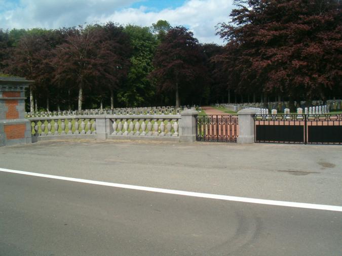
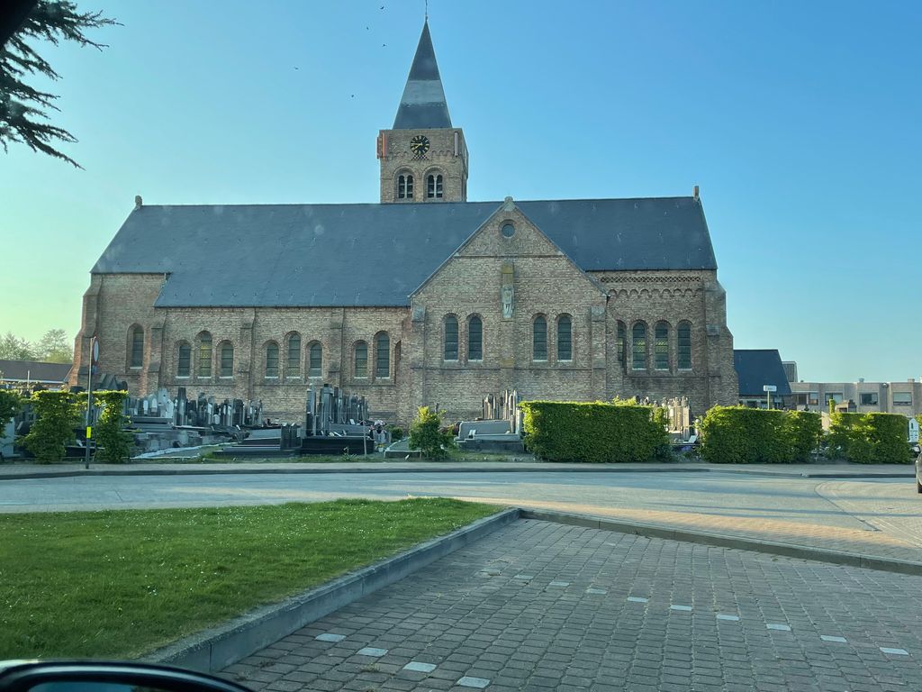
| Description | : | The village of Houthulst is located south of the town of Diksmuide off the N369 which runs between Veurne and Ieper. Driving out of Diksmuide you come to the village of Woumen, take the left hand turning signed to Klerken. Follow this road into Klerken and you come to a T junction, turn right on the N301 direction Houthulst. In the village you come to a crossroads, turn left into Kerkstraat, then take the first turn right into Liniestraat and the church is on the left. The graves are on the left of the church entrance. Historical Information: The British... Read More |
frequently asked questions (FAQ):
-
Where is Houthulst Churchyard?
Houthulst Churchyard is located at Houthulst, Arrondissement Diksmuide ,West Flanders (West-Vlaanderen) ,Belgium.
-
Houthulst Churchyard cemetery's updated grave count on graveviews.com?
0 memorials
-
Where are the coordinates of the Houthulst Churchyard?
Latitude: 50.9780600
Longitude: 2.9513500
Nearby Cemetories:
1. Houthulst Belgian Military Cemetery
Houthulst, Arrondissement Diksmuide, Belgium
Coordinate: 50.9664100, 2.9482400
2. Zarren Communal Cemetery
Kortemark, Arrondissement Diksmuide, Belgium
Coordinate: 51.0169500, 2.9509900
3. Staden Communal Cemetery
Staden, Arrondissement Roeselare, Belgium
Coordinate: 50.9771900, 3.0146200
4. Werken Churchyard
Kortemark, Arrondissement Diksmuide, Belgium
Coordinate: 51.0288900, 2.9630500
5. Poelkapelle British Cemetery
Brugsken, Arrondissement Dendermonde, Belgium
Coordinate: 50.9202445, 2.9713097
6. Poelcapelle British Cemetery
Langemark-Poelkapelle, Arrondissement Ieper, Belgium
Coordinate: 50.9201800, 2.9715400
7. Georges Guynemer Memorial
Langemark-Poelkapelle, Arrondissement Ieper, Belgium
Coordinate: 50.9176310, 2.9565570
8. Handzame Communal Cemetery
Kortemark, Arrondissement Diksmuide, Belgium
Coordinate: 51.0284900, 3.0050800
9. Poelkapelle Cemetery
Langemark-Poelkapelle, Arrondissement Ieper, Belgium
Coordinate: 50.9170800, 2.9627600
10. Langemark German Military Cemetery
Langemark-Poelkapelle, Arrondissement Ieper, Belgium
Coordinate: 50.9198700, 2.9167800
11. Vladslo Churchyard
Diksmuide, Arrondissement Diksmuide, Belgium
Coordinate: 51.0464100, 2.9155300
12. Diksmuide Communal Cemetery
Diksmuide, Arrondissement Diksmuide, Belgium
Coordinate: 51.0261100, 2.8642900
13. Ruisseau Farm Cemetery
Langemark-Poelkapelle, Arrondissement Ieper, Belgium
Coordinate: 50.9118900, 2.8992600
14. Oostnieuwkerke Cemetery
Staden, Arrondissement Roeselare, Belgium
Coordinate: 50.9464200, 3.0590900
15. Bikschote Churchyard
Bikschote, Arrondissement Ieper, Belgium
Coordinate: 50.9262070, 2.8646400
16. Cement House Cemetery
Langemark-Poelkapelle, Arrondissement Ieper, Belgium
Coordinate: 50.9049700, 2.9068200
17. Sint-Niklaaskerk
Diksmuide, Arrondissement Diksmuide, Belgium
Coordinate: 51.0341282, 2.8642080
18. Kortemark Communal Cemetery
Kortemark, Arrondissement Diksmuide, Belgium
Coordinate: 51.0300600, 3.0449900
19. St. Julien Canadian War Memorial
Langemark-Poelkapelle, Arrondissement Ieper, Belgium
Coordinate: 50.8996120, 2.9406510
20. New Hooglede Communal Cemetery
Hooglede, Arrondissement Roeselare, Belgium
Coordinate: 50.9819900, 3.0776800
21. Old Hooglede Communal Cemetery
Hooglede, Arrondissement Roeselare, Belgium
Coordinate: 50.9806900, 3.0801400
22. Crypte Ijzertoren Diksmuide
Diksmuide, Arrondissement Diksmuide, Belgium
Coordinate: 51.0322760, 2.8537950
23. Passchendaele New British Cemetery
Zonnebeke, Arrondissement Ieper, Belgium
Coordinate: 50.9047600, 3.0102500
24. Yser Tower
Diksmuide, Arrondissement Diksmuide, Belgium
Coordinate: 51.0317350, 2.8522330