| Memorials | : | 0 |
| Location | : | Wabash, Phillips County, USA |
| Coordinate | : | 34.3900300, -90.8655800 |
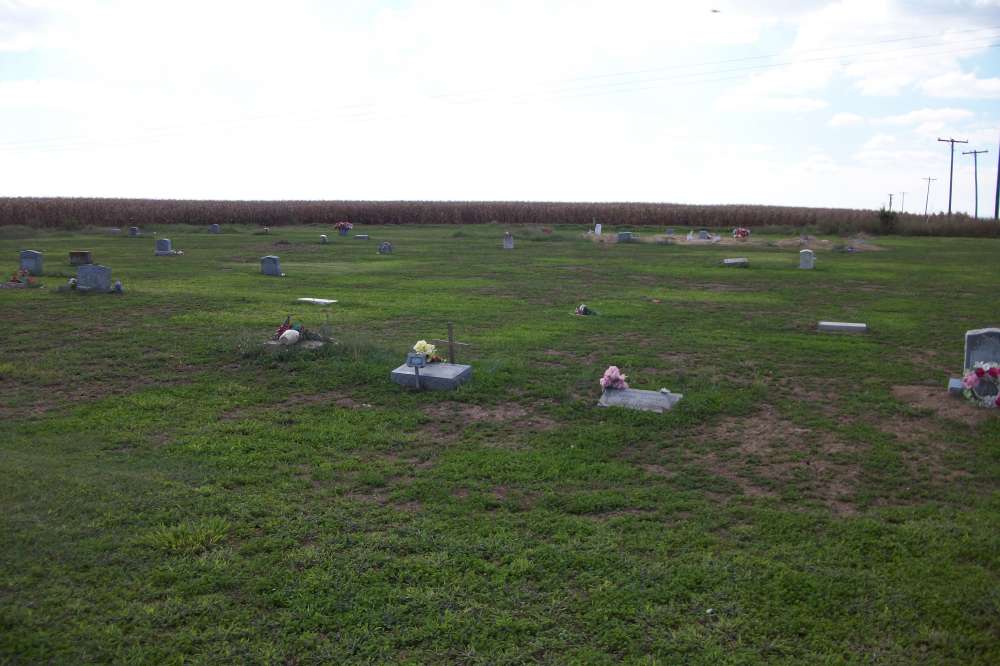
| Description | : | This cemetery, located behind a sharecoppers' church in Wabash on Phillips County Road 433, was part of what is known by the local residents as Howe Plantation Cemetery. The plantation was owned by Jimmy Howe, son of Otis Wilson Howe and Harriet Virginia May, and grandson of Wilson Herrick Howe. African American sharecroppers in and around Wabash worked the plantation fields until the early 1950s. Due to poverty of sharecoppers, many were buried (as well as their family members) in a field behind the sharecoppers' church. There are more unmarked graves in this cemetery than graves with stones. There... Read More |
frequently asked questions (FAQ):
-
Where is Howe Plantation Cemetery?
Howe Plantation Cemetery is located at Wabash, Phillips County ,Arkansas ,USA.
-
Howe Plantation Cemetery cemetery's updated grave count on graveviews.com?
0 memorials
-
Where are the coordinates of the Howe Plantation Cemetery?
Latitude: 34.3900300
Longitude: -90.8655800
Nearby Cemetories:
1. Pilgrims Rest Cemetery
Wabash, Phillips County, USA
Coordinate: 34.3899370, -90.8663670
2. New Jerusalem Cemetery
Phillips County, USA
Coordinate: 34.3732986, -90.8047028
3. Taylor Cemetery
Phillips County, USA
Coordinate: 34.4385986, -90.9225006
4. Morning Star Cemetery
Elaine, Phillips County, USA
Coordinate: 34.3235600, -90.8445800
5. Mount Pleasant Cemetery
Lakeview, Phillips County, USA
Coordinate: 34.4085999, -90.7771988
6. Coffee Creek Cemetery
Phillips County, USA
Coordinate: 34.4592018, -90.9103012
7. Pilgrim Guide Cemetery
Phillips County, USA
Coordinate: 34.3352840, -90.7776910
8. Salem Cemetery
Lakeview, Phillips County, USA
Coordinate: 34.4160995, -90.7583008
9. Oneida Cemetery
Oneida, Phillips County, USA
Coordinate: 34.4599200, -90.7866100
10. Trenton Cemetery
Trenton, Phillips County, USA
Coordinate: 34.4982605, -90.8686981
11. Saint Peter Cemetery
Phillips County, USA
Coordinate: 34.2817001, -90.8632965
12. Pleasant Grove Cemetery
Trenton, Phillips County, USA
Coordinate: 34.4987907, -90.8697128
13. Saint Claire Cemetery
Phillips County, USA
Coordinate: 34.3064003, -90.7769012
14. Jones Cemetery
Phillips County, USA
Coordinate: 34.3074989, -90.7735977
15. Saint Johns Cemetery
Phillips County, USA
Coordinate: 34.4817009, -90.7771988
16. Mount Zion Cemetery
Phillips County, USA
Coordinate: 34.4617004, -90.9792023
17. Lightfoot Cemetery
Phillips County, USA
Coordinate: 34.4561005, -90.9871979
18. Cypert Cemetery
Cypert, Phillips County, USA
Coordinate: 34.4915320, -90.9557980
19. Connells Cemetery
Connells Point, Monroe County, USA
Coordinate: 34.4057999, -91.0192032
20. Morning Grove Cemetery
Phillips County, USA
Coordinate: 34.4472008, -90.7257996
21. Smalley Cemetery
Connells Point, Monroe County, USA
Coordinate: 34.4164009, -91.0183029
22. Mount Olive Cemetery
Spring Creek Township, Phillips County, USA
Coordinate: 34.4785520, -90.7506330
23. Maney Cemetery
Phillips County, USA
Coordinate: 34.3941994, -90.7074966
24. Israel Chapel Cemetery
Creigh, Monroe County, USA
Coordinate: 34.4631004, -91.0008011

