
| Memorials | : | 1 |
| Location | : | Hundborg, Thisted Kommune, Denmark |
| Coordinate | : | 56.8440300, 8.5128480 |
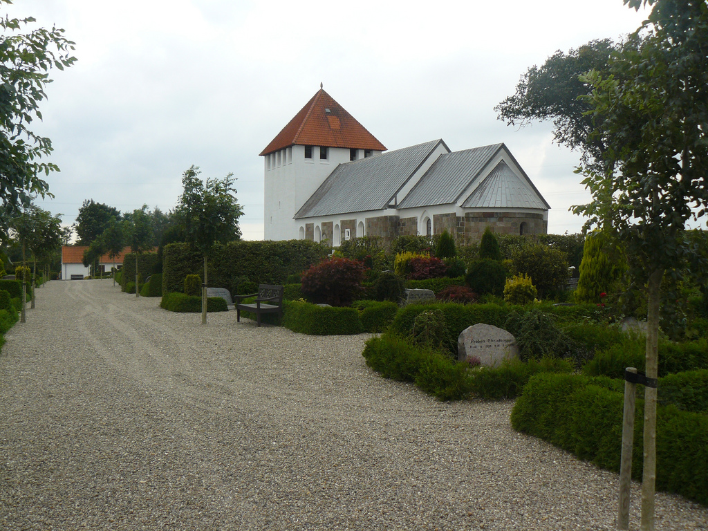
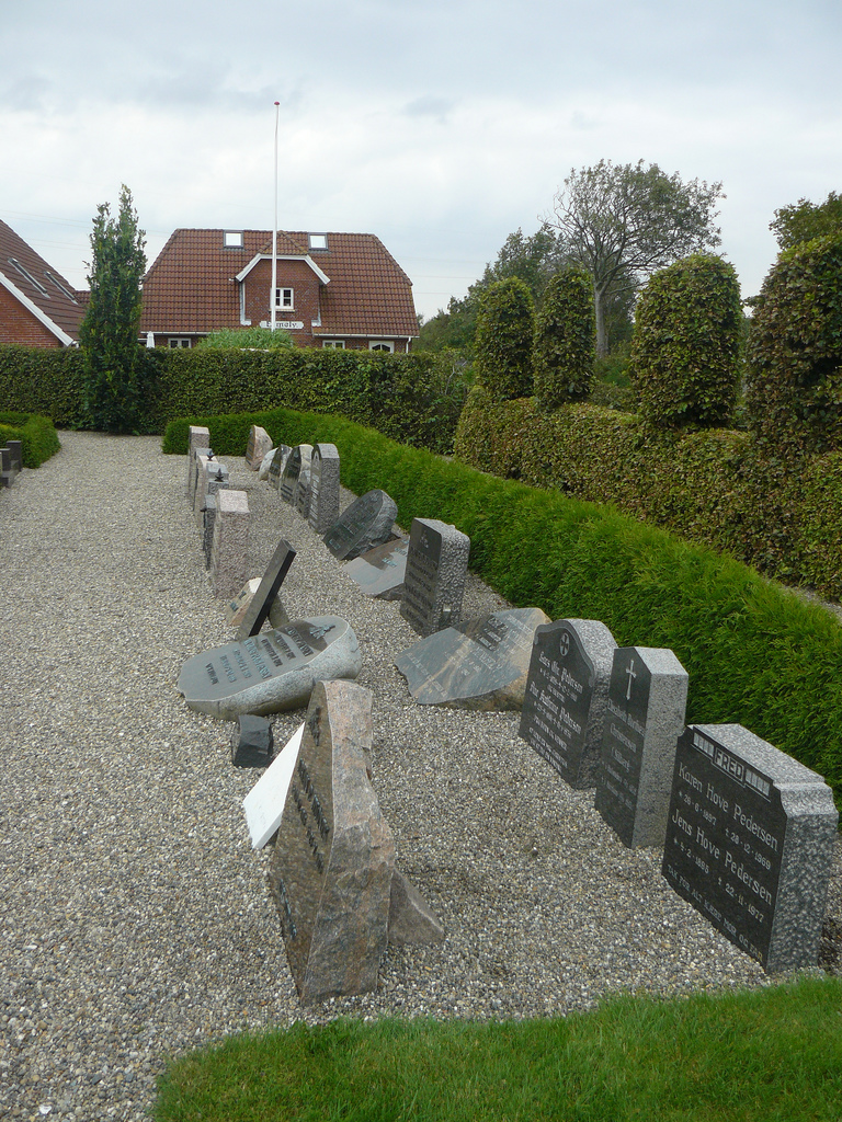
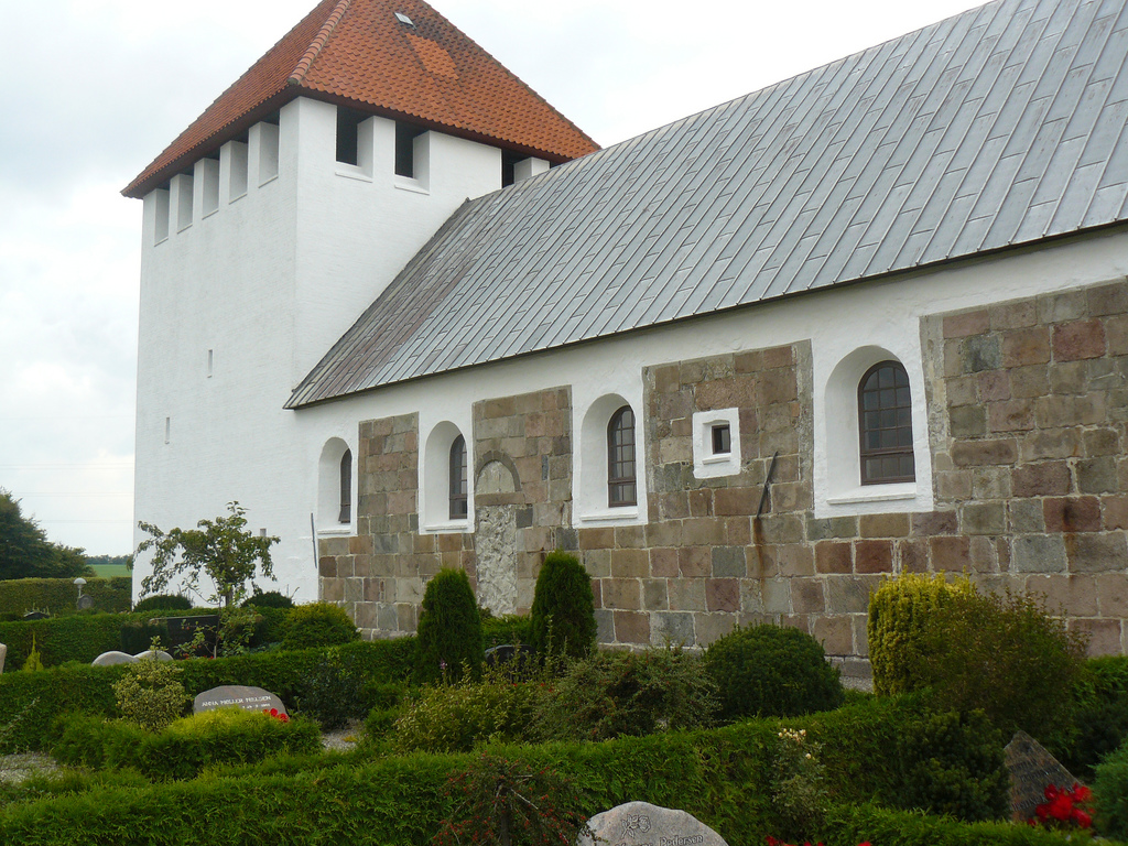
| Description | : | The Hørdum Church and its cemetery are actually located 12km south of Hundborg. Please see the map and GPS coordinates for accurate directions. Located in the traditional Thy district, now the Thisted Municipality, where every village has its own church. The Hørdum Church was built around 1170 and has been in use as a church for 800 years. It is home to Denmark's only picture stone of the Viking Age, known as the Hørdum stone or Thor's stone. The stone was rediscovered in 1954 and depicts a well-known scene from Nordic mythology called Thor's haul. The Hørdum... Read More |
frequently asked questions (FAQ):
-
Where is Hørdum Kirkegård?
Hørdum Kirkegård is located at Thorsvej 25A, 7752 Snedsted, Denmark Hundborg, Thisted Kommune ,Nordjylland ,Denmark.
-
Hørdum Kirkegård cemetery's updated grave count on graveviews.com?
1 memorials
-
Where are the coordinates of the Hørdum Kirkegård?
Latitude: 56.8440300
Longitude: 8.5128480
Nearby Cemetories:
1. Snedsted Kirke
Snedsted, Thisted Kommune, Denmark
Coordinate: 56.8942400, 8.5406700
2. Visby Thisted Amt
Visby, Thisted Kommune, Denmark
Coordinate: 56.7932600, 8.4634900
3. Vestervig Gamle Kirkegaard
Vestervig, Thisted Kommune, Denmark
Coordinate: 56.7731400, 8.3172000
4. Vang Kirke
Aarhus, Arhus Kommune, Denmark
Coordinate: 56.9841500, 8.5104000
5. Ydby Kirkegaard
Ydby, Thisted Kommune, Denmark
Coordinate: 56.7000000, 8.4166700
6. Helligsoe Churchyard
Helligso, Thisted Kommune, Denmark
Coordinate: 56.7016943, 8.3470745
7. Sennels
Sennels, Thisted Kommune, Denmark
Coordinate: 56.9654558, 8.7948655
8. Nykøbing Mors Cemetery
Nykobing Mors, Morsø Kommune, Denmark
Coordinate: 56.7985701, 8.8688021
9. Hansted Cemetery
Hanstholm, Thisted Kommune, Denmark
Coordinate: 57.1133325, 8.5993621
10. Vigsø Kirkegård
Vigso, Thisted Kommune, Denmark
Coordinate: 57.0953160, 8.7113760
11. Vejby Kirke
Vejby, Hjørring Kommune, Denmark
Coordinate: 56.6061878, 8.8088544
12. Vejby Kirke
Vejby, Skive Kommune, Denmark
Coordinate: 56.6035245, 8.8104935
13. Lemvig Cemetery
Lemvig, Lemvig Kommune, Denmark
Coordinate: 56.5497700, 8.2973800
14. Håsum Kirkegård
Hasum, Skive Kommune, Denmark
Coordinate: 56.5794106, 8.8472049
15. Heldum Kirke
Heldum, Lemvig Kommune, Denmark
Coordinate: 56.5472990, 8.2729645
16. Lild kirke & kirkegård
Bjerget, Thisted Kommune, Denmark
Coordinate: 57.1059329, 9.0010730
17. Lild kirke & kirkegård
Bjerget, Thisted Kommune, Denmark
Coordinate: 57.1059329, 9.0010730
18. Dybe Kirkegård
Dybe, Lemvig Kommune, Denmark
Coordinate: 56.5113307, 8.1722669
19. Resen Cemetery
Skive Kommune, Denmark
Coordinate: 56.5907763, 9.0360498
20. Vitskøl Klosterkirchhof
Ranum, Vesthimmerland Kommune, Denmark
Coordinate: 56.8691734, 9.2129499
21. Vust kirke & kirkegård
Vust, Jammerbugt Kommune, Denmark
Coordinate: 57.1151716, 9.0636249
22. Egeris Cemetery
Skive Kommune, Denmark
Coordinate: 56.5510692, 9.0275774
23. Over Lade Kirkegaard
Nørresundby, Aalborg Kommune, Denmark
Coordinate: 56.8573490, 9.2661310
24. Flynder Kirkegård
Baekmarksbro, Lemvig Kommune, Denmark
Coordinate: 56.4473225, 8.3047532