
| Memorials | : | 0 |
| Location | : | Carthage, Smith County, USA |
| Coordinate | : | 36.2026420, -85.8982160 |
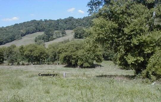
| Description | : | Hubbard Cemetery The Hubbard Cemetery is located on the James Kemp farm (was the old Hubbard farm) about 1 mile from Stonewall at #93 Smiths Road. It is located in the field about 150 yards behind the house. There are 6 known graves. 4 unmarked, 2 of which are unknown. |
frequently asked questions (FAQ):
-
Where is Hubbard Cemetery?
Hubbard Cemetery is located at Carthage, Smith County ,Tennessee ,USA.
-
Hubbard Cemetery cemetery's updated grave count on graveviews.com?
0 memorials
-
Where are the coordinates of the Hubbard Cemetery?
Latitude: 36.2026420
Longitude: -85.8982160
Nearby Cemetories:
1. John Vaden Cemetery
Elmwood, Smith County, USA
Coordinate: 36.2058100, -85.9142020
2. Mack Vaden Cemetery
Elmwood, Smith County, USA
Coordinate: 36.2080400, -85.9140400
3. Vanderpool-Rittenberry Cemetery
Elmwood, Smith County, USA
Coordinate: 36.1979670, -85.9171630
4. Cooper Cemetery
Elmwood, Smith County, USA
Coordinate: 36.2025300, -85.9198500
5. Vaden-Hubbard-Ford Cemetery
Elmwood, Smith County, USA
Coordinate: 36.2180160, -85.9122920
6. Farmer Cemetery
Chestnut Mound, Smith County, USA
Coordinate: 36.2040620, -85.8745800
7. Timberlake Cemetery
Elmwood, Smith County, USA
Coordinate: 36.2115700, -85.8768300
8. Nichols-Ford Cemetery
Elmwood, Smith County, USA
Coordinate: 36.2194800, -85.8825010
9. Barnett Cemetery
Elmwood, Smith County, USA
Coordinate: 36.2189390, -85.8810310
10. Owen Cemetery
Gordonsville, Smith County, USA
Coordinate: 36.1949000, -85.9270800
11. Allgier Cemetery
Elmwood, Smith County, USA
Coordinate: 36.2253970, -85.8851530
12. Gibbs Cemetery
Elmwood, Smith County, USA
Coordinate: 36.2270090, -85.9063910
13. Boulton Cemetery
Smith County, USA
Coordinate: 36.2235900, -85.9173350
14. Elmwood United Methodist Church Cemetery
Elmwood, Smith County, USA
Coordinate: 36.2269220, -85.8859420
15. Ford Cemetery
Elmwood, Smith County, USA
Coordinate: 36.2189800, -85.8710900
16. Ford Cemetery
Elmwood, Smith County, USA
Coordinate: 36.2171200, -85.8688400
17. McKinney Cemetery
Chestnut Mound, Smith County, USA
Coordinate: 36.1971530, -85.8630140
18. Craig Cemetery
Elmwood, Smith County, USA
Coordinate: 36.2306260, -85.8856090
19. Farmer Cemetery
Elmwood, Smith County, USA
Coordinate: 36.2112120, -85.8623600
20. Coffee Cemetery
Gordonsville, Smith County, USA
Coordinate: 36.1883011, -85.9317017
21. Preston Cemetery
Gordonsville, Smith County, USA
Coordinate: 36.1761017, -85.9203033
22. Boze Cemetery
Smith County, USA
Coordinate: 36.2106190, -85.8580630
23. Wade Family Cemetery
Chestnut Mound, Smith County, USA
Coordinate: 36.1966940, -85.8572580
24. Gordonsville Cemetery
Gordonsville, Smith County, USA
Coordinate: 36.1834200, -85.9326900