
| Memorials | : | 3148 |
| Location | : | Forest, Hardin County, USA |
| Coordinate | : | 40.8041992, -83.5547028 |
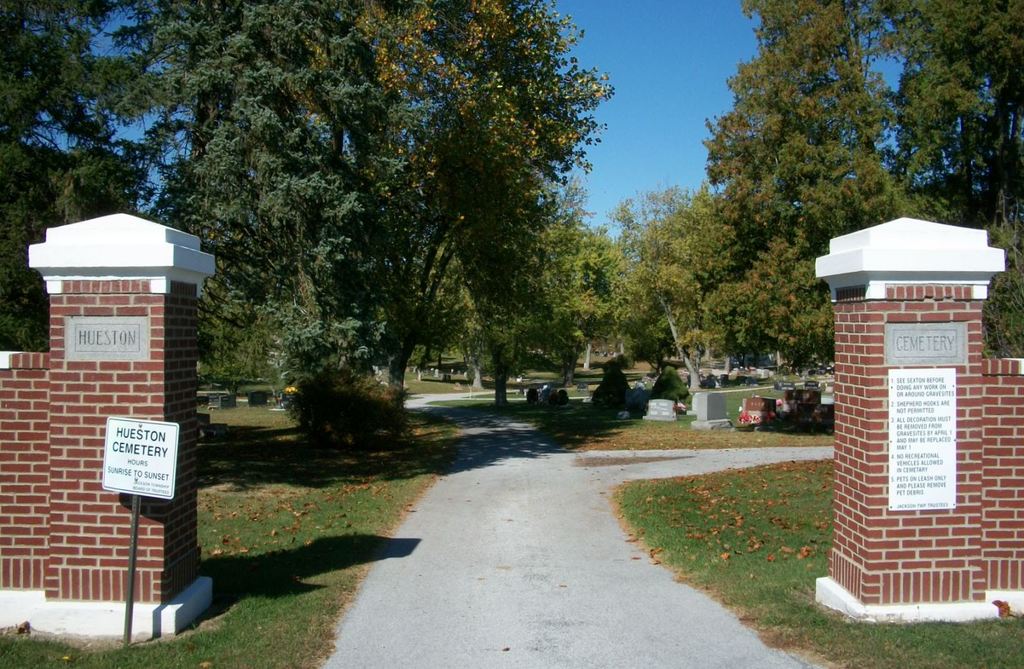
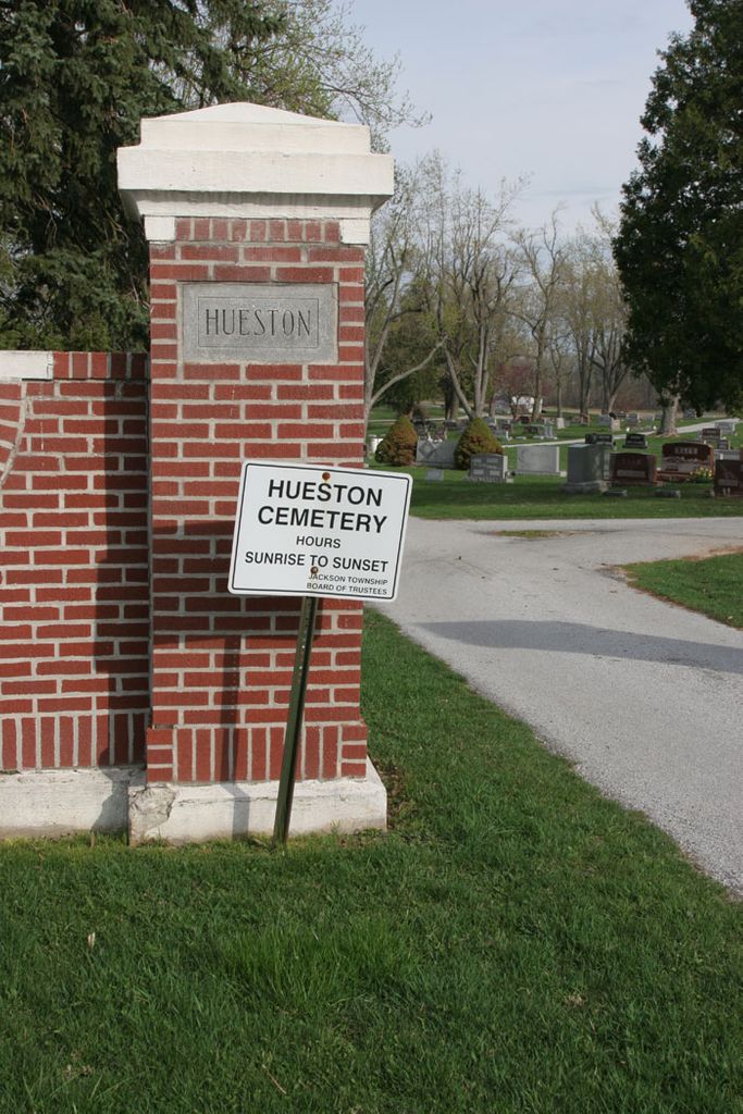
| Description | : | The cemetery is located on the northwest corner of the intersection of County Road 20 and Musson Road. The cemetery was established in 1831. The cemetery is 19 acres in size. The cemetery is located in Jackson Township, Hardin County, Ohio, and is # 4893 (Forrest Cemetery / Hueston Cemetery / Huston Cemetery) in “Ohio Cemeteries 1803-2003”, compiled by the Ohio Genealogical Society. The cemetery is registered with the Ohio Division of Real Estate and Professional Licensing (ODRE) as Hueston Cemetery with registration license number CGR.0000982071. The U.S. Geological Survey (USGS) Geographic Names Information System (GNIS) feature ID... Read More |
frequently asked questions (FAQ):
-
Where is Hueston Cemetery?
Hueston Cemetery is located at County Road 20 and Musson Road Forest, Hardin County ,Ohio , 45843USA.
-
Hueston Cemetery cemetery's updated grave count on graveviews.com?
3142 memorials
-
Where are the coordinates of the Hueston Cemetery?
Latitude: 40.8041992
Longitude: -83.5547028
Nearby Cemetories:
1. Price Cemetery
Hardin County, USA
Coordinate: 40.7894190, -83.5311400
2. Patterson Cemetery
Patterson, Hardin County, USA
Coordinate: 40.7873340, -83.5283400
3. Johnson Cemetery
Delaware Township, Hancock County, USA
Coordinate: 40.8410988, -83.5456009
4. Callahan Cemetery
Wyandot County, USA
Coordinate: 40.8106003, -83.4922028
5. Hall Family Cemetery
Hardin County, USA
Coordinate: 40.7620750, -83.5952380
6. Earlywine Cemetery
Mount Blanchard, Hancock County, USA
Coordinate: 40.8699989, -83.5875015
7. Dunkirk Cemetery
Dunkirk, Hardin County, USA
Coordinate: 40.7764015, -83.6417007
8. Spoon Cemetery
Wharton, Wyandot County, USA
Coordinate: 40.8574982, -83.4914017
9. Adams Cemetery
Mount Blanchard, Hancock County, USA
Coordinate: 40.8727989, -83.5180969
10. Williamstown Cemetery
Arlington, Hancock County, USA
Coordinate: 40.8349991, -83.6500015
11. Grant Cemetery
Grant, Hardin County, USA
Coordinate: 40.7242012, -83.5607986
12. Jackson Center Cemetery
Kirby, Wyandot County, USA
Coordinate: 40.7694016, -83.4574966
13. Armstrong Cemetery
Kirby, Wyandot County, USA
Coordinate: 40.8319016, -83.4471970
14. Wharton Cemetery
Wharton, Wyandot County, USA
Coordinate: 40.8581100, -83.4568700
15. Dola Cemetery
Dola, Hardin County, USA
Coordinate: 40.7799988, -83.6746979
16. Castor Cemetery
Arlington, Hancock County, USA
Coordinate: 40.8918991, -83.6044006
17. Burson Cemetery
Mount Blanchard, Hancock County, USA
Coordinate: 40.8998000, -83.5643000
18. Unidentified Cemetery #1
Jackson Township, Wyandot County, USA
Coordinate: 40.7389000, -83.4612670
19. Mount Blanchard Cemetery
Mount Blanchard, Hancock County, USA
Coordinate: 40.9036102, -83.5522232
20. Saint Mary Catholic Cemetery
Kirby, Wyandot County, USA
Coordinate: 40.8167200, -83.4165900
21. Krout Cemetery
Mount Blanchard, Hancock County, USA
Coordinate: 40.9129982, -83.5559998
22. Good Hope Cemetery
Wyandot County, USA
Coordinate: 40.7094002, -83.4828033
23. Riverview Cemetery
Mount Blanchard, Hancock County, USA
Coordinate: 40.9136009, -83.5563965
24. Shanks Cemetery
Wyandot County, USA
Coordinate: 40.7016000, -83.4898460