
| Memorials | : | 0 |
| Location | : | Harpster, Wyandot County, USA |
| Coordinate | : | 40.7347350, -83.2568610 |
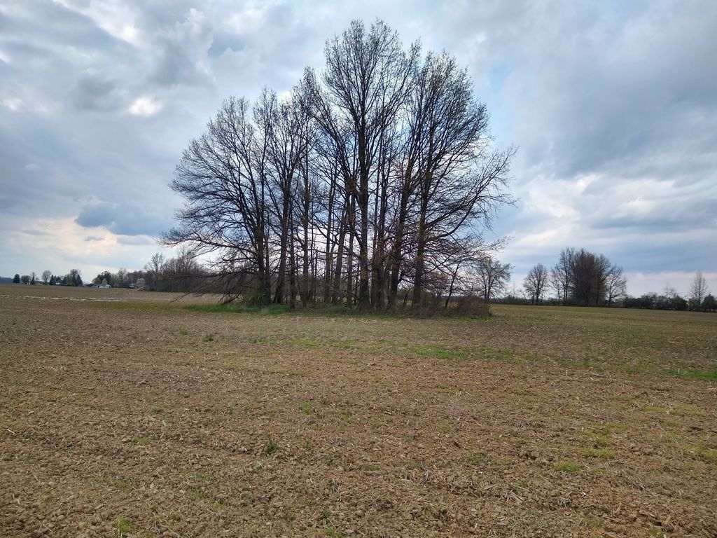
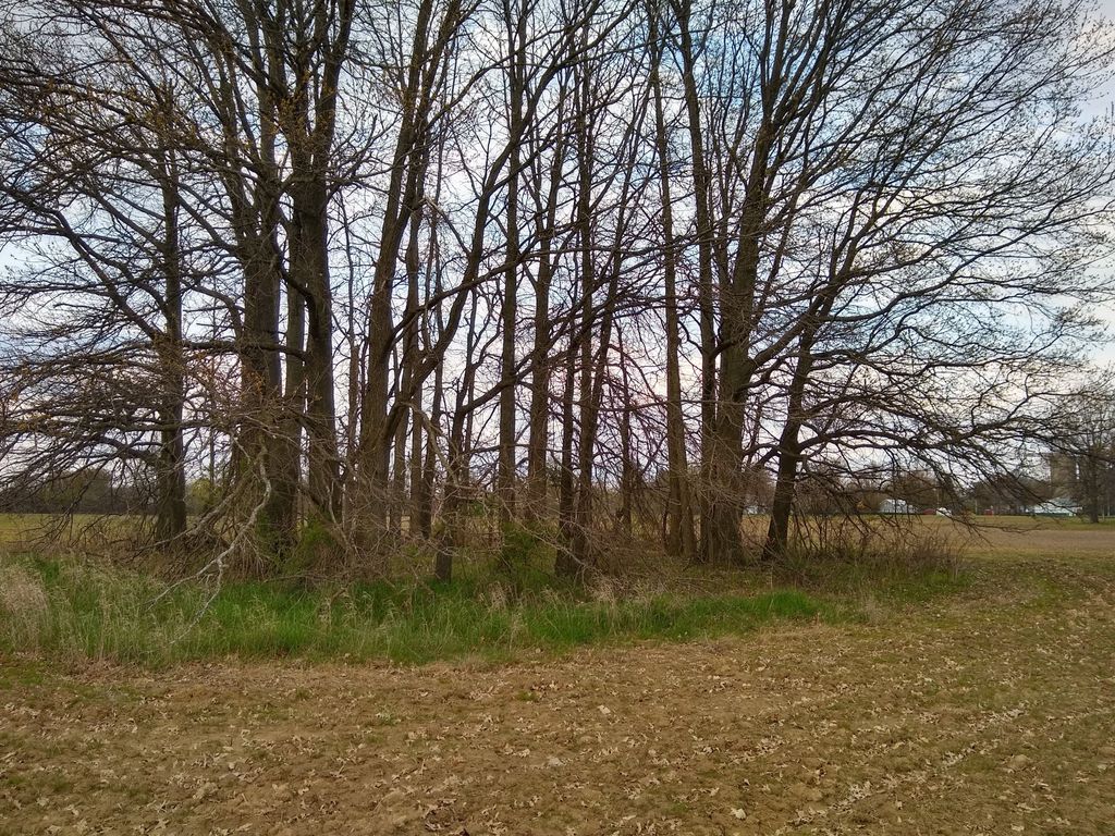
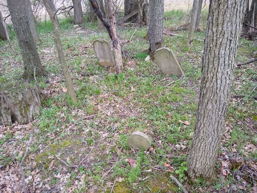
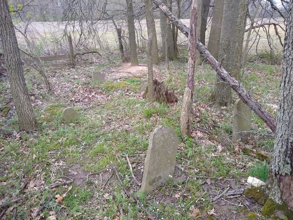
| Description | : | Small family cemetery located on privately owned property. No access road or path from any road/street. As of April 2020, the cemetery is completely overgrown with full sized trees and brush and is in a complete state of disrepair. The plot of land is approximately 60 feet by 60 feet and is located 1150 feet west of County Highway 119 and 1200 feet south of State Route 294. This cemetery was "discovered" by Dan Reid and Keith Newell circa 1970 during a hiking expedition near Dan's home. The cemetery is located in Pitt... Read More |
frequently asked questions (FAQ):
-
Where is Hunt Cemetery?
Hunt Cemetery is located at Cherokee Street (County Road 119) Harpster, Wyandot County ,Ohio , 43323USA.
-
Hunt Cemetery cemetery's updated grave count on graveviews.com?
0 memorials
-
Where are the coordinates of the Hunt Cemetery?
Latitude: 40.7347350
Longitude: -83.2568610
Nearby Cemetories:
1. Little John Green Cemetery
Harpster, Wyandot County, USA
Coordinate: 40.7095270, -83.2473940
2. John Green Cemetery
Harpster, Wyandot County, USA
Coordinate: 40.7095000, -83.2450000
3. Bowsherville Cemetery
Harpster, Wyandot County, USA
Coordinate: 40.7313995, -83.2944031
4. Little Sandusky Cemetery
Little Sandusky, Wyandot County, USA
Coordinate: 40.7367200, -83.2174200
5. McClain Cemetery
Upper Sandusky, Wyandot County, USA
Coordinate: 40.7846929, -83.2419017
6. Neff Cemetery
Morral, Marion County, USA
Coordinate: 40.6858900, -83.2218600
7. Pipetown Indian Cemetery #2
Nevada, Wyandot County, USA
Coordinate: 40.7577950, -83.1883690
8. Pipetown Indian Cemetery #1
Nevada, Wyandot County, USA
Coordinate: 40.7577980, -83.1881750
9. Reber Cemetery
Upper Sandusky, Wyandot County, USA
Coordinate: 40.7937600, -83.2672450
10. Hendrickson Cemetery
Upper Sandusky, Wyandot County, USA
Coordinate: 40.7667236, -83.3243637
11. Oak Hill Cemetery
Upper Sandusky, Wyandot County, USA
Coordinate: 40.7952995, -83.2758026
12. Deal Cemetery
Meeker, Marion County, USA
Coordinate: 40.6819000, -83.3019028
13. Emanuel United Church of Christ Cemetery
Upper Sandusky, Wyandot County, USA
Coordinate: 40.7897980, -83.2073110
14. Upper Sandusky Mausoleum
Wyandot County, USA
Coordinate: 40.8077030, -83.2843710
15. Swartz Cemetery
Nevada, Wyandot County, USA
Coordinate: 40.7728336, -83.1688090
16. Wyandot Indian Cemetery
Nevada, Wyandot County, USA
Coordinate: 40.7675216, -83.1617790
17. Peters Cemetery
Upper Sandusky, Wyandot County, USA
Coordinate: 40.8122220, -83.2794440
18. Macedonia Cemetery
Wyandot County, USA
Coordinate: 40.7176400, -83.1496220
19. Stansbery Cemetery
Wyandot County, USA
Coordinate: 40.7280998, -83.3747025
20. Grand Prairie Cemetery
Brush Ridge, Marion County, USA
Coordinate: 40.6906013, -83.1539001
21. Rock Run Cemetery
Upper Sandusky, Wyandot County, USA
Coordinate: 40.8217010, -83.2225037
22. Union Cemetery
Big Island, Marion County, USA
Coordinate: 40.6436005, -83.2707977
23. Bretz Cemetery
Brush Ridge, Marion County, USA
Coordinate: 40.6977997, -83.1455994
24. Old Indian Burial Grounds
Upper Sandusky, Wyandot County, USA
Coordinate: 40.8265540, -83.2779740