
| Memorials | : | 3 |
| Location | : | West Sonora, Preble County, USA |
| Coordinate | : | 39.9100500, -84.5313400 |
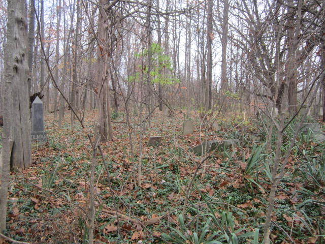
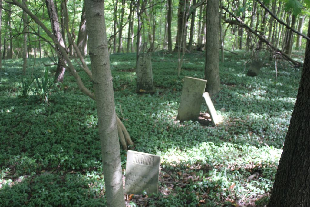
| Description | : | a.k.a. - LOY CEMETERY It is located in Section 3, Harrison Twp. West of 503 and North of Georgetown-Verona Road on the Hunt or Studebaker farm. The cemetery is located in Israel Township, Preble County, Ohio, and is # 9985 (Hunt Cemetery / Loy Cemetery / Tilman Cemetery / Hapner Cemetery) in “Ohio Cemeteries 1803-2003”, compiled by the Ohio Genealogical Society. |
frequently asked questions (FAQ):
-
Where is Hunt Cemetery?
Hunt Cemetery is located at Georgetown Verona Road West Sonora, Preble County ,Ohio , 45338USA.
-
Hunt Cemetery cemetery's updated grave count on graveviews.com?
2 memorials
-
Where are the coordinates of the Hunt Cemetery?
Latitude: 39.9100500
Longitude: -84.5313400
Nearby Cemetories:
1. Gordon Cemetery
Gordon, Darke County, USA
Coordinate: 39.9283840, -84.5063390
2. Ithaca Lutheran Cemetery
Ithaca, Darke County, USA
Coordinate: 39.9357490, -84.5517200
3. Verona Cemetery
Verona, Preble County, USA
Coordinate: 39.8958015, -84.4961014
4. Ithaca Cemetery
Ithaca, Darke County, USA
Coordinate: 39.9431000, -84.5597000
5. Brown Cemetery
West Manchester, Preble County, USA
Coordinate: 39.8950005, -84.5958328
6. Roselawn Cemetery
Lewisburg, Preble County, USA
Coordinate: 39.8518982, -84.5428009
7. Lower Lewisburg Cemetery
Lewisburg, Preble County, USA
Coordinate: 39.8453331, -84.5369339
8. Dry Fork Cemetery
West Manchester, Preble County, USA
Coordinate: 39.8795433, -84.6157150
9. Castine Cemetery
Castine, Darke County, USA
Coordinate: 39.9306050, -84.6210650
10. Railroad Cemetery
Castine, Darke County, USA
Coordinate: 39.9183410, -84.6244710
11. Bachman Cemetery
Bachman, Montgomery County, USA
Coordinate: 39.8613620, -84.4602300
12. Old Castine Cemetery
Castine, Darke County, USA
Coordinate: 39.9383011, -84.6250000
13. Saint Johns Evangelical Lutheran Cemetery
Lewisburg, Preble County, USA
Coordinate: 39.8385620, -84.4880680
14. Parish Cemetery
Arlington, Montgomery County, USA
Coordinate: 39.8660660, -84.4297028
15. Arlington Cemetery
Brookville, Montgomery County, USA
Coordinate: 39.8652992, -84.4297028
16. Arnett Cemetery
Miami County, USA
Coordinate: 39.9546220, -84.4172500
17. Monroe Cemetery
Eldorado, Preble County, USA
Coordinate: 39.8878710, -84.6562140
18. Phillipsburg Christian Cemetery
Phillipsburg, Montgomery County, USA
Coordinate: 39.9068240, -84.4026870
19. Wares Chapel Cemetery
West Manchester, Preble County, USA
Coordinate: 39.8644447, -84.6466675
20. Mote Cemetery
Pitsburg, Darke County, USA
Coordinate: 39.9916801, -84.4562836
21. Pleasant View Church Cemetery
Eldorado, Preble County, USA
Coordinate: 39.8860700, -84.6611710
22. Phillipsburg Cemetery
Phillipsburg, Montgomery County, USA
Coordinate: 39.9124985, -84.3974991
23. Old South Fork Friends Cemetery
Phillipsburg, Montgomery County, USA
Coordinate: 39.9043330, -84.3971670
24. Beech Grove Cemetery
Arcanum, Darke County, USA
Coordinate: 39.9907800, -84.6180000