| Memorials | : | 91 |
| Location | : | Hopewell, Mercer County, USA |
| Coordinate | : | 40.3653800, -74.8163100 |
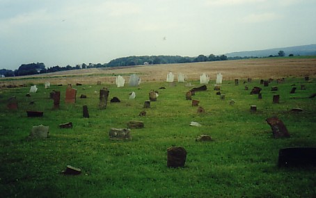
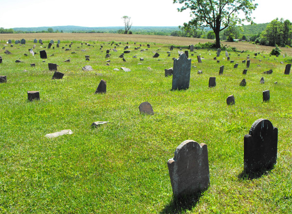
| Description | : | Over 400 stones arranged in 22 rows. John Hart, a signer of the declaration of Independence, was buried here until he was re-interred in the Old School Baptist Cemetery in Hopewell.When the cemetery was cleaned up stones were placed in the above positions, so they may not reflect where someone is actually interred. |
frequently asked questions (FAQ):
-
Where is Hunt Farm Burial Ground?
Hunt Farm Burial Ground is located at Hopewell, Mercer County ,New Jersey ,USA.
-
Hunt Farm Burial Ground cemetery's updated grave count on graveviews.com?
91 memorials
-
Where are the coordinates of the Hunt Farm Burial Ground?
Latitude: 40.3653800
Longitude: -74.8163100
Nearby Cemetories:
1. Harbourton Cemetery
Harbourton, Mercer County, USA
Coordinate: 40.3521400, -74.8524300
2. Cornell Burying Ground
Pennington, Mercer County, USA
Coordinate: 40.3373860, -74.7873630
3. Pennington Methodist Church Burial Ground
Pennington, Mercer County, USA
Coordinate: 40.3247590, -74.8140310
4. Golden Burial Ground
Hopewell, Mercer County, USA
Coordinate: 40.3924510, -74.7760810
5. Pennington Presbyterian Church Cemetery
Pennington, Mercer County, USA
Coordinate: 40.3276138, -74.7906647
6. Pennington Cemetery
Pennington, Mercer County, USA
Coordinate: 40.3282500, -74.7885800
7. Hopewell Baptist Meeting House Cemetery
Hopewell, Mercer County, USA
Coordinate: 40.3879600, -74.7646800
8. Old School Baptist Yard
Baptistown, Hunterdon County, USA
Coordinate: 40.3879600, -74.7646800
9. Highland Cemetery
Hopewell, Mercer County, USA
Coordinate: 40.3955994, -74.7660980
10. Rockefeller-Wikoff Burying Ground
Rocktown, Hunterdon County, USA
Coordinate: 40.3978424, -74.8675385
11. Second Calvary Baptist Churchyard
Hopewell, Mercer County, USA
Coordinate: 40.3870811, -74.7552185
12. Pennington African Cemetery
Pennington, Mercer County, USA
Coordinate: 40.3185900, -74.7879700
13. Saint Alphonsus Roman Catholic Cemetery
Hopewell, Mercer County, USA
Coordinate: 40.3888397, -74.7559357
14. Winder Phillips Grave Yard
Mount Airy, Hunterdon County, USA
Coordinate: 40.3847222, -74.8833333
15. Rocks Methodist Episcopal Cemetery
Mount Airy, Hunterdon County, USA
Coordinate: 40.3844986, -74.8835983
16. Stevenson Family Burying Ground
Mount Airy, Hunterdon County, USA
Coordinate: 40.3685188, -74.8912277
17. Titusville Methodist Church Cemetery
Titusville, Mercer County, USA
Coordinate: 40.3208960, -74.8684790
18. Saint Luke Lutheran Church Memorial Garden
Willingboro, Burlington County, USA
Coordinate: 40.3379800, -74.8936080
19. Stoutsburg Cemetery
Hopewell, Mercer County, USA
Coordinate: 40.4046100, -74.7462500
20. Phillips Family Burial Ground
Hopewell, Mercer County, USA
Coordinate: 40.3363330, -74.8979690
21. Lane Collings Family Burial Ground
Stoutsburg, Mercer County, USA
Coordinate: 40.3930490, -74.7321110
22. Titusville Presbyterian Churchyard
Titusville, Mercer County, USA
Coordinate: 40.3102860, -74.8783600
23. Union Cemetery
Ringoes, Hunterdon County, USA
Coordinate: 40.4261017, -74.8732986
24. Second English Presbyterian Church Cemetery
Amwell, Hunterdon County, USA
Coordinate: 40.3984718, -74.9072189


