| Memorials | : | 2 |
| Location | : | Hopewell, Mercer County, USA |
| Coordinate | : | 40.3375810, -74.9141400 |
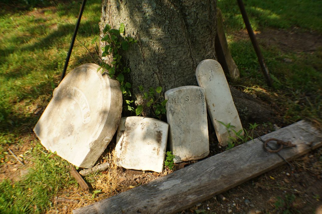
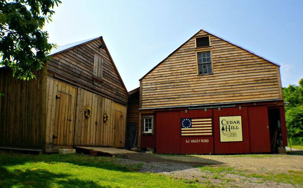
| Description | : | GPS Coordinates: 40.337581, -74.914140 This cemetery does not exist per se and is on PRIVATE LAND. The Hunt Farm now called Cedar Hill was built in 1720. Early settlers were buried in the nearby fields. The current owner, who runs a nursery/perennial farm, occasionally finds headstones while plowing the fields. The greenhouses are open seasonally from 9-5, so respect the privacy of the owners. Two of the headstones and several footstones can be seen under and leaning against the large cherry tree close to the home (door yard area on the right as you enter... Read More |
frequently asked questions (FAQ):
-
Where is Hunt Farm Cemetery?
Hunt Farm Cemetery is located at Cedar Hill Farm, 62 Valley Road, Hopewell Township but mailing address is Lambertville, NJ Hopewell, Mercer County ,New Jersey , 08530USA.
-
Hunt Farm Cemetery cemetery's updated grave count on graveviews.com?
2 memorials
-
Where are the coordinates of the Hunt Farm Cemetery?
Latitude: 40.3375810
Longitude: -74.9141400
Nearby Cemetories:
1. Phillips Family Burial Ground
Hopewell, Mercer County, USA
Coordinate: 40.3363330, -74.8979690
2. Washington Crossing State Park
Washington Crossing, Bucks County, USA
Coordinate: 40.3311539, -74.9325943
3. Saint Luke Lutheran Church Memorial Garden
Willingboro, Burlington County, USA
Coordinate: 40.3379800, -74.8936080
4. Thompson Memorial Cemetery
New Hope, Bucks County, USA
Coordinate: 40.3353004, -74.9464035
5. Saint John the Evangelist Cemetery
Lambertville, Hunterdon County, USA
Coordinate: 40.3621100, -74.9412000
6. Mount Hope Cemetery
Lambertville, Hunterdon County, USA
Coordinate: 40.3630562, -74.9405594
7. New Hope Cemetery
New Hope, Bucks County, USA
Coordinate: 40.3552742, -74.9526825
8. Stevenson Family Burying Ground
Mount Airy, Hunterdon County, USA
Coordinate: 40.3685188, -74.8912277
9. First Presbyterian Church Cemetery
Lambertville, Hunterdon County, USA
Coordinate: 40.3667700, -74.9456300
10. Saint Martin of Tours Cemetery
New Hope, Bucks County, USA
Coordinate: 40.3614000, -74.9536000
11. Titusville Presbyterian Churchyard
Titusville, Mercer County, USA
Coordinate: 40.3102860, -74.8783600
12. Titusville Methodist Church Cemetery
Titusville, Mercer County, USA
Coordinate: 40.3208960, -74.8684790
13. Mount Moriah AME Church Cemetery
New Hope, Bucks County, USA
Coordinate: 40.3608900, -74.9619190
14. Harbourton Cemetery
Harbourton, Mercer County, USA
Coordinate: 40.3521400, -74.8524300
15. Rocks Methodist Episcopal Cemetery
Mount Airy, Hunterdon County, USA
Coordinate: 40.3844986, -74.8835983
16. Winder Phillips Grave Yard
Mount Airy, Hunterdon County, USA
Coordinate: 40.3847222, -74.8833333
17. Holcombe Riverview Cemetery
Lambertville, Hunterdon County, USA
Coordinate: 40.3828011, -74.9535980
18. Washington Crossing United Methodist Cemetery
Washington Crossing, Bucks County, USA
Coordinate: 40.2923000, -74.8693000
19. Saint Philips Episcopal Church Columbarium
New Hope, Bucks County, USA
Coordinate: 40.3783500, -74.9661800
20. Lewis Family Cemetery
Newtown, Allegheny County, USA
Coordinate: 40.3070080, -74.9820480
21. Second English Presbyterian Church Cemetery
Amwell, Hunterdon County, USA
Coordinate: 40.3984718, -74.9072189
22. Solebury Friends Graveyard
Solebury, Bucks County, USA
Coordinate: 40.3716393, -74.9867020
23. Ascension Lutheran Church Memorial Garden
Newtown, Bucks County, USA
Coordinate: 40.2721980, -74.8950430
24. Rockefeller-Wikoff Burying Ground
Rocktown, Hunterdon County, USA
Coordinate: 40.3978424, -74.8675385


