
| Memorials | : | 1 |
| Location | : | Sanbornville, Carroll County, USA |
| Coordinate | : | 43.5573807, -71.0097885 |
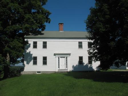
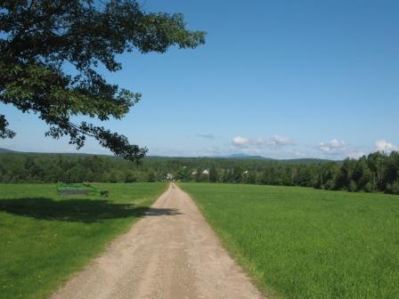
| Description | : | Built in 1774, the 4 bedroom colonial has been restored to it's original interior. The Front faces East and the house sits on 121 acres. The back of the house has the view of Mt. Washington Range. "Jug Road" ran to the right of the house, between the house and barn but is now the driveway that ends at the house. Thankfully, the The property is in Conservation and will never be developed. The cemetery is in the NE corner of the property in open field and in poor repair. |
frequently asked questions (FAQ):
-
Where is Hutchins Brackett Farm Cemetery?
Hutchins Brackett Farm Cemetery is located at Sanbornville, Carroll County ,New Hampshire ,USA.
-
Hutchins Brackett Farm Cemetery cemetery's updated grave count on graveviews.com?
1 memorials
-
Where are the coordinates of the Hutchins Brackett Farm Cemetery?
Latitude: 43.5573807
Longitude: -71.0097885
Nearby Cemetories:
1. Sanborn Cemetery 35
Wakefield, Carroll County, USA
Coordinate: 43.5656189, -71.0039812
2. Lovell Lake Cemetery
Sanbornville, Carroll County, USA
Coordinate: 43.5506000, -71.0244000
3. Wentworth-Garvin Cemetery
Wakefield, Carroll County, USA
Coordinate: 43.5680560, -70.9983330
4. Historic Wakefield Corner Burial Ground
Wakefield, Carroll County, USA
Coordinate: 43.5719719, -71.0258713
5. Hutchins Cemetery
Wakefield, Carroll County, USA
Coordinate: 43.5481000, -71.0330000
6. Dodavah Copp Burial Site
Wakefield, Carroll County, USA
Coordinate: 43.5767308, -70.9995894
7. Saint Anthonys Cemetery
Sanbornville, Carroll County, USA
Coordinate: 43.5494500, -71.0386710
8. Dow Cemetery
Wakefield, Carroll County, USA
Coordinate: 43.5825000, -71.0150000
9. Gage Hill Cemetery
Wakefield, Carroll County, USA
Coordinate: 43.5743900, -71.0408300
10. Hutchins Family Cemetery
Sanbornville, Carroll County, USA
Coordinate: 43.5319366, -70.9909897
11. Pike Cemetery
Brookfield, Carroll County, USA
Coordinate: 43.5318500, -70.9910667
12. Garland Family Cemetery
Wakefield, Carroll County, USA
Coordinate: 43.5313000, -70.9902000
13. Farnham Cemetery
Wakefield, Carroll County, USA
Coordinate: 43.5408330, -70.9744440
14. Gilman Cemetery
Wakefield, Carroll County, USA
Coordinate: 43.5316670, -71.0383330
15. Clark Cemetery
Brookfield, Carroll County, USA
Coordinate: 43.5274710, -71.0299160
16. Ferguson-Chamberlain Cemetery
Brookfield, Carroll County, USA
Coordinate: 43.5327000, -71.0408000
17. Dealand Cemetery
Brookfield, Carroll County, USA
Coordinate: 43.5452510, -71.0532190
18. Pike Cemetery
Brookfield, Carroll County, USA
Coordinate: 43.5735220, -71.0515990
19. Thompson Cemetery
Acton, York County, USA
Coordinate: 43.5691930, -70.9634960
20. Farnham-Dearborn Cemetery
Strafford County, USA
Coordinate: 43.5258150, -70.9843180
21. Belknap Cemetery
Brookfield, Carroll County, USA
Coordinate: 43.5361050, -71.0515020
22. Pike-Perkins Cemetery
Brookfield, Carroll County, USA
Coordinate: 43.5801000, -71.0507000
23. Horn Cemetery
Wakefield, Carroll County, USA
Coordinate: 43.5497220, -70.9591670
24. Berry Cemetery
Milton Mills, Strafford County, USA
Coordinate: 43.5313900, -70.9724500