
| Memorials | : | 0 |
| Location | : | Lisbon, Lisboa Municipality, Portugal |
| Coordinate | : | 38.7133920, -9.1434550 |
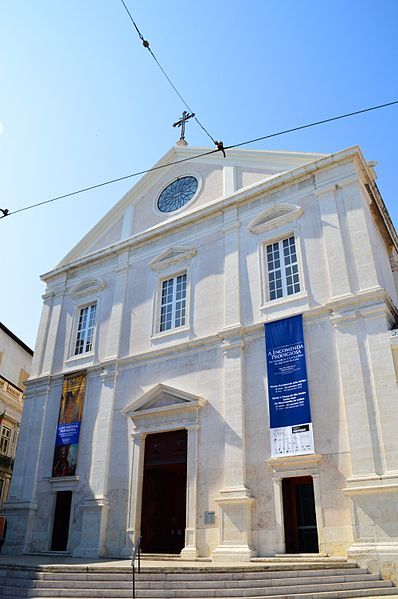
| Description | : | The Igreja de São Roque (Church of St Roch) in Lisbon was the earliest Jesuit church in the Portuguese world, and one of the first Jesuit churches anywhere. It served as the Society’s home church in Portugal for over 200 years, before the Jesuits were expelled from that country. After the 1755 Lisbon earthquake, the church and its ancillary residence were given to the Santa Casa da Misericórdia de Lisboa (the Charity House of Lisbon) to replace their church and headquarters which had been destroyed. It remains a part of the Santa Casa today, one of its many heritage buildings. The... Read More |
frequently asked questions (FAQ):
-
Where is Igreja de São Roque?
Igreja de São Roque is located at Largo Trindade Coelho Lisbon, Lisboa Municipality ,Lisboa , 1200-470Portugal.
-
Igreja de São Roque cemetery's updated grave count on graveviews.com?
0 memorials
-
Where are the coordinates of the Igreja de São Roque?
Latitude: 38.7133920
Longitude: -9.1434550
Nearby Cemetories:
1. Igreja de Nossa Senhora da Encarnação
Lisbon, Lisboa Municipality, Portugal
Coordinate: 38.7103740, -9.1428250
2. Igreja de São Domingos
Lisbon, Lisboa Municipality, Portugal
Coordinate: 38.7147360, -9.1383810
3. Sé de Lisboa
Lisbon, Lisboa Municipality, Portugal
Coordinate: 38.7098270, -9.1330930
4. Monastery of São Vicente de Fora
Lisbon, Lisboa Municipality, Portugal
Coordinate: 38.7147220, -9.1277780
5. British Cemetery
Lisbon, Lisboa Municipality, Portugal
Coordinate: 38.7157900, -9.1598800
6. Basílica da Estrela
Lisbon, Lisboa Municipality, Portugal
Coordinate: 38.7131120, -9.1607650
7. Panteão Nacional
Lisbon, Lisboa Municipality, Portugal
Coordinate: 38.7150580, -9.1246860
8. Cemitério dos Prazeres
Lisbon, Lisboa Municipality, Portugal
Coordinate: 38.7139600, -9.1699800
9. Cemitério do Alto de São João
Lisbon, Lisboa Municipality, Portugal
Coordinate: 38.7290100, -9.1222900
10. Convento da Madre de Deus
Lisbon, Lisboa Municipality, Portugal
Coordinate: 38.7247000, -9.1141000
11. Monastery of Jeronimos
Lisbon, Lisboa Municipality, Portugal
Coordinate: 38.6978220, -9.2071890
12. Cemitério do Lumiar
Lisbon, Lisboa Municipality, Portugal
Coordinate: 38.7721333, -9.1685503
13. Mosteiro de Odivelas
Odivelas, Odivelas Municipality, Portugal
Coordinate: 38.7913810, -9.1827590
14. Cemitério Paroquial de Amora
Amora, Seixal Municipality, Portugal
Coordinate: 38.6290156, -9.1189561
15. Cemitério do Vale da Amoreira
Moita Municipality, Portugal
Coordinate: 38.6440253, -9.0423571
16. Cemitério de Belas
Belas, Sintra Municipality, Portugal
Coordinate: 38.7825576, -9.2637414
17. Cemitério de Oeiras
Oeiras, Oeiras Municipality, Portugal
Coordinate: 38.6992760, -9.3080448
18. Cemitério de Trajouce
Trajouce, Cascais Municipality, Portugal
Coordinate: 38.7319470, -9.3413760
19. Cemitério do São Pedro de Penaferrim
Sintra Municipality, Portugal
Coordinate: 38.7910051, -9.3675851
20. Cemitério de Calhandriz
Calhandriz, Vila Franca de Xira Municipality, Portugal
Coordinate: 38.9295702, -9.0645013
21. Cemiterio do Castelo
Setúbal Municipality, Portugal
Coordinate: 38.4512806, -9.1081056
22. Cemiterio de Runa
Runa, Torres Vedras Municipality, Portugal
Coordinate: 39.0674280, -9.2145300
23. Igreja de Nossa Senhora da Encarnação
Olhalvo, Alenquer Municipality, Portugal
Coordinate: 39.0984300, -9.0646700
24. Igreja de Santa Maria da Graça
Santarem, Castro Daire Municipality, Portugal
Coordinate: 39.2348440, -8.6803280