
| Memorials | : | 0 |
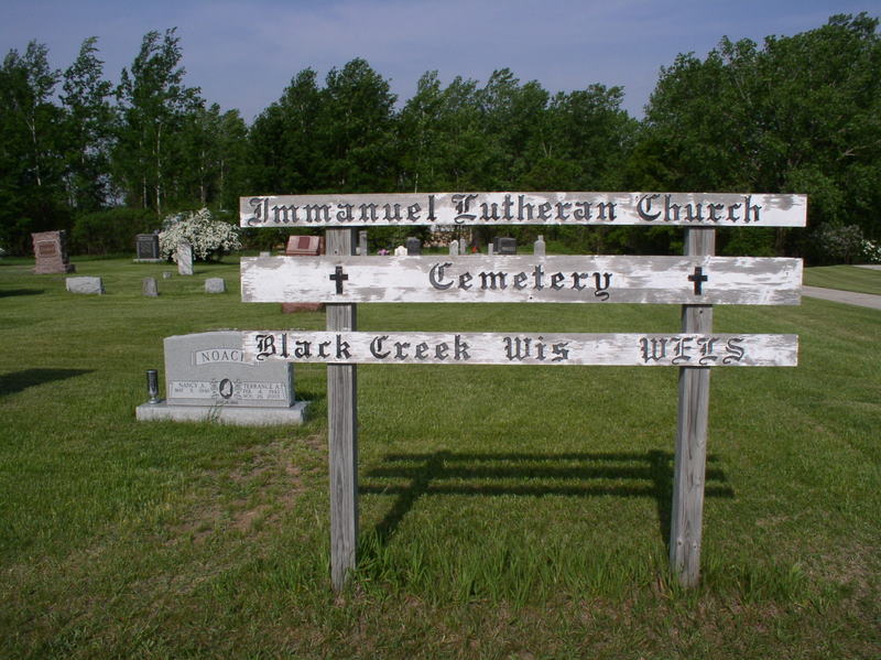
| Location | : | Black Creek, Outagamie County, USA |
| Coordinate | : | 44.5024986, -88.4522018 |
frequently asked questions (FAQ):
-
Where is Immanuel Lutheran Church Cemetery?
Immanuel Lutheran Church Cemetery is located at N7327 Wisconsin 47 Black Creek, Outagamie County ,Wisconsin , 54106USA.
-
Immanuel Lutheran Church Cemetery cemetery's updated grave count on graveviews.com?
0 memorials
-
Where are the coordinates of the Immanuel Lutheran Church Cemetery?
Latitude: 44.5024986
Longitude: -88.4522018
Nearby Cemetories:
1. Cicero United Methodist Cemetery
Cicero, Outagamie County, USA
Coordinate: 44.5229470, -88.4241490
2. Saint Marys Cemetery
Black Creek, Outagamie County, USA
Coordinate: 44.4668920, -88.4460300
3. South Cicero Cemetery
Black Creek, Outagamie County, USA
Coordinate: 44.5231018, -88.4052963
4. Black Creek Evangelical Cemetery
Black Creek, Outagamie County, USA
Coordinate: 44.4594002, -88.4505997
5. Immanuel Lutheran Cemetery
Binghamton, Outagamie County, USA
Coordinate: 44.4446983, -88.4700012
6. Town of Black Creek Cemetery
Binghamton, Outagamie County, USA
Coordinate: 44.4441986, -88.4700012
7. Saint Petri Cemetery
Black Creek, Outagamie County, USA
Coordinate: 44.4375000, -88.4313965
8. Zion Lutheran Church Cemetery
Seymour, Outagamie County, USA
Coordinate: 44.5115013, -88.3480148
9. South Maine Cemetery
Shiocton, Outagamie County, USA
Coordinate: 44.5330400, -88.5517700
10. Emmanuel Lutheran Cemetery
Seymour, Outagamie County, USA
Coordinate: 44.5289001, -88.3482971
11. Seymour Cemetery
Seymour, Outagamie County, USA
Coordinate: 44.5303001, -88.3478012
12. Oak Hill Cemetery
Shiocton, Outagamie County, USA
Coordinate: 44.5456009, -88.5543976
13. Miller Family Cemetery
Seymour, Outagamie County, USA
Coordinate: 44.5081400, -88.3329800
14. Saint John Catholic Cemetery
Seymour, Outagamie County, USA
Coordinate: 44.4991989, -88.3292007
15. North Cicero Cemetery
Cicero, Outagamie County, USA
Coordinate: 44.5847015, -88.3863983
16. Union Cemetery
Navarino, Shawano County, USA
Coordinate: 44.6039009, -88.4599991
17. Twelve Corners Cemetery
Twelve Corners, Outagamie County, USA
Coordinate: 44.4016170, -88.4352740
18. Freedom Cemetery
Freedom, Outagamie County, USA
Coordinate: 44.4110985, -88.3722000
19. Salem Evangelical Cemetery
Seymour, Outagamie County, USA
Coordinate: 44.5721270, -88.3329110
20. Saint Lawrence Cemetery
Navarino, Shawano County, USA
Coordinate: 44.6094017, -88.5017014
21. Shiocton-Bovina Saint Denis Cemetery
Shiocton, Outagamie County, USA
Coordinate: 44.4235992, -88.5671997
22. Rexford Cemetery
Shiocton, Outagamie County, USA
Coordinate: 44.4160995, -88.5603027
23. Elm Lawn Cemetery
Rose Lawn, Shawano County, USA
Coordinate: 44.6025009, -88.3610992
24. Emmanuel United Methodist Cemetery
Black Creek, Outagamie County, USA
Coordinate: 44.3792980, -88.4742740