
| Memorials | : | 0 |
| Location | : | Middle Smithfield Township, Monroe County, USA |
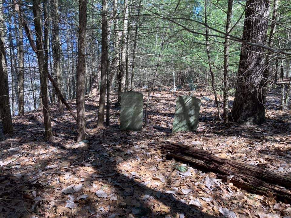
| Description | : | The cemetery is now within the Delaware Water Gap National Recreation Area. It is on Hogback Road which is now basically defunct. Anyone wishing to find the cemetery would be advised to contact the Park's office on Rte. 209 for further guidance. This cemetery was on family-owned land and the last resident, Sterling Schoonover, was relocated as part of the Tocks Island Dam project, which ultimately never was built. |
frequently asked questions (FAQ):
-
Where is Indian Cemetery?
Indian Cemetery is located at No GPS information available Add GPSHogback Road Middle Smithfield Township, Monroe County ,Pennsylvania ,USA.
-
Indian Cemetery cemetery's updated grave count on graveviews.com?
0 memorials
Nearby Cemetories:
1. Beakleyville Baptist Church Cemetery
Monroe County, USA
2. Blakeslee Cemetery
Blakeslee, Monroe County, USA
Coordinate: 41.1678900, -75.2744220
3. Wieand Family Cemetery
Blakeslee, Monroe County, USA
Coordinate: 40.9509720, -75.3333350
4. Otter Lake Family Cemetery
East Stroudsburg, Monroe County, USA
Coordinate: 41.1232450, -75.2897570
5. Prospect Cemetery
East Stroudsburg, Monroe County, USA
Coordinate: 41.0640000, -75.3184000
6. Saint Matthew's Cemetery #1
East Stroudsburg, Monroe County, USA
Coordinate: 41.0450000, -75.3113000
7. Saint Matthews Catholic Church Cemetery
East Stroudsburg, Monroe County, USA
Coordinate: 41.0804000, -75.2680000
8. Van Auken Family Cemetery
East Stroudsburg, Monroe County, USA
Coordinate: 41.0449600, -75.3116545
9. Wooddale United Methodist Church Cemetery
East Stroudsburg, Monroe County, USA
Coordinate: 41.0517000, -75.2206000
10. Kellers Cherry Valley Cemetery
Monroe County, USA
Coordinate: 40.9375000, -75.2543000
11. Kresgeville Cemetery
Kresgeville, Monroe County, USA
Coordinate: 41.1733000, -75.3582000
12. McComas Chapel Cemetery
Monroe County, USA
Coordinate: 41.1514000, -75.3576000
13. Weiss-Green-Hoodmacher Graveyard
McIlhaney, Monroe County, USA
14. Mountainhome United Methodist Church Cemetery
Monroe County, USA
Coordinate: 41.1678900, -75.2744220
15. Neola Methodist Church Cemetery
Monroe County, USA
Coordinate: 40.9509720, -75.3333350
16. Keokee Chapel Cemetery
Paradise Valley, Monroe County, USA
Coordinate: 41.1232450, -75.2897570
17. Saint Johns Cemetery
Scotrun, Monroe County, USA
Coordinate: 41.0640000, -75.3184000
18. Grace United Church of Christ Cemetery
Tannersville, Monroe County, USA
Coordinate: 41.0450000, -75.3113000
19. Pocono Union Church Cemetery
Tannersville, Monroe County, USA
Coordinate: 41.0804000, -75.2680000
20. Tannersville Union Cemetery
Tannersville, Monroe County, USA
Coordinate: 41.0449600, -75.3116545
21. Analomink United Methodist Churchyard
Analomink, Monroe County, USA
Coordinate: 41.0517000, -75.2206000
22. Cherry Valley United Methodist Church Cemetery
Monroe County, USA
Coordinate: 40.9375000, -75.2543000
23. North and South Cemetery
Coolbaugh, Monroe County, USA
Coordinate: 41.1733000, -75.3582000
24. Spruce Grove Cemetery
Coolbaugh, Monroe County, USA
Coordinate: 41.1514000, -75.3576000