
| Memorials | : | 0 |
| Location | : | Keytesville Township, Chariton County, USA |
| Coordinate | : | 39.4267502, -92.9080963 |
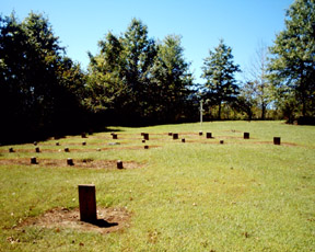
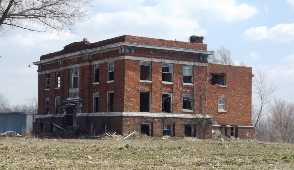
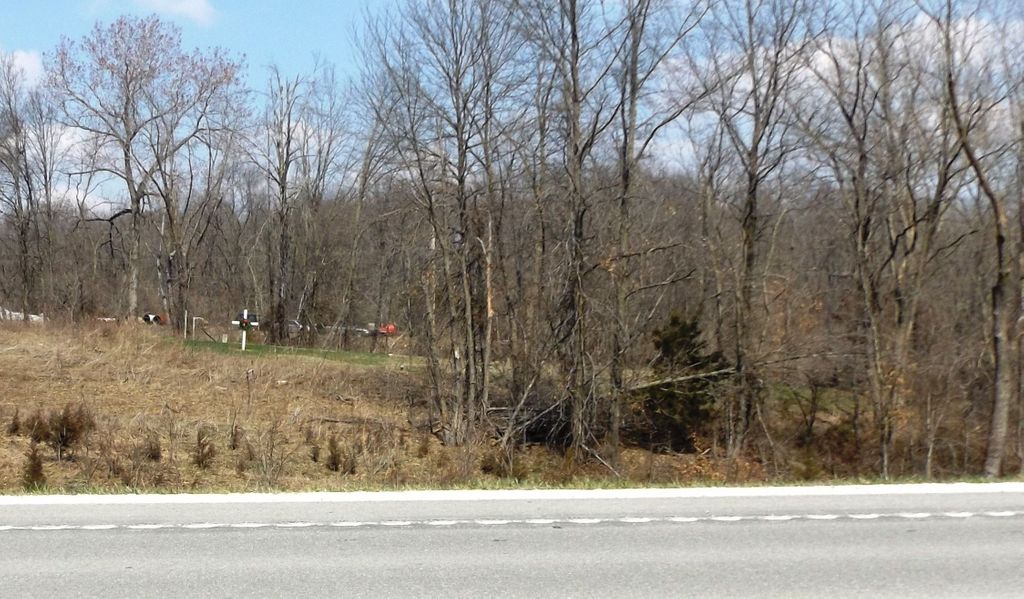
| Description | : | The original "Poor Farm" was started by the Chariton County Judges/Commissioners about 1868 and was located in the Dalton hills in Section 11, Township 53, Range 19. It housed the handicapped, disabled, insane and paupers of the county. There were many burials here but the graveyard has not been located and no buildings remain. Cropland surrounds a wooded area where we were told the house used to stand. We plan to do more searching this fall but doubt grave markers were ever erected. In 1912 the County Judges voted to move the newly named 'County Infirmary' to a... Read More |
frequently asked questions (FAQ):
-
Where is Infirmary Cemetery?
Infirmary Cemetery is located at Keytesville Township, Chariton County ,Missouri ,USA.
-
Infirmary Cemetery cemetery's updated grave count on graveviews.com?
0 memorials
-
Where are the coordinates of the Infirmary Cemetery?
Latitude: 39.4267502
Longitude: -92.9080963
Nearby Cemetories:
1. Vohner Cemetery
Keytesville, Chariton County, USA
Coordinate: 39.4393997, -92.8902969
2. Keytesville City Cemetery
Keytesville Township, Chariton County, USA
Coordinate: 39.4373016, -92.9418030
3. Walton Cemetery
Salisbury Township, Chariton County, USA
Coordinate: 39.4025993, -92.8500977
4. Williams Cemetery #3
Bowling Green Township, Chariton County, USA
Coordinate: 39.4145012, -92.9731979
5. Freeman Cemetery
Salisbury Township, Chariton County, USA
Coordinate: 39.3978996, -92.8417969
6. Bethany Cemetery
Keytesville Township, Chariton County, USA
Coordinate: 39.4838982, -92.9262009
7. Bennett Cemetery
Keytesville Township, Chariton County, USA
Coordinate: 39.4855003, -92.8883972
8. New Hope Cemetery
Salisbury, Chariton County, USA
Coordinate: 39.3743100, -92.8676400
9. Finnell Cemetery #2
Keytesville Township, Chariton County, USA
Coordinate: 39.3661003, -92.8965988
10. Eads Cemetery
Bowling Green Township, Chariton County, USA
Coordinate: 39.4127430, -92.9885630
11. Schulte - Meyer Cemetery
Dalton, Chariton County, USA
Coordinate: 39.3725470, -92.9580520
12. Dalton City Cemetery
Bowling Green Township, Chariton County, USA
Coordinate: 39.4006004, -92.9900970
13. Asbury Methodist Cemetery
Keytesville Township, Chariton County, USA
Coordinate: 39.3573990, -92.8975983
14. Saint Joseph Cemetery
Salisbury Township, Chariton County, USA
Coordinate: 39.4277992, -92.8169022
15. Eccles Cemetery
Keytesville Township, Chariton County, USA
Coordinate: 39.4905014, -92.8690033
16. Meyer Cemetery
Bowling Green Township, Chariton County, USA
Coordinate: 39.3777008, -92.9748001
17. Wheeler Cemetery
Keytesville Township, Chariton County, USA
Coordinate: 39.4893200, -92.9573720
18. John H Brown Cemetery
Bowling Green Township, Chariton County, USA
Coordinate: 39.3700830, -92.9706730
19. Hoffman-Brown Cemetery
Chariton Township, Chariton County, USA
Coordinate: 39.3699989, -92.9705963
20. Buddenberg Cemetery
Chariton County, USA
Coordinate: 39.3846800, -92.9880100
21. Tisdale Cemetery
Chariton County, USA
Coordinate: 39.4143510, -93.0034790
22. Harper - Grotjan Cemetery
Bowling Green Township, Chariton County, USA
Coordinate: 39.4027940, -92.9998080
23. Shannondale Cemetery
Shannondale, Chariton County, USA
Coordinate: 39.3603830, -92.8618530
24. Bradley Cemetery
Bowling Green Township, Chariton County, USA
Coordinate: 39.3680496, -92.9693527