
| Memorials | : | 0 |
| Location | : | Cologne, Stadtkreis Köln, Germany |
| Coordinate | : | 50.8979600, 6.9391700 |
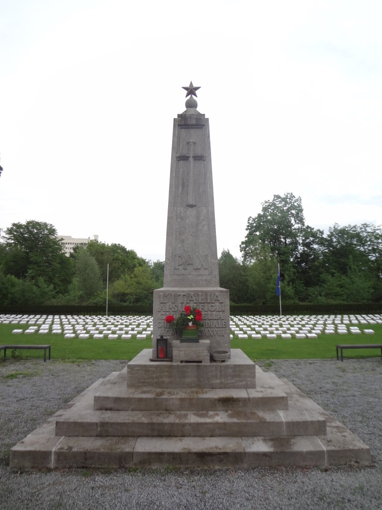
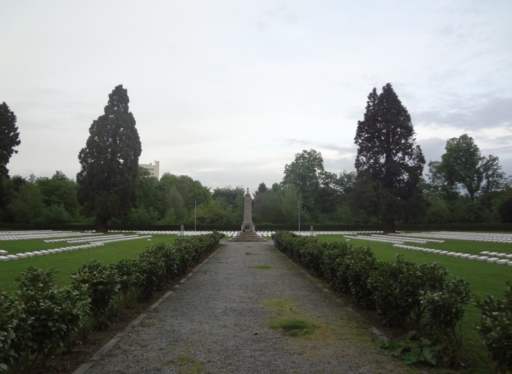
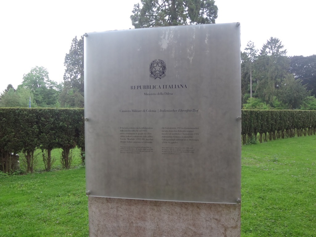
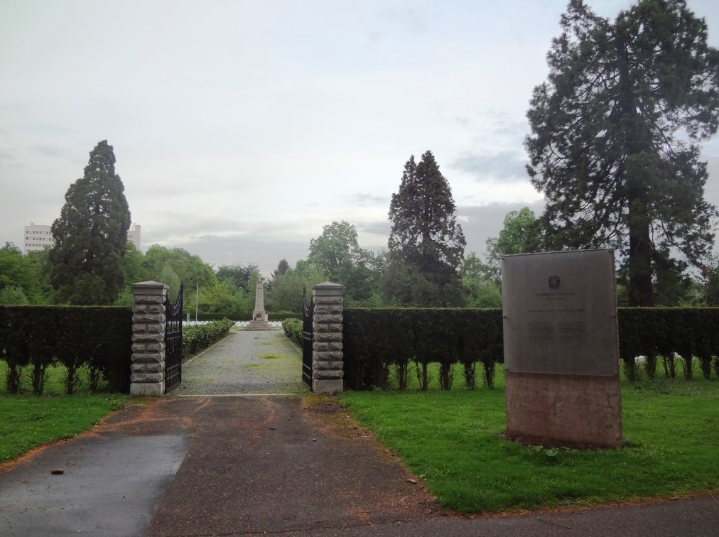
| Description | : | Italienischer Ehrenfriedhof (Cimitero Militare di Colonia) is located in Section 48 of the cemetery Sudfriedhof Koln and is now maintained by the city of Cologne. The land was acquired by the Italian Government in 1926 from the City of Cologne to rebury Italian prisoners of war who died in German POW camps during World War I, that were buried in different regions of Germany. In 1928, about 1,914 Italian soldiers from all over West Germany that died between 1915 and 1918 were interred here. The center of the military cemetery is an obelisk crowned with a gilded star, with small... Read More |
frequently asked questions (FAQ):
-
Where is Italienischer Ehrenfriedhof?
Italienischer Ehrenfriedhof is located at Honinger Platz 25 Cologne, Stadtkreis Köln ,Nordrhein-Westfalen , 50969Germany.
-
Italienischer Ehrenfriedhof cemetery's updated grave count on graveviews.com?
0 memorials
-
Where are the coordinates of the Italienischer Ehrenfriedhof?
Latitude: 50.8979600
Longitude: 6.9391700
Nearby Cemetories:
1. Cologne Memorial
Cologne, Stadtkreis Köln, Germany
Coordinate: 50.8979600, 6.9391700
2. Cologne Southern Cemetery
Cologne, Stadtkreis Köln, Germany
Coordinate: 50.8979600, 6.9391700
3. Südfriedhof
Cologne, Stadtkreis Köln, Germany
Coordinate: 50.9004920, 6.9437290
4. Friedhof Steinneuerhof
Cologne, Stadtkreis Köln, Germany
Coordinate: 50.8734970, 6.9371040
5. Geusenfriedhof
Cologne, Stadtkreis Köln, Germany
Coordinate: 50.9253650, 6.9269240
6. Krieler Dömchen Alt Sankt Stephan
Stadtkreis Köln, Germany
Coordinate: 50.9194440, 6.9061110
7. Sankt Pantaleon
Cologne, Stadtkreis Köln, Germany
Coordinate: 50.9283900, 6.9474400
8. Friedhof Frankstrasse
Cologne, Stadtkreis Köln, Germany
Coordinate: 50.8947300, 6.9888170
9. Hürth-Efferen Friedhof
Efferen, Rhein-Erft-Kreis, Germany
Coordinate: 50.9029100, 6.8885100
10. Friedhof Rondorf
Cologne, Stadtkreis Köln, Germany
Coordinate: 50.8680100, 6.9608300
11. Jüdischer Friedhof Deckstein
Lindenthal, Stadtkreis Köln, Germany
Coordinate: 50.9192300, 6.8974300
12. Sankt Maria im Kapitol
Cologne, Stadtkreis Köln, Germany
Coordinate: 50.9345000, 6.9573000
13. Friedhof Deutz
Cologne, Stadtkreis Köln, Germany
Coordinate: 50.9242190, 6.9863140
14. Katholischer Friedhof Immendorf
Cologne, Stadtkreis Köln, Germany
Coordinate: 50.8594932, 6.9572050
15. Jüdischer Friedhof Deutz
Cologne, Stadtkreis Köln, Germany
Coordinate: 50.9283330, 6.9819440
16. Friedhof Meschenich
Cologne, Stadtkreis Köln, Germany
Coordinate: 50.8564900, 6.9347500
17. Minoritenkirche
Cologne, Stadtkreis Köln, Germany
Coordinate: 50.9394600, 6.9540500
18. Melaten-Friedhof
Cologne, Stadtkreis Köln, Germany
Coordinate: 50.9390100, 6.9168800
19. Friedhof Sürther Strasse
Rodenkirchen, Stadtkreis Köln, Germany
Coordinate: 50.8794800, 7.0029700
20. Sankt Andreas
Cologne, Stadtkreis Köln, Germany
Coordinate: 50.9417700, 6.9549300
21. Kölner Dom
Cologne, Stadtkreis Köln, Germany
Coordinate: 50.9413450, 6.9582260
22. Friedhof Sankt Gereon
Cologne, Stadtkreis Köln, Germany
Coordinate: 50.9434490, 6.9461440
23. Jüdischer Friedhof Ehrenfeld
Ehrenfeld, Stadtkreis Köln, Germany
Coordinate: 50.9426700, 6.9134600
24. Hürth-Kendenich Friedhof
Kendenich, Rhein-Erft-Kreis, Germany
Coordinate: 50.8656599, 6.8824201