
| Memorials | : | 0 |
| Location | : | Rockhouse, Madison County, USA |
| Coordinate | : | 36.2771900, -93.6355100 |
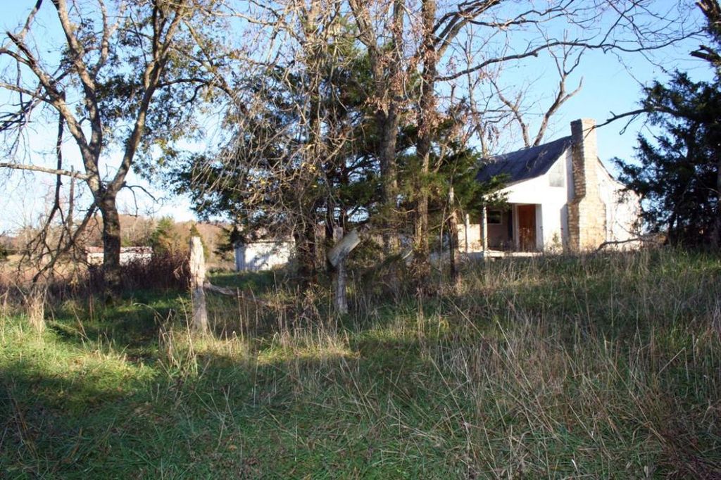
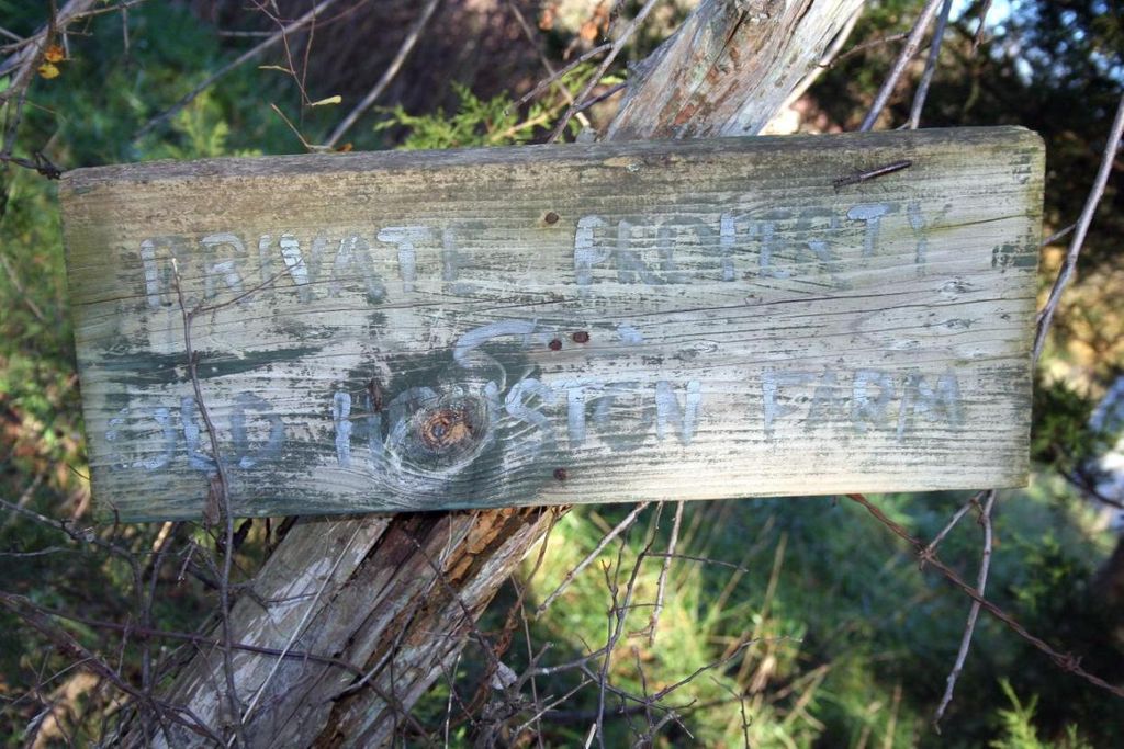
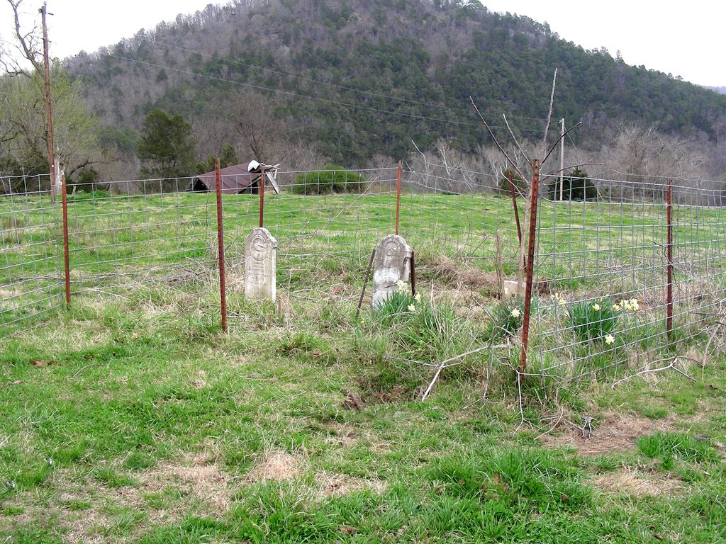
| Description | : | "J. C. Houston Homestead Cemetery" - this is the name assigned to this cemetery in the official records of Madison County and this name appears in the records of The Madison County Genealogical & Historical Society. GPS Coordinates: Latitude: 36.27719, Longitude: -93.63551 This small cemetery, which contains only two marked graves, is located in Madison County on the banks of Kings River on land that was homesteaded by “Joseph C. Houston” [Joseph Calvin Houston] on February 1, 1860, and described as the Northwest Quarter of the Southwest Quarter of Section 27, Township 19 North, Range 25 West, 40 acres. (Kings... Read More |
frequently asked questions (FAQ):
-
Where is J. C. Houston Homestead Cemetery?
J. C. Houston Homestead Cemetery is located at Rockhouse, Madison County ,Arkansas ,USA.
-
J. C. Houston Homestead Cemetery cemetery's updated grave count on graveviews.com?
0 memorials
-
Where are the coordinates of the J. C. Houston Homestead Cemetery?
Latitude: 36.2771900
Longitude: -93.6355100
Nearby Cemetories:
1. Rockhouse Cemetery
Rockhouse, Madison County, USA
Coordinate: 36.2837400, -93.6664700
2. Hawkins Family Cemetery at Chaplin
Rockhouse, Madison County, USA
Coordinate: 36.2491700, -93.6407200
3. Pension Mountain Cemetery
Carroll County, USA
Coordinate: 36.2975006, -93.6081009
4. McClain Cemetery
Madison County, USA
Coordinate: 36.2447014, -93.6367035
5. Brushy Cemetery
Metalton, Carroll County, USA
Coordinate: 36.2456500, -93.5797600
6. White Oak Cemetery
Metalton, Carroll County, USA
Coordinate: 36.2099991, -93.6156006
7. Hyden Graves
Forum, Madison County, USA
Coordinate: 36.2030600, -93.6524880
8. Farmer Cemetery
Berryville, Carroll County, USA
Coordinate: 36.3191986, -93.5543976
9. Moore Cemetery
Cabanal, Carroll County, USA
Coordinate: 36.2861023, -93.5333328
10. Rush Cemetery
Berryville, Carroll County, USA
Coordinate: 36.3507996, -93.5800018
11. Shady Grove Cemetery
Berryville, Carroll County, USA
Coordinate: 36.3683014, -93.6358032
12. Clark Family Cemetery
Forum, Madison County, USA
Coordinate: 36.2211600, -93.7252000
13. Swain Mountain-Gullick Cemetery
Clifty, Madison County, USA
Coordinate: 36.2863180, -93.7508020
14. Gumm Cemetery
Forum, Madison County, USA
Coordinate: 36.2085100, -93.7226000
15. Berryville Memorial Cemetery
Berryville, Carroll County, USA
Coordinate: 36.3683014, -93.5847015
16. Snow Homestead Cemetery
Carroll County, USA
Coordinate: 36.3111900, -93.5181600
17. Old Berryville Cemetery
Berryville, Carroll County, USA
Coordinate: 36.3635048, -93.5685450
18. Briley Cemetery
Berryville, Carroll County, USA
Coordinate: 36.3358002, -93.5314026
19. Berry-Brown Cemetery
Clifty, Madison County, USA
Coordinate: 36.3010800, -93.7594700
20. Snow Cemetery
Green Forest, Carroll County, USA
Coordinate: 36.3288002, -93.5220032
21. Merrill Cemetery
Madison County, USA
Coordinate: 36.1773700, -93.5947100
22. Pleasant Valley Cemetery
Carroll County, USA
Coordinate: 36.3821983, -93.6113968
23. Beulah Union Cemetery
Eureka Springs, Carroll County, USA
Coordinate: 36.3252380, -93.7605800
24. Dean Cemetery
Dean, Carroll County, USA
Coordinate: 36.1921860, -93.5335800