
| Memorials | : | 0 |
| Location | : | Morrow, Warren County, USA |
| Coordinate | : | 39.3897750, -84.1294380 |
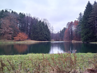
| Description | : | From Interstate 71, Exit 32, go east towards Morrow on State Route 123, 1.4 miles to Waynesville Road. Turn Right on Waynesville Road and go south 0.6 miles to a Christmas tree farm. The cemetery consists of a single remaining monument plus some field stones that are located about 1/2 mile off the road on the 194-acre Christmas tree farm. This is on private property. There are six known burials. The cemetery is located in Salem Township, Warren County, Ohio, and is # 14205 in “Ohio Cemeteries 1803-2003”, compiled by the Ohio Genealogical Society. |
frequently asked questions (FAQ):
-
Where is Jack Cemetery?
Jack Cemetery is located at 2544 S. Waynesville Road Morrow, Warren County ,Ohio , 45152USA.
-
Jack Cemetery cemetery's updated grave count on graveviews.com?
0 memorials
-
Where are the coordinates of the Jack Cemetery?
Latitude: 39.3897750
Longitude: -84.1294380
Nearby Cemetories:
1. Bethel Baptist Church Cemetery
Turtlecreek Township, Warren County, USA
Coordinate: 39.4057999, -84.1072006
2. Bethany Christian Church Cemetery
Lebanon, Warren County, USA
Coordinate: 39.4170000, -84.1557700
3. Baker Orchard Cemetery
Morrow, Warren County, USA
Coordinate: 39.3719440, -84.1713890
4. Greenwood Cemetery
Oregonia, Warren County, USA
Coordinate: 39.4286700, -84.1285500
5. Morrow Cemetery
Morrow, Warren County, USA
Coordinate: 39.3509500, -84.1260200
6. Roachester Methodist Cemetery
Morrow, Warren County, USA
Coordinate: 39.3578400, -84.0979900
7. Old Quaker Cemetery
Roachester, Warren County, USA
Coordinate: 39.3585240, -84.0957070
8. Everett Irons Farm Cemetery
Lebanon, Warren County, USA
Coordinate: 39.4063890, -84.1858330
9. Saint Malachy Catholic Cemetery
Morrow, Warren County, USA
Coordinate: 39.3409690, -84.1289300
10. LeFever Cemetery
Lebanon, Warren County, USA
Coordinate: 39.4161110, -84.1836110
11. Baker Cemetery
South Lebanon, Warren County, USA
Coordinate: 39.3547900, -84.1804600
12. Mounts Cemetery
Morrow, Warren County, USA
Coordinate: 39.3547220, -84.1847220
13. Olive Branch Cemetery
Warren County, USA
Coordinate: 39.4304630, -84.0804910
14. Whitacre Farm Cemetery
Morrow, Warren County, USA
Coordinate: 39.3349990, -84.1058330
15. Plum Run Cemetery
Zoar, Warren County, USA
Coordinate: 39.3573980, -84.1943780
16. Deerfield Cemetery
South Lebanon, Warren County, USA
Coordinate: 39.3739014, -84.2052994
17. Jeffrey Cemetery
Turtlecreek Township, Warren County, USA
Coordinate: 39.4517000, -84.1255000
18. Landaker Cemetery
Morrow, Warren County, USA
Coordinate: 39.3280983, -84.1211014
19. Banta Farm Cemetery
Turtlecreek Township, Warren County, USA
Coordinate: 39.4502970, -84.1594500
20. Fox Cemetery
Genntown, Warren County, USA
Coordinate: 39.4527780, -84.1522220
21. Howard Cemetery
Pleasant Plain, Warren County, USA
Coordinate: 39.3316994, -84.0886002
22. Old South Lebanon Cemetery (Defunct)
South Lebanon, Warren County, USA
Coordinate: 39.3716890, -84.2153920
23. Ertel-Patterson Cemetery
Maineville, Warren County, USA
Coordinate: 39.3243200, -84.1749000
24. Rossburg Cemetery
Morrow, Warren County, USA
Coordinate: 39.3130989, -84.1222000