
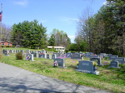
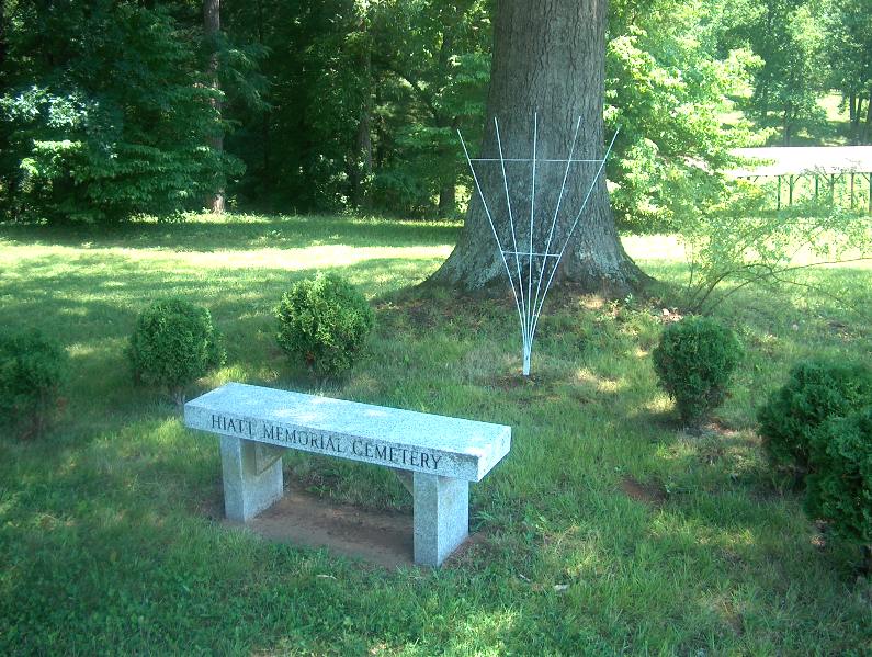
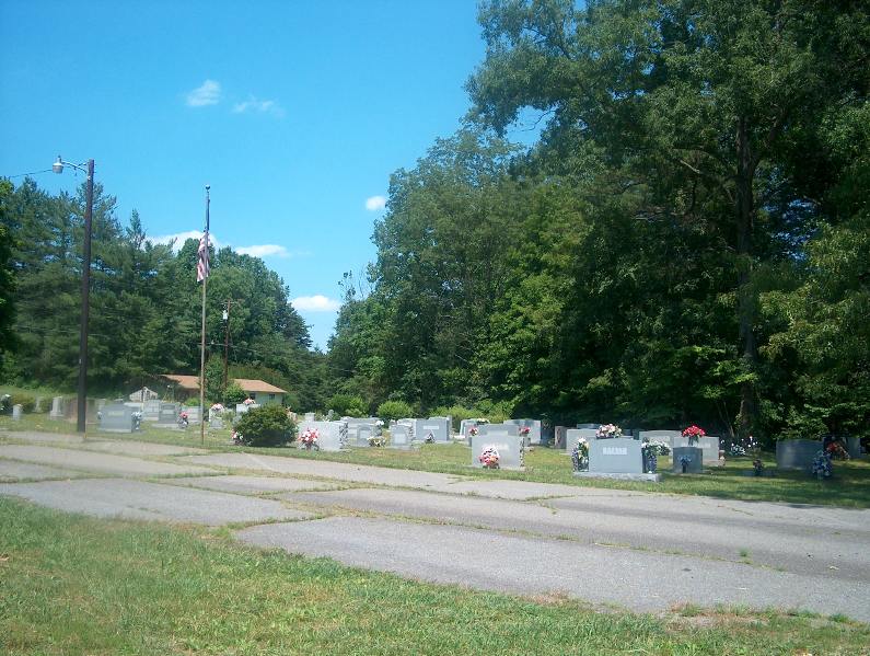
| Memorials | : | 119 |
| Location | : | Sheltontown, Surry County, USA |
| Coordinate | : | 36.4937782, -80.5521698 |
| Description | : | From the intersection of Westfield Road (NC Highway 89) and South Main Street (US Highway 52 Business), travel 2.2 miles east on Westfield Road (NC Highway 89); the cemetery will be on the right. |
frequently asked questions (FAQ):
-
Where is James Monroe Hiatt Memorial Cemetery?
James Monroe Hiatt Memorial Cemetery is located at Westfield Road (NC Highway 89) Sheltontown, Surry County ,North Carolina , 27030USA.
-
James Monroe Hiatt Memorial Cemetery cemetery's updated grave count on graveviews.com?
117 memorials
-
Where are the coordinates of the James Monroe Hiatt Memorial Cemetery?
Latitude: 36.4937782
Longitude: -80.5521698
Nearby Cemetories:
1. Shelton Church Of The Brethren Cemetery
Sheltontown, Surry County, USA
Coordinate: 36.4945180, -80.5473210
2. Kirkman Cemetery
Sheltontown, Surry County, USA
Coordinate: 36.4974420, -80.5485980
3. Forkner Cemetery
Mount Airy, Surry County, USA
Coordinate: 36.4978900, -80.5628510
4. Kirkman Family Cemetery
Sheltontown, Surry County, USA
Coordinate: 36.4851110, -80.5421120
5. Midkiff Cemetery
Flat Rock, Surry County, USA
Coordinate: 36.5038986, -80.5642014
6. Haymore Family Cemetery
Mount Airy, Surry County, USA
Coordinate: 36.4812486, -80.5608610
7. Oak Grove United Methodist Church Cemetery
Oak Grove (Mount Airy South), Surry County, USA
Coordinate: 36.4899770, -80.5757520
8. Indian Grove Family Cemetery
Indian Grove, Surry County, USA
Coordinate: 36.4906235, -80.5245209
9. Mount Calvary Christian Methodist Episcopal Cemetery
Combstown, Surry County, USA
Coordinate: 36.5005470, -80.5794810
10. Flat Rock Baptist Cemetery
Flat Rock, Surry County, USA
Coordinate: 36.5085983, -80.5749969
11. Smith Family Cemetery
Mount Airy, Surry County, USA
Coordinate: 36.4773598, -80.5760269
12. Payne's Chapel Baptist Church Cemetery
Flat Rock, Surry County, USA
Coordinate: 36.5184200, -80.5609100
13. Southside Baptist Church Cemetery
Boones Hill, Surry County, USA
Coordinate: 36.4725280, -80.5729720
14. New Venture Baptist Church Cemetery
Flat Rock, Surry County, USA
Coordinate: 36.5211372, -80.5454407
15. Blue Hollow Baptist Church Cemetery
Slate Mountain, Surry County, USA
Coordinate: 36.5167160, -80.5297910
16. Hicks Family Cemetery
Mount Airy, Surry County, USA
Coordinate: 36.5228043, -80.5402527
17. Holly Springs Baptist Church Cemetery
Holly Springs, Surry County, USA
Coordinate: 36.4625816, -80.5570297
18. Skyline Memory Gardens
Mount Airy, Surry County, USA
Coordinate: 36.4745610, -80.5856500
19. Miracle Waters Worship Center Cemetery
Flat Rock, Surry County, USA
Coordinate: 36.5243250, -80.5691160
20. Bobby and Arbra Inman Family Cemetery
Mount Airy, Surry County, USA
Coordinate: 36.4974900, -80.5075100
21. Chestnut Ridge Primitive Baptist Cemetery
Mount Airy, Surry County, USA
Coordinate: 36.5100849, -80.5071676
22. Old Methodist Cemetery
Mount Airy, Surry County, USA
Coordinate: 36.4948349, -80.6033630
23. McArthur-Strickland Family Cemetery
Slate Mountain, Surry County, USA
Coordinate: 36.5204735, -80.5130005
24. McGee Cemetery
Mount Airy, Surry County, USA
Coordinate: 36.4550800, -80.5700400