
| Memorials | : | 0 |
| Location | : | Osterberg, Landkreis Neu-Ulm, Germany |
| Coordinate | : | 48.1456828, 10.1670503 |
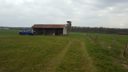
| Description | : | Der Kolbenweg führt zum linksseitigen Wald. Bald steigt eine kleine Treppe zum Friedhof empor, der mit einer Steinmauer umgeben ist. |
frequently asked questions (FAQ):
-
Where is Jüdischer Friedhof?
Jüdischer Friedhof is located at Kolbenweg Osterberg, Landkreis Neu-Ulm ,Bavaria (Bayern) , 89296Germany.
-
Jüdischer Friedhof cemetery's updated grave count on graveviews.com?
0 memorials
-
Where are the coordinates of the Jüdischer Friedhof?
Latitude: 48.1456828
Longitude: 10.1670503
Nearby Cemetories:
1. Friedhof Babenhausen
Babenhausen, Landkreis Unterallgäu, Germany
Coordinate: 48.1451900, 10.2589200
2. Waldfriedhof in Memmingen
Memmingen, Stadtkreis Memmingen, Germany
Coordinate: 47.9924900, 10.1903200
3. Alter Friedhof Memmingen
Memmingen, Stadtkreis Memmingen, Germany
Coordinate: 47.9882000, 10.1891700
4. Westfriedhof Krumbach
Krumbach, Landkreis Günzburg, Germany
Coordinate: 48.2386579, 10.3602433
5. Friedhof Weissenhorn
Weissenhorn, Landkreis Neu-Ulm, Germany
Coordinate: 48.3087335, 10.1589623
6. Friedhof Ochsenhausen
Ochsenhausen, Landkreis Biberach, Germany
Coordinate: 48.0621089, 9.9545597
7. Jüdischer Friedhof Hürben
Krumbach, Landkreis Günzburg, Germany
Coordinate: 48.2468267, 10.3792761
8. Friedhof Oberrieden
Oberrieden, Landkreis Unterallgäu, Germany
Coordinate: 48.0908300, 10.4280100
9. Waldfriedhof Senden
Senden, Landkreis Neu-Ulm, Germany
Coordinate: 48.3263995, 10.0774208
10. Friedhof Volkratshofen
Volkratshofen, Stadtkreis Memmingen, Germany
Coordinate: 47.9548740, 10.1173953
11. Jüdischer Friedhof Laupheim
Laupheim, Landkreis Biberach, Germany
Coordinate: 48.2322230, 9.8847300
12. Friedhof Kirchheim
Kirchheim, Landkreis Unterallgäu, Germany
Coordinate: 48.1711200, 10.4795200
13. Friedhof
Pfaffenhofen an der Roth, Landkreis Neu-Ulm, Germany
Coordinate: 48.3576633, 10.1597117
14. Friedhof Edelstetten
Edelstetten, Landkreis Günzburg, Germany
Coordinate: 48.2984400, 10.3947700
15. Friedhof Ursberg
Ursberg, Landkreis Günzburg, Germany
Coordinate: 48.2693400, 10.4402500
16. Kloster Ursberg
Ursberg, Landkreis Günzburg, Germany
Coordinate: 48.2661200, 10.4464100
17. Reutti Kriegsgräber
Reutti, Landkreis Neu-Ulm, Germany
Coordinate: 48.3639610, 10.0832290
18. Friedhof Ottobeuren
Ottobeuren, Landkreis Unterallgäu, Germany
Coordinate: 47.9369626, 10.3048760
19. Pfarrkirche St. Martin
Schemmerberg, Landkreis Biberach, Germany
Coordinate: 48.1929872, 9.8244121
20. Stadtpfarrkirche St. Stephan
Mindelheim, Landkreis Unterallgäu, Germany
Coordinate: 48.0476980, 10.4900830
21. Friedhof Wiblingen
Ulm, Stadtkreis Ulm, Germany
Coordinate: 48.3535836, 9.9847389
22. Friedhof Ummendorf
Ummendorf, Landkreis Biberach, Germany
Coordinate: 48.0571500, 9.8311300
23. Kloster Wiblingen
Ulm, Stadtkreis Ulm, Germany
Coordinate: 48.3616670, 9.9919440
24. Städtischer Friedhof Ichenhausen
Ichenhausen, Landkreis Günzburg, Germany
Coordinate: 48.3747929, 10.3137918