
| Memorials | : | 0 |
| Location | : | Tata, Tatai járás, Hungary |
| Coordinate | : | 47.6387840, 18.3183660 |
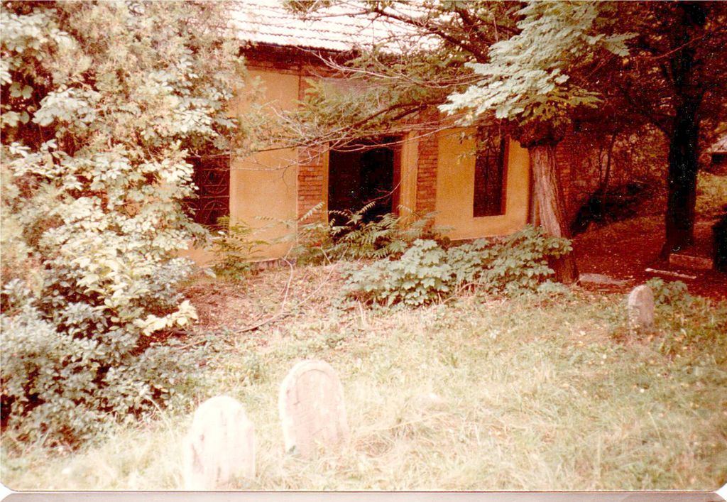
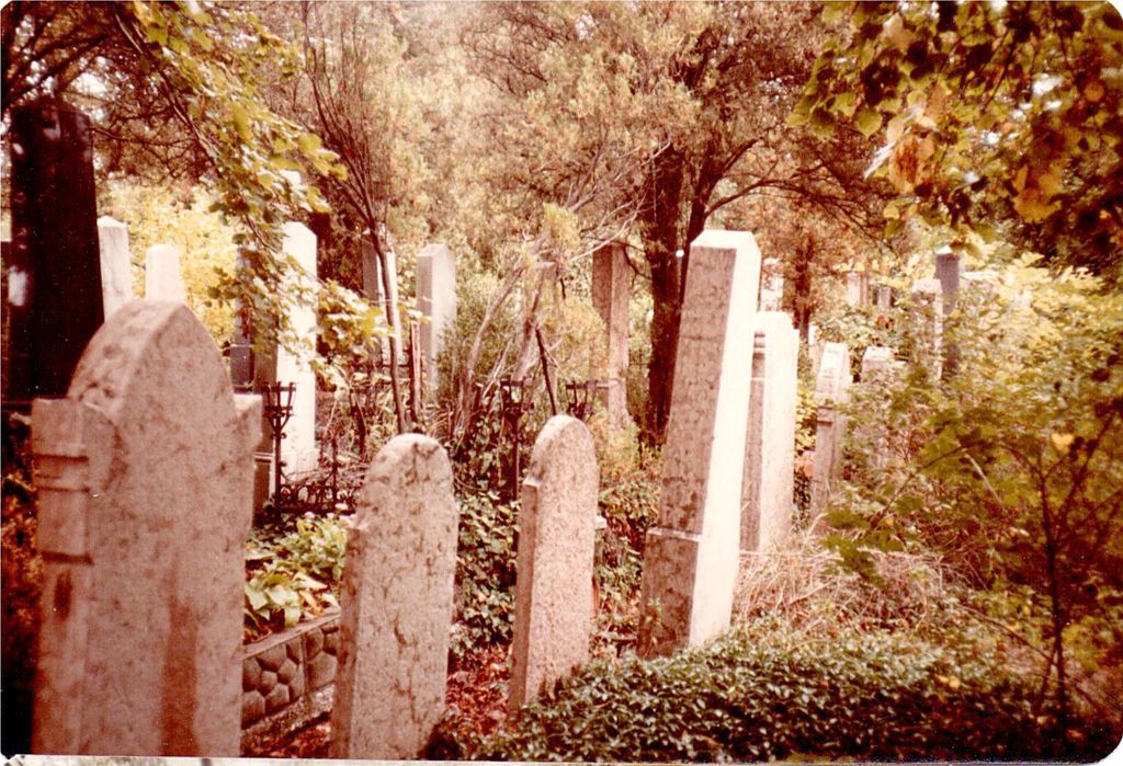
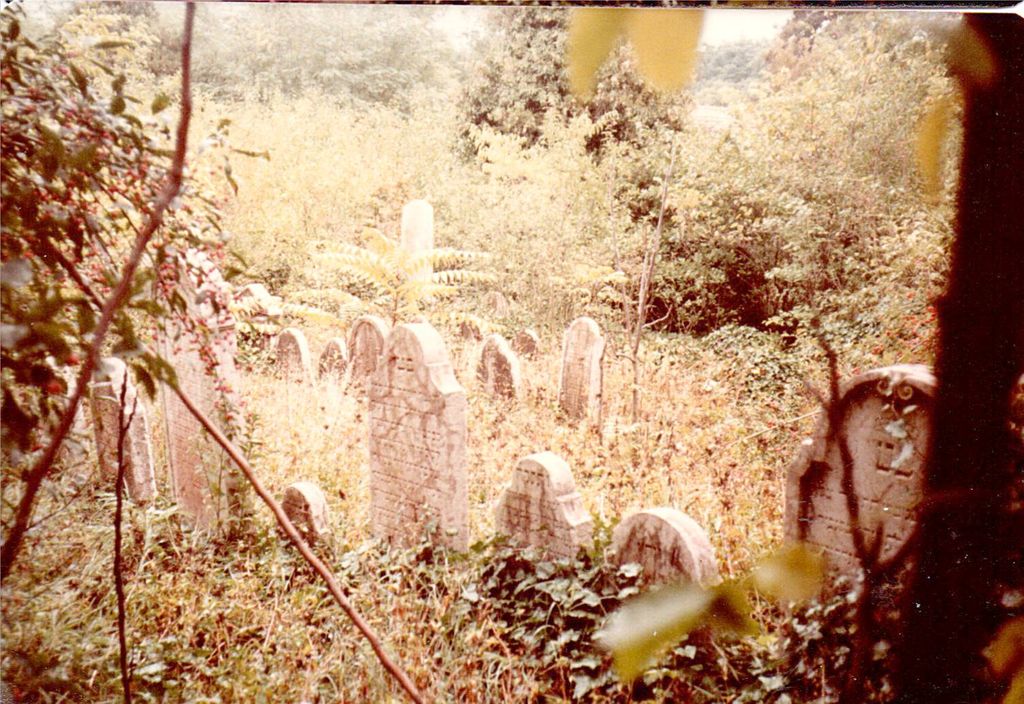
| Description | : | The very large cemetery is very much overgrown. The chapel at the entrance evidenced recent roof and gutter replacement. The former caretaker's cottage is now occupied by non-Jews who purchased the property in the 1970's with the provision that they retain the book which shows a list of persons buried there and make it available to anyone who to ask to see it. We were told that the last burial was three years ago. The well maintained and landmarked cemetery is located next to Esterházy Castle on Kálvária Hill. Holocaust memorial was erected in 2005. Oldest tombstone dates from 1740. |
frequently asked questions (FAQ):
-
Where is Jewish Cemetery?
Jewish Cemetery is located at Tata, Tatai járás ,Komárom-Esztergom ,Hungary.
-
Jewish Cemetery cemetery's updated grave count on graveviews.com?
0 memorials
-
Where are the coordinates of the Jewish Cemetery?
Latitude: 47.6387840
Longitude: 18.3183660
Nearby Cemetories:
1. Dunaalmás temető
Dunaalmás, Tatai járás, Hungary
Coordinate: 47.7319860, 18.3272540
2. Tatabánya Újtelepi temető
Tatabánya, Tatabányai járás, Hungary
Coordinate: 47.5493190, 18.4269860
3. Körtvélyesi erdei temető
Szárliget, Tatabányai járás, Hungary
Coordinate: 47.5128490, 18.4458510
4. Bajna Cemetery
Bajna, Esztergomi járás, Hungary
Coordinate: 47.6557520, 18.6036510
5. Német katonatemető - Soldatenfriedhof
Bajna, Esztergomi járás, Hungary
Coordinate: 47.6551820, 18.6050530
6. Sándor and Sándor-Metternich Family Tomb
Gyermely, Tatabányai járás, Hungary
Coordinate: 47.5844520, 18.6116420
7. Starý Cintorín
Dulovce, okres Komárno, Slovakia
Coordinate: 47.8665365, 18.2684629
8. Kápolnapuszta Gánt Cemetery
Gánt, Bicskei járás, Hungary
Coordinate: 47.3961160, 18.3579760
9. Muzsla - Mužla
Muzla, okres Nové Zámky, Slovakia
Coordinate: 47.7956573, 18.6018475
10. Nový Cintorín
Dulovce, okres Komárno, Slovakia
Coordinate: 47.8882858, 18.2452454
11. Jewish Cemetery , Bicske
Bicske, Bicskei járás, Hungary
Coordinate: 47.4854760, 18.6372340
12. Jewish cemetery, Mór.
Mór, Móri járás, Hungary
Coordinate: 47.3700290, 18.1954950
13. Cemetery of Uny
Úny, Esztergomi járás, Hungary
Coordinate: 47.6441271, 18.7394166
14. Jewish Cemetery of Uny
Úny, Esztergomi járás, Hungary
Coordinate: 47.6428191, 18.7431326
15. Esztergomi 7.sz. hadifogoly temetö
Esztergom, Esztergomi járás, Hungary
Coordinate: 47.7487520, 18.7511390
16. Štúrovo Stary cintorin
Sturovo, okres Nové Zámky, Slovakia
Coordinate: 47.7985170, 18.7209660
17. Régi katolikus temető
Vértesacsa, Bicskei járás, Hungary
Coordinate: 47.3775580, 18.5820220
18. Franciscan Church
Esztergom, Esztergomi járás, Hungary
Coordinate: 47.7899900, 18.7392300
19. Primatial Basilica of the Assumption
Esztergom, Esztergomi járás, Hungary
Coordinate: 47.7988890, 18.7363890
20. Jewish cemetery, Esztergom
Esztergom, Esztergomi járás, Hungary
Coordinate: 47.7870830, 18.7476940
21. Belvárosi Temető - Esztergom
Esztergom, Esztergomi járás, Hungary
Coordinate: 47.7878524, 18.7473597
22. Kamenin Jewish Cemetery
Kamenin, okres Nové Zámky, Slovakia
Coordinate: 47.8846410, 18.6438880
23. Szentgyörgymezői temető
Esztergom, Esztergomi járás, Hungary
Coordinate: 47.8080960, 18.7411250
24. Esztergomi honvédtemetö
Esztergom, Esztergomi járás, Hungary
Coordinate: 47.8106800, 18.7449130