
| Memorials | : | 0 |
| Location | : | Worms, Stadtkreis Worms, Germany |
| Coordinate | : | 49.6442950, 8.3388700 |
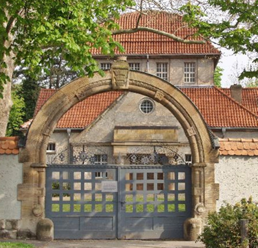
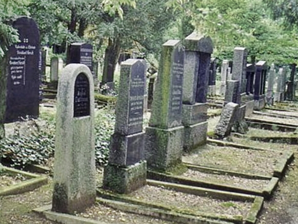
| Description | : | After the first Jewish Cemetery (Heiliger Sand) in the city of Worms became to small, the Jewish community tried since 1888 to establish a new burial ground. In 1910 it was able to establish this cemetery, right next to the Hauptfriedhof Worms (aka Friedhof Hochheimer Höhe), with a separate entrance. It was opened in 1911 and is one of five Jewish cemeteries in the city of Worms. Cemeteries in Worms: Hauptfriedhof Worms (Hochheimer Höhe) Friedhof Abenheim Friedhof Heppenheim Friedhof Herrnsheim Friedhof Horchheim Friedhof Ibersheim Friedhof Leiselheim Friedhof Pfeddersheim Friedhof Pfiffligheim Friedhof Rheindürkheim Friedhof Weinsheim Friedhof Wiesoppenheim There are also 5 Jewish Cemeteries in Worms: Jüdischer Friedhof Heiliger Sand Jüdischer Friedhof Heppenheim Jüdischer Friedhof Herrnsheim Jüdischer Friedhof Hochheim Jüdischer Friedhof... Read More |
frequently asked questions (FAQ):
-
Where is Jewish Cemetery Hochheim Worms?
Jewish Cemetery Hochheim Worms is located at Worms-Hochheim, Eckenbertstraße Worms, Stadtkreis Worms ,Rheinland-Pfalz ,Germany.
-
Jewish Cemetery Hochheim Worms cemetery's updated grave count on graveviews.com?
0 memorials
-
Where are the coordinates of the Jewish Cemetery Hochheim Worms?
Latitude: 49.6442950
Longitude: 8.3388700

Nearby Cemetories:
1. Hauptfriedhof Worms
Worms, Stadtkreis Worms, Germany
Coordinate: 49.6452400, 8.3380700
2. Friedhof Pfiffligheim Worms
Worms, Stadtkreis Worms, Germany
Coordinate: 49.6350590, 8.3281300
3. Friedhof Herrnsheim
Worms, Stadtkreis Worms, Germany
Coordinate: 49.6580700, 8.3278410
4. Jüdischer Friedhof Heiliger Sand
Worms, Stadtkreis Worms, Germany
Coordinate: 49.6297800, 8.3555100
5. Friedhof Leiselheim Worms
Worms, Stadtkreis Worms, Germany
Coordinate: 49.6423430, 8.3095590
6. Cathedral of St Peter
Worms, Stadtkreis Worms, Germany
Coordinate: 49.6302780, 8.3597220
7. Friedhof Horchheim Worms
Worms, Stadtkreis Worms, Germany
Coordinate: 49.6114450, 8.3146440
8. Friedhof Pfeddersheim Worms
Worms, Stadtkreis Worms, Germany
Coordinate: 49.6407170, 8.2822110
9. Jewish Cemetery Pfeddersheim Worms
Worms, Stadtkreis Worms, Germany
Coordinate: 49.6421300, 8.2817170
10. Friedhof Weinsheim Worms
Worms, Stadtkreis Worms, Germany
Coordinate: 49.6053240, 8.3323360
11. Friedhof Wiesoppenheim Worms
Worms, Stadtkreis Worms, Germany
Coordinate: 49.6047150, 8.3021020
12. Friedhof Abenheim Worms
Worms, Stadtkreis Worms, Germany
Coordinate: 49.6786510, 8.2846780
13. Friedhof Hofheim Lampertheim
Kreis Bergstraße, Germany
Coordinate: 49.6606100, 8.4124160
14. Friedhof Rheinduerkheim Worms
Worms, Stadtkreis Worms, Germany
Coordinate: 49.7020270, 8.3516050
15. Kleinniedesheim
Kleinniedesheim, Rhein-Pfalz-Kreis, Germany
Coordinate: 49.5870652, 8.3205073
16. Bergfriedhof Osthofen
Osthofen, Landkreis Alzey-Worms, Germany
Coordinate: 49.7014704, 8.3178089
17. Jewish Cemetery Heppenheim Worms
Worms, Stadtkreis Worms, Germany
Coordinate: 49.6093610, 8.2612680
18. Friedhof Heppenheim Worms
Worms, Stadtkreis Worms, Germany
Coordinate: 49.6081470, 8.2624480
19. Jüdischer Friedhof Osthofen
Osthofen, Landkreis Alzey-Worms, Germany
Coordinate: 49.7087786, 8.3253344
20. Friedhof Roxheim
Bobenheim-Roxheim, Rhein-Pfalz-Kreis, Germany
Coordinate: 49.5804700, 8.3621900
21. Friedhof Bobstadt
Kreis Bergstraße, Germany
Coordinate: 49.6629290, 8.4369640
22. Jüdischer Friedhof Osthofen
Landkreis Alzey-Worms, Germany
Coordinate: 49.7097717, 8.3237703
23. Friedhof Monsheim
Monsheim, Landkreis Alzey-Worms, Germany
Coordinate: 49.6338470, 8.2150320
24. Stadtfriedhof Lampertheim
Kreis Bergstraße, Germany
Coordinate: 49.5956460, 8.4768960