
| Memorials | : | 0 |
| Location | : | Winsted, Litchfield County, USA |
| Coordinate | : | 41.9297170, -73.0561320 |
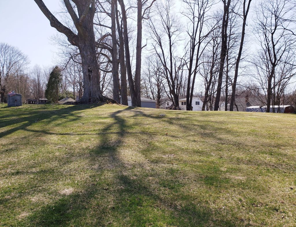
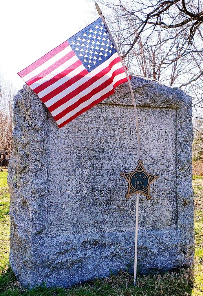
| Description | : | This is a small cemetery that was established in 1787 when John Darbe donated part of his land on the south side of what is now known as Wallens Street in Winsted to be used as a public cemetery. Burials were from 1788 - 1804, all of the headstones are missing. There is a monument that was erected in 1929 by the Greenwood Chapter of the Daughters of the American Revolution that lists the last names of people that were interred in John Darbe Cemetery. |
frequently asked questions (FAQ):
-
Where is John Darbe Cemetery?
John Darbe Cemetery is located at Wallens Street Winsted, Litchfield County ,Connecticut , 06098USA.
-
John Darbe Cemetery cemetery's updated grave count on graveviews.com?
0 memorials
-
Where are the coordinates of the John Darbe Cemetery?
Latitude: 41.9297170
Longitude: -73.0561320
Nearby Cemetories:
1. Saint Josephs Old Catholic Cemetery
Winsted, Litchfield County, USA
Coordinate: 41.9253006, -73.0635529
2. Winsted Old Burying Ground
Winsted, Litchfield County, USA
Coordinate: 41.9226700, -73.0607400
3. Forest View Cemetery
Winsted, Litchfield County, USA
Coordinate: 41.9171982, -73.0610962
4. Old North Road Burying Ground
Winsted, Litchfield County, USA
Coordinate: 41.9435997, -73.0456009
5. New Saint Joseph Cemetery
Winsted, Litchfield County, USA
Coordinate: 41.9136009, -73.0547028
6. Hemlock Cemetery
Colebrook, Litchfield County, USA
Coordinate: 41.9655991, -73.0492020
7. Old Riverton Cemetery
Riverton, Litchfield County, USA
Coordinate: 41.9621700, -73.0200200
8. Riverton Cemetery
Barkhamsted, Litchfield County, USA
Coordinate: 41.9600906, -73.0166931
9. Riverside Cemetery
Barkhamsted, Litchfield County, USA
Coordinate: 41.9096985, -72.9880981
10. New Colebrook Cemetery
Colebrook, Litchfield County, USA
Coordinate: 41.9838982, -73.0361023
11. South Cemetery
Colebrook, Litchfield County, USA
Coordinate: 41.9838982, -73.0847015
12. Danbury Quarter Cemetery
Winchester, Litchfield County, USA
Coordinate: 41.9369011, -73.1339035
13. Burr Pond State Park
Torrington, Litchfield County, USA
Coordinate: 41.8725204, -73.0907516
14. Winchester Cemetery
Winchester Center, Litchfield County, USA
Coordinate: 41.8917007, -73.1271973
15. Hurlbut Cemetery
Winchester Center, Litchfield County, USA
Coordinate: 41.8936005, -73.1294022
16. Barkhamsted Center Cemetery
Barkhamsted, Litchfield County, USA
Coordinate: 41.9235992, -72.9655991
17. Burrville Cemetery
Torrington, Litchfield County, USA
Coordinate: 41.8650360, -73.0848236
18. Colebrook Center Cemetery
Colebrook, Litchfield County, USA
Coordinate: 41.9929428, -73.0983276
19. North Village Cemetery
New Hartford, Litchfield County, USA
Coordinate: 41.8789406, -72.9826508
20. Immaculate Conception Cemetery
New Hartford, Litchfield County, USA
Coordinate: 41.8781586, -72.9824982
21. Fyler Cemetery
Torrington, Litchfield County, USA
Coordinate: 41.8631706, -73.1230774
22. Pine Meadow Cemetery
New Hartford, Litchfield County, USA
Coordinate: 41.8760490, -72.9681473
23. Saint John's Episcopal Church Memorial Garden
Pine Meadow, Litchfield County, USA
Coordinate: 41.8745850, -72.9681730
24. Pine Grove Cemetery
New Hartford, Litchfield County, USA
Coordinate: 41.8782997, -72.9621964