
| Memorials | : | 2 |
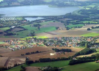
| Location | : | Rieste, Landkreis Osnabrück, Germany |
| Coordinate | : | 52.4957923, 8.0239155 |
| Description | : | There are two cemeteries in Rieste. This one is owned and managed by the Catholic Diocese of Osnabrück. The Catholic cemetery is just a few hundred feet downhill from the St. John's Church (Wallfahrtskirche Johannes der Täufer) and the Abbey of the Dominican Sisters of Lage. The cemetery is only about 0.5 acre in size. Contact: St. Johannes Rieste - Pfarrbüro Lage 7 49597 Rieste Tel: 05464 91080 Fax: 05464 91086 Please note that the graves in Germany are not perpetual. After a certain period of repose (20-30 years) the graves are being leveled and re-used. There is no toxic embalming being done in Germany, so the... Read More |
frequently asked questions (FAQ):
-
Where is Katholischer Friedhof Rieste-Lage?
Katholischer Friedhof Rieste-Lage is located at Lager Allee / Johanniterstrasse Rieste, Landkreis Osnabrück ,Lower Saxony (Niedersachsen) , 49597Germany.
-
Katholischer Friedhof Rieste-Lage cemetery's updated grave count on graveviews.com?
2 memorials
-
Where are the coordinates of the Katholischer Friedhof Rieste-Lage?
Latitude: 52.4957923
Longitude: 8.0239155
Nearby Cemetories:
1. Evangelischer Friedhof Rieste
Rieste, Landkreis Osnabrück, Germany
Coordinate: 52.4767042, 8.0095491
2. Friedhof Alfhausen
Alfhausen, Landkreis Osnabrück, Germany
Coordinate: 52.4970150, 7.9518810
3. Sögeln
Bramsche, Landkreis Osnabrück, Germany
Coordinate: 52.4485314, 7.9920896
4. Friedhof Hastrup
Landkreis Osnabrück, Germany
Coordinate: 52.5601460, 7.9515530
5. Katholischer Friedhof Bersenbrück
Landkreis Osnabrück, Germany
Coordinate: 52.5604710, 7.9506040
6. Evangelischer Friedhof Gehrde
Gehrde, Landkreis Osnabrück, Germany
Coordinate: 52.5786300, 8.0059390
7. Friedhof St. Martin - Bramsche
Bramsche, Landkreis Osnabrück, Germany
Coordinate: 52.4127821, 7.9720561
8. Friedhof Bramsche
Bramsche, Landkreis Osnabrück, Germany
Coordinate: 52.4026541, 7.9902046
9. Friedhof Ankum
Ankum, Landkreis Osnabrück, Germany
Coordinate: 52.5426420, 7.8728630
10. Friedhof Saint Viktor
Damme, Landkreis Vechta, Germany
Coordinate: 52.5228900, 8.1970000
11. Friedhof Merzen
Merzen, Landkreis Osnabrück, Germany
Coordinate: 52.4810320, 7.8319980
12. Katholischer Friedhof Nortrup
Nortrup, Landkreis Osnabrück, Germany
Coordinate: 52.5995160, 7.8818160
13. Friedhof Neuenkirchen (Kreis Osnabrück)
Neuenkirchen, Landkreis Osnabrück, Germany
Coordinate: 52.4161690, 7.8372650
14. Friedhof St Georg Badbergen
Badbergen, Landkreis Osnabrück, Germany
Coordinate: 52.6333100, 7.9821740
15. Alte St. Alexanderkirche
Wallenhorst, Landkreis Osnabrück, Germany
Coordinate: 52.3554991, 8.0154957
16. Friedhof Wallenhorst
Wallenhorst, Landkreis Osnabrück, Germany
Coordinate: 52.3522284, 8.0122577
17. Friedhof Eggermühlen
Eggermuhlen, Landkreis Osnabrück, Germany
Coordinate: 52.5686360, 7.8107860
18. Friedhof Steinfeld/Oldenburg
Steinfeld, Landkreis Vechta, Germany
Coordinate: 52.5875158, 8.2211954
19. Kommunaler Friedhof Hollage
Wallenhorst, Landkreis Osnabrück, Germany
Coordinate: 52.3474616, 7.9700617
20. Gefallenendenkmal Hollage
Hollage, Landkreis Osnabrück, Germany
Coordinate: 52.3472652, 7.9695735
21. Friedhof Kettenkamp
Kettenkamp, Landkreis Osnabrück, Germany
Coordinate: 52.5892450, 7.8221800
22. St. Johannes Rulle - Opfer der Kriege
Rulle, Landkreis Osnabrück, Germany
Coordinate: 52.3357448, 8.0536720
23. Friedhof Rulle
Landkreis Osnabrück, Germany
Coordinate: 52.3350199, 8.0544506
24. Pyer Friedhof
Osnabrück, Stadtkreis Osnabrück, Germany
Coordinate: 52.3231494, 7.9971465