
| Memorials | : | 17 |
| Location | : | Centropolis, Franklin County, USA |
| Coordinate | : | 38.7172012, -95.3899994 |
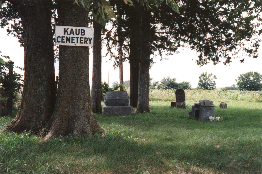
| Description | : | From Centropolis, drive 1/2 mile north, 2 miles west and 1/2 mile south. The cemetery is on the west side of the road. Sometime after 1865 John and Catherine (Beeghly) Kaub donated the southeast corner of their farm for a cemetery. At least thirty graves are thought to be here. |
frequently asked questions (FAQ):
-
Where is Kaub Cemetery?
Kaub Cemetery is located at Centropolis, Franklin County ,Kansas ,USA.
-
Kaub Cemetery cemetery's updated grave count on graveviews.com?
1 memorials
-
Where are the coordinates of the Kaub Cemetery?
Latitude: 38.7172012
Longitude: -95.3899994
Nearby Cemetories:
1. Pleasant Hill Cemetery
Centropolis, Franklin County, USA
Coordinate: 38.7243996, -95.4021988
2. Union Cemetery
Globe, Douglas County, USA
Coordinate: 38.7407800, -95.3713000
3. Centropolis Cemetery
Centropolis, Franklin County, USA
Coordinate: 38.7242737, -95.3525009
4. Minneola Cemetery
Centropolis, Franklin County, USA
Coordinate: 38.7036200, -95.3345900
5. Bethel Cemetery
Worden, Douglas County, USA
Coordinate: 38.7675018, -95.3439026
6. Appanoose Cemetery
Globe, Douglas County, USA
Coordinate: 38.7392006, -95.4642029
7. Foster Cemetery
Ottawa, Franklin County, USA
Coordinate: 38.6651390, -95.3324460
8. Parkinson Cemetery
Franklin County, USA
Coordinate: 38.6479500, -95.3804800
9. Dean Cemetery
Pomona, Franklin County, USA
Coordinate: 38.7038994, -95.4781036
10. Dodder Cemetery
Baldwin City, Douglas County, USA
Coordinate: 38.7827988, -95.4452972
11. Worden Cemetery
Worden, Douglas County, USA
Coordinate: 38.7818985, -95.3261032
12. Saint Johns Cemetery
Worden, Douglas County, USA
Coordinate: 38.7959000, -95.3349000
13. Evergreen Mound Cemetery
Ottawa, Franklin County, USA
Coordinate: 38.6357994, -95.3225021
14. Copple Cemetery
Franklin County, USA
Coordinate: 38.7384020, -95.2619900
15. Colyer Cemetery
Worden, Douglas County, USA
Coordinate: 38.8189011, -95.3625031
16. Mewhinney Cemetery
Ottawa, Franklin County, USA
Coordinate: 38.7176400, -95.2529310
17. Sutton Cemetery
Baldwin City, Douglas County, USA
Coordinate: 38.7817001, -95.2786026
18. Williams Cemetery
Willow Springs Township, Douglas County, USA
Coordinate: 38.8188460, -95.3354070
19. Washington Creek Cemetery
Lone Star, Douglas County, USA
Coordinate: 38.8273800, -95.3997900
20. Woodlawn Cemetery
Pomona, Franklin County, USA
Coordinate: 38.6100006, -95.4681015
21. Pleasant Ridge Cemetery
Osage County, USA
Coordinate: 38.6492004, -95.5271988
22. Chippewa Hills Cemetery
Ottawa, Franklin County, USA
Coordinate: 38.5913100, -95.3649200
23. Hope Cemetery
Ottawa, Franklin County, USA
Coordinate: 38.6171989, -95.2874985
24. Valley Brook Cemetery
Michigan Valley, Osage County, USA
Coordinate: 38.7242279, -95.5646362