
| Memorials | : | 0 |
| Location | : | Philadelphia, Philadelphia County, USA |
| Coordinate | : | 39.9927700, -75.2232900 |
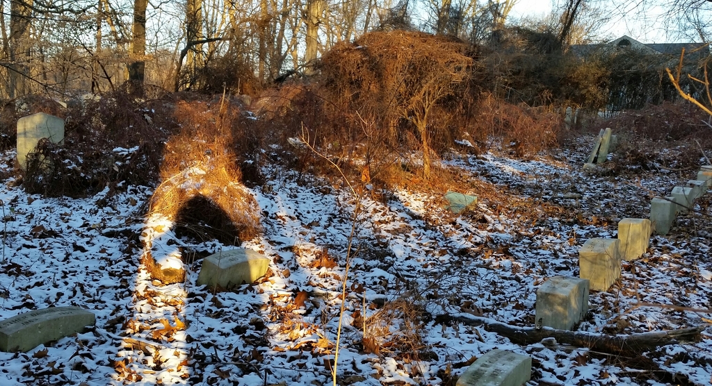
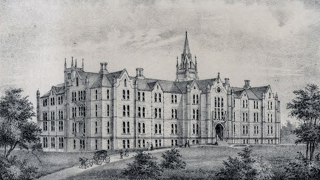
| Description | : | This burial ground was used for the poor and widowed women that were residents of the Christ Church Hospital that was established by Dr. John Kearsley, who was a a physician and minister at Christ Church on 2nd Street in the Old City section of Philadelphia. In 1961, the hospital became Kearsley Rehab and Nursing Center and they moved to new facilities in Wynnefield. In 2011, Kearsley Rehab was purchased by a private retirement company. |
frequently asked questions (FAQ):
-
Where is Kearsley Rehab. and Nursing Center Cemetery?
Kearsley Rehab. and Nursing Center Cemetery is located at 2100 North 49th Street Philadelphia, Philadelphia County ,Pennsylvania , 19131USA.
-
Kearsley Rehab. and Nursing Center Cemetery cemetery's updated grave count on graveviews.com?
0 memorials
-
Where are the coordinates of the Kearsley Rehab. and Nursing Center Cemetery?
Latitude: 39.9927700
Longitude: -75.2232900
Nearby Cemetories:
1. Saint Asaph Church Cemetery
Bala Cynwyd, Montgomery County, USA
Coordinate: 40.0026512, -75.2269363
2. Saint Matthias Roman Catholic Church Founders' Chapel Crypt
Bala Cynwyd, Montgomery County, USA
Coordinate: 40.0036825, -75.2350693
3. West Laurel Hill Cemetery
Bala Cynwyd, Montgomery County, USA
Coordinate: 40.0140170, -75.2277120
4. African Episcopal Church of Saint Thomas
Philadelphia, Philadelphia County, USA
Coordinate: 39.9867000, -75.2514000
5. Blockley Baptist Church Cemetery (Defunct)
Philadelphia, Philadelphia County, USA
Coordinate: 39.9691760, -75.2265040
6. Sisters of Mercy Cemetery
Merion Station, Montgomery County, USA
Coordinate: 40.0100600, -75.2514400
7. Merion Friends Burial Ground
Merion Station, Montgomery County, USA
Coordinate: 40.0088000, -75.2528200
8. Merion Memorial Park
Bala Cynwyd, Montgomery County, USA
Coordinate: 40.0167694, -75.2428818
9. Westminster Cemetery
Bala Cynwyd, Montgomery County, USA
Coordinate: 40.0219002, -75.2285995
10. Laurel Hill Cemetery
Philadelphia, Philadelphia County, USA
Coordinate: 40.0038890, -75.1875000
11. Haddington Methodist Episcopal Cemetery (Defunct)
Haddington, Philadelphia County, USA
Coordinate: 39.9725430, -75.2532180
12. Mount Peace Cemetery
Philadelphia, Philadelphia County, USA
Coordinate: 40.0018539, -75.1842804
13. Mikveh Israel Cemetery #03
Philadelphia, Philadelphia County, USA
Coordinate: 39.9612083, -75.2302933
14. German Lutheran Cemetery (Defunct)
Philadelphia, Philadelphia County, USA
Coordinate: 39.9974632, -75.1817627
15. Saint John the Baptist Catholic Church Cemetery
Manayunk, Philadelphia County, USA
Coordinate: 40.0250282, -75.2195282
16. Fourth Reformed Churchyard (Defunct)
Philadelphia, Philadelphia County, USA
Coordinate: 40.0262720, -75.2213970
17. Kelphius Memorial
Germantown, Philadelphia County, USA
Coordinate: 40.0237730, -75.2015340
18. First Presbyterian Church Grounds
Manayunk, Philadelphia County, USA
Coordinate: 40.0283430, -75.2280010
19. Glenwood Cemetery (Defunct)
Philadelphia, Philadelphia County, USA
Coordinate: 39.9850860, -75.1774310
20. Saint Timothys Episcopal Church Cemetery
Roxborough, Philadelphia County, USA
Coordinate: 40.0275230, -75.2107315
21. Saint Davids Protestant Episcopal Churchyard
Manayunk, Philadelphia County, USA
Coordinate: 40.0288467, -75.2272415
22. Bethany German Lutheran Cemetery
Manayunk, Philadelphia County, USA
Coordinate: 40.0301208, -75.2170715
23. African Friends to Harmony Burial Ground
Philadelphia, Philadelphia County, USA
Coordinate: 39.9562090, -75.2051990
24. American Mechanics Cemetery (Defunct)
Philadelphia, Philadelphia County, USA
Coordinate: 39.9872260, -75.1701680