
| Memorials | : | 1 |
| Location | : | Chouteau County, USA |
| Coordinate | : | 47.5093500, -110.7410000 |
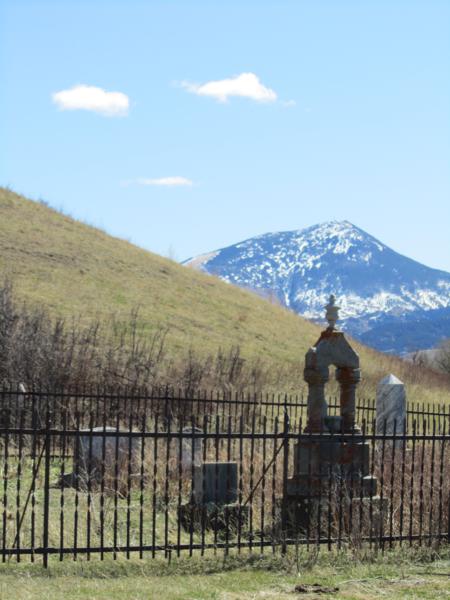
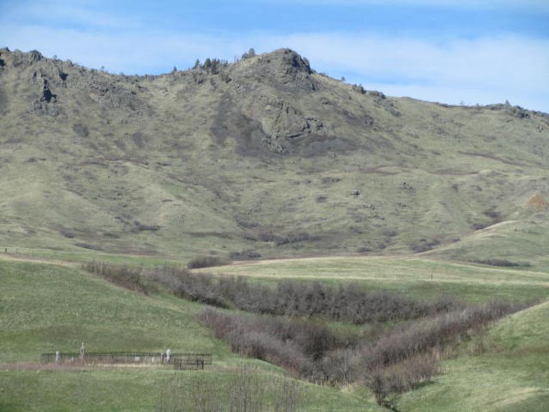
| Description | : | This small cemetery is on private land, just off Highwood Rd., at a curve in the road. It is inside iron fencing with no signage. Please respect the landowners who have been very kind to allow cemetery researchers to take photos at this site. And, as always, when on the backroads of Montana, "Leave the gate as you found it." Thank you! Identified as "Keaster" from secondary information in the obituary of William Henry Thomas (whose headstone is located in this cemetery), which was published in a Helena, MT newspaper. Additional research in a regional history, "Trails and Tales of... Read More |
frequently asked questions (FAQ):
-
Where is Keaster Cemetery?
Keaster Cemetery is located at Burley Rd. & Upper Highwood Rd Chouteau County ,Montana ,USA.
-
Keaster Cemetery cemetery's updated grave count on graveviews.com?
1 memorials
-
Where are the coordinates of the Keaster Cemetery?
Latitude: 47.5093500
Longitude: -110.7410000
Nearby Cemetories:
1. Upper Highwood Cemetery
Chouteau County, USA
Coordinate: 47.5092010, -110.6881027
2. Big Willow Cemetery
Belt, Cascade County, USA
Coordinate: 47.4164009, -110.7444000
3. Upper Shonkin Cemetery
Chouteau County, USA
Coordinate: 47.5220000, -110.5770000
4. Pleasant View Cemetery
Belt, Cascade County, USA
Coordinate: 47.3722000, -110.9088974
5. McLeish Cemetery
Judith Basin County, USA
Coordinate: 47.3596992, -110.5772018
6. Montague Cemetery
Chouteau County, USA
Coordinate: 47.6783000, -110.4670000
7. Memory Gardens Pet Cemetery
Great Falls, Cascade County, USA
Coordinate: 47.4642000, -111.1287000
8. Pleasant Valley Colony Cemetery
Pleasant Valley Colony, Cascade County, USA
Coordinate: 47.3409000, -111.0482000
9. Geyser Cemetery
Geyser, Judith Basin County, USA
Coordinate: 47.2619019, -110.5064011
10. Sand Coulee Cemetery
Tracy, Cascade County, USA
Coordinate: 47.4219017, -111.1744003
11. Tiger Butte Cemetery
Belt, Cascade County, USA
Coordinate: 47.2597008, -111.0108032
12. Carter Cemetery
Carter, Chouteau County, USA
Coordinate: 47.7852000, -110.9616000
13. Museum of the Upper Missouri
Fort Benton, Chouteau County, USA
Coordinate: 47.8207000, -110.6642000
14. Cottonwood Bench Cemetery
Cascade County, USA
Coordinate: 47.3128014, -111.1247025
15. Holy Spirit Catholic Church Columbarium
Great Falls, Cascade County, USA
Coordinate: 47.5024000, -111.2295000
16. Old Shep Gravesite
Fort Benton, Chouteau County, USA
Coordinate: 47.8369000, -110.6557000
17. Kibbey Cemetery
Monarch, Cascade County, USA
Coordinate: 47.1742200, -110.7339300
18. Big Stone Colony Cemetery
Big Stone Colony, Cascade County, USA
Coordinate: 47.3986000, -111.2098000
19. Geraldine Cemetery
Geraldine, Chouteau County, USA
Coordinate: 47.5965500, -110.2578000
20. Riverside Cemetery
Fort Benton, Chouteau County, USA
Coordinate: 47.8402330, -110.6408830
21. Sunrise Presbyterian Church Columbarium
Great Falls, Cascade County, USA
Coordinate: 47.4986500, -111.2407000
22. Hebrew Cemetery
Great Falls, Cascade County, USA
Coordinate: 47.4656000, -111.2512000
23. First Congregational UCC Columbarium
Great Falls, Cascade County, USA
Coordinate: 47.4947000, -111.2567000
24. Mount Olivet Cemetery
Great Falls, Cascade County, USA
Coordinate: 47.4812600, -111.2601700