| Memorials | : | 3 |
| Location | : | Keno, Klamath County, USA |
| Coordinate | : | 42.1236000, -121.9263992 |
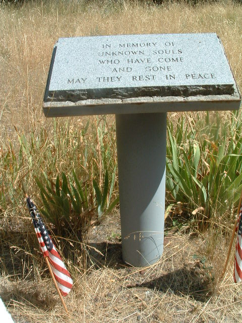
| Description | : | Keno Cemetery was once located near the banks of the Klamath River on property owned by the Snowgoose family. The cemetery was moved in 1831 to its present location on land the family donated to the public. The cemetery's board bylaws require the cemetery to be maintained in a natural state without professional landscaping. The native arrowleaf balsamroot, Balsamorhiza sagittata, commonly known as "Oregon sunflower" can be located growing naturally in the cemetery. More information about the cemetery operations can be found in an article that appeared in the 22 May 2016 issue of the Klamath Falls, Oregon Herald... Read More |
frequently asked questions (FAQ):
-
Where is Keno Cemetery?
Keno Cemetery is located at Keno-Worden Rd Keno, Klamath County ,Oregon , 97627USA.
-
Keno Cemetery cemetery's updated grave count on graveviews.com?
3 memorials
-
Where are the coordinates of the Keno Cemetery?
Latitude: 42.1236000
Longitude: -121.9263992
Nearby Cemetories:
1. Gordon Cemetery
Klamath County, USA
Coordinate: 42.0457993, -121.8846970
2. Spencer Cemetery
Klamath County, USA
Coordinate: 42.1516991, -122.0333023
3. Klamath Memorial Park
Klamath Falls, Klamath County, USA
Coordinate: 42.1953011, -121.7874985
4. Mount Laki Cemetery
Lost River, Klamath County, USA
Coordinate: 42.1128006, -121.7210999
5. Linkville Pioneer Cemetery
Klamath Falls, Klamath County, USA
Coordinate: 42.2332993, -121.7806015
6. Picard Cemetery
Siskiyou County, USA
Coordinate: 41.9724998, -121.9785995
7. Eternal Hills Memorial Gardens
Klamath Falls, Klamath County, USA
Coordinate: 42.1823500, -121.6970700
8. Way Cemetery
Klamath County, USA
Coordinate: 42.0135000, -122.1472400
9. Mount Calvary Catholic Cemetery
Klamath Falls, Klamath County, USA
Coordinate: 42.1897011, -121.6613998
10. Merrill IOOF Cemetery
Merrill, Klamath County, USA
Coordinate: 42.0410000, -121.6400000
11. Hibbert Cemetery
Klamath County, USA
Coordinate: 42.2797000, -121.6658000
12. Gabriel Cemetery
Klamath County, USA
Coordinate: 42.3208008, -121.7106018
13. Merrill Cemetery
Klamath County, USA
Coordinate: 42.0220000, -121.5910000
14. Lakeview Cemetery
Macdoel, Siskiyou County, USA
Coordinate: 41.8244019, -121.9749985
15. Pinehurst Cemetery
Pinehurst, Jackson County, USA
Coordinate: 42.1264000, -122.3707962
16. Bedfield Cemetery
Klamath County, USA
Coordinate: 42.1250000, -121.4674988
17. Wright Family Plot
White City, Jackson County, USA
Coordinate: 42.0326110, -122.3927780
18. Hill Cemetery Indian Burial Ground
Chiloquin, Klamath County, USA
Coordinate: 42.4986000, -121.9056015
19. Malin Cemetery
Malin, Klamath County, USA
Coordinate: 42.0208015, -121.4056015
20. Bonanza Memorial Park
Bonanza, Klamath County, USA
Coordinate: 42.1960983, -121.3914032
21. Wilson Cemetery
Klamath County, USA
Coordinate: 42.5307999, -121.8891983
22. Friendship Cemetery
Chiloquin, Klamath County, USA
Coordinate: 42.5738983, -121.8589020
23. Lobert Cemetery
Klamath County, USA
Coordinate: 42.5861015, -121.9250031
24. Jackson Cemetery
Klamath County, USA
Coordinate: 42.4267006, -121.4338989


