
| Memorials | : | 0 |
| Location | : | Pfaffenhofen am Inn, Landkreis Rosenheim, Germany |
| Coordinate | : | 47.8912335, 12.1243346 |
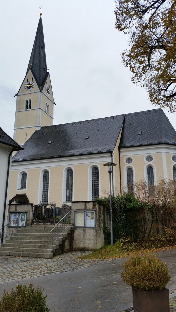
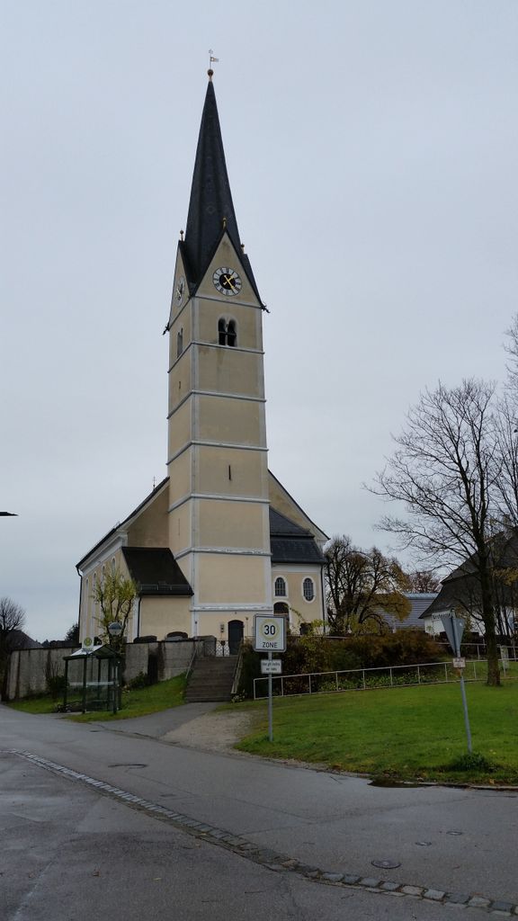
| Description | : | The old cemetery lies around the village church St- Laurentius. |
frequently asked questions (FAQ):
-
Where is Kirchfriedhof Pfaffenhofen am Inn?
Kirchfriedhof Pfaffenhofen am Inn is located at Kirchgasse 7A Pfaffenhofen am Inn, Landkreis Rosenheim ,Bavaria (Bayern) , 83135Germany.
-
Kirchfriedhof Pfaffenhofen am Inn cemetery's updated grave count on graveviews.com?
0 memorials
-
Where are the coordinates of the Kirchfriedhof Pfaffenhofen am Inn?
Latitude: 47.8912335
Longitude: 12.1243346
Nearby Cemetories:
1. Friedhof Rosenheim
Rosenheim, Stadtkreis Rosenheim, Germany
Coordinate: 47.8612690, 12.1216940
2. Friedhof Großkarolinenfeld
Grosskarolinenfeld, Landkreis Rosenheim, Germany
Coordinate: 47.8853602, 12.0775321
3. Friedhof Ellmosen
Ellmosen, Landkreis Rosenheim, Germany
Coordinate: 47.8814302, 12.0233899
4. Ellmosener Str. Friedhof
Bad Aibling, Landkreis Rosenheim, Germany
Coordinate: 47.8697048, 12.0146083
5. WALLFAHRTSBASILIKA MARIA HIMMELFAHRT
Tuntenhausen, Landkreis Rosenheim, Germany
Coordinate: 47.9348160, 12.0149370
6. Friedhof Ostermünchen
Ostermunchen, Landkreis Rosenheim, Germany
Coordinate: 47.9533329, 12.0308687
7. Friedhof Rott am Inn
Rott am Inn, Landkreis Rosenheim, Germany
Coordinate: 47.9826501, 12.1297863
8. Friedhof Rohrdorf
Rohrdorf, Landkreis Rosenheim, Germany
Coordinate: 47.7989458, 12.1664251
9. Städtischer Friedhof
Berbling, Landkreis Rosenheim, Germany
Coordinate: 47.8438344, 11.9726557
10. Pfarrfriedhof Mariä Himmelfahrt
Tuntenhausen, Landkreis Rosenheim, Germany
Coordinate: 47.9491380, 11.9681560
11. Antwort
Antwort, Landkreis Rosenheim, Germany
Coordinate: 47.8914389, 12.3047614
12. Friedhof Ramerberg
Ramerberg, Landkreis Rosenheim, Germany
Coordinate: 48.0179966, 12.1453783
13. Mainkofen District Hospital
Deggendorf, Landkreis Deggendorf, Germany
Coordinate: 48.0000000, 12.0000000
14. Friedhof
Frasdorf, Landkreis Rosenheim, Germany
Coordinate: 47.8032549, 12.2869068
15. Friedhof Prien am Chiemsee
Prien am Chiemsee, Landkreis Rosenheim, Germany
Coordinate: 47.8586140, 12.3440160
16. Frauenneuharting Friedhof
Fraueneuharting, Landkreis Ebersberg, Germany
Coordinate: 48.0392720, 12.0486350
17. Friedhof Straußdorf
Straussdorf, Landkreis Ebersberg, Germany
Coordinate: 48.0233003, 11.9934930
18. Friedhof Hittenkirchen
Hittenkirchen, Landkreis Rosenheim, Germany
Coordinate: 47.8232690, 12.3452480
19. Friedhof Am Herder Wasserburg am Inn
Wasserburg am Inn, Landkreis Rosenheim, Germany
Coordinate: 48.0451622, 12.2118379
20. Flintsbach am Inn
Rosenheim, Stadtkreis Rosenheim, Germany
Coordinate: 47.7265560, 12.1175700
21. Sankt Margarethen
Brannenburg, Landkreis Rosenheim, Germany
Coordinate: 47.7262060, 12.0845220
22. Katholischer Friedhof Edling
Edling, Landkreis Rosenheim, Germany
Coordinate: 48.0581600, 12.1620400
23. Gemeindefriedhof Aschau
Aschau im Chiemgau, Landkreis Rosenheim, Germany
Coordinate: 47.7811260, 12.3207480
24. Oberelkofen Soldatenfriedhof
Assling, Landkreis Ebersberg, Germany
Coordinate: 48.0251380, 11.9633460