
| Memorials | : | 0 |
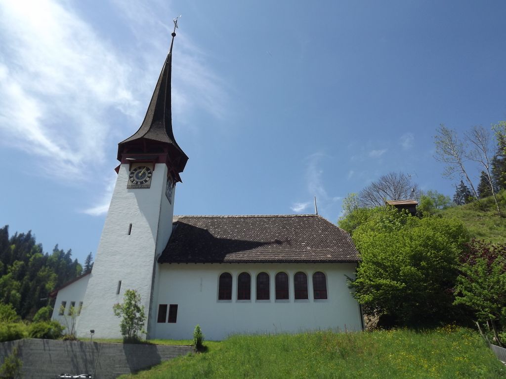
| Location | : | Röthenbach, Verwaltungskreis Emmental, Switzerland |
| Coordinate | : | 46.8547300, 7.7414600 |
frequently asked questions (FAQ):
-
Where is Kirchgemeinde Röthenbach Cemetery?
Kirchgemeinde Röthenbach Cemetery is located at Röthenbach, Verwaltungskreis Emmental ,Bern ,Switzerland.
-
Kirchgemeinde Röthenbach Cemetery cemetery's updated grave count on graveviews.com?
0 memorials
-
Where are the coordinates of the Kirchgemeinde Röthenbach Cemetery?
Latitude: 46.8547300
Longitude: 7.7414600
Nearby Cemetories:
1. Friedhof Buchholterberg
Buchholterberg, Verwaltungskreis Thun, Switzerland
Coordinate: 46.8279959, 7.6974728
2. Friedhof Eggiwil
Eggiwil, Verwaltungskreis Emmental, Switzerland
Coordinate: 46.8732300, 7.7957900
3. Friedhof Linden
Linden, Verwaltungskreis Bern-Mittelland, Switzerland
Coordinate: 46.8473337, 7.6772059
4. Friedhof Bowil
Bowil, Verwaltungskreis Bern-Mittelland, Switzerland
Coordinate: 46.8955780, 7.6963968
5. Friedhof Schwarzenegg bei der Kirche
Schwarzenegg, Verwaltungskreis Thun, Switzerland
Coordinate: 46.7954800, 7.7145500
6. Friedhof Schwarzenegg Brauchern
Schwarzenegg, Verwaltungskreis Thun, Switzerland
Coordinate: 46.7938000, 7.7211600
7. Friedhof Signau
Signau, Verwaltungskreis Emmental, Switzerland
Coordinate: 46.9204600, 7.7245000
8. Friedhof Zäziwil
Zaziwil, Verwaltungskreis Bern-Mittelland, Switzerland
Coordinate: 46.9029401, 7.6604354
9. Friedhof Grosshöchstetten
Grosshöchstetten, Verwaltungskreis Bern-Mittelland, Switzerland
Coordinate: 46.9048426, 7.6446446
10. Alter Friedhof Grosshöchstetten
Grosshöchstetten, Verwaltungskreis Bern-Mittelland, Switzerland
Coordinate: 46.9071996, 7.6412917
11. Friedhof Schangnau
Schangnau, Verwaltungskreis Emmental, Switzerland
Coordinate: 46.8282200, 7.8640000
12. Friedhof Bärau
Barau, Verwaltungskreis Emmental, Switzerland
Coordinate: 46.9272217, 7.8159923
13. Friedhof Langnau im Emmental
Langnau, Verwaltungskreis Emmental, Switzerland
Coordinate: 46.9460659, 7.7745276
14. Friedhof Trubschachen
Trubschachen, Verwaltungskreis Emmental, Switzerland
Coordinate: 46.9234646, 7.8462670
15. Friedhof Steffisburg Reformierte Kirche (Defunct)
Steffisburg, Verwaltungskreis Thun, Switzerland
Coordinate: 46.7817011, 7.6357689
16. Friedhof Schlosswil
Schlosswil, Verwaltungskreis Bern-Mittelland, Switzerland
Coordinate: 46.9087300, 7.6070500
17. Friedhof Biglen
Biglen, Verwaltungskreis Bern-Mittelland, Switzerland
Coordinate: 46.9297778, 7.6301513
18. Friedhof Eichfeld
Steffisburg, Verwaltungskreis Thun, Switzerland
Coordinate: 46.7793227, 7.6291244
19. Friedhof Lauperswil
Lauperswil, Verwaltungskreis Emmental, Switzerland
Coordinate: 46.9662200, 7.7420800
20. Stadtkirche Thun
Thun, Verwaltungskreis Thun, Switzerland
Coordinate: 46.7588300, 7.6314200
21. Friedhof Trub
Trub, Verwaltungskreis Emmental, Switzerland
Coordinate: 46.9440899, 7.8765282
22. Stadtfriedhof
Thun, Verwaltungskreis Thun, Switzerland
Coordinate: 46.7524811, 7.6187490
23. Friedhof Hilterfingen
Hilterfingen, Verwaltungskreis Thun, Switzerland
Coordinate: 46.7334413, 7.6626624
24. Oberhofen am Thunersee Hilterfingen Cemetery
Oberhofen, Verwaltungskreis Thun, Switzerland
Coordinate: 46.7334091, 7.6626511