
| Memorials | : | 1 |
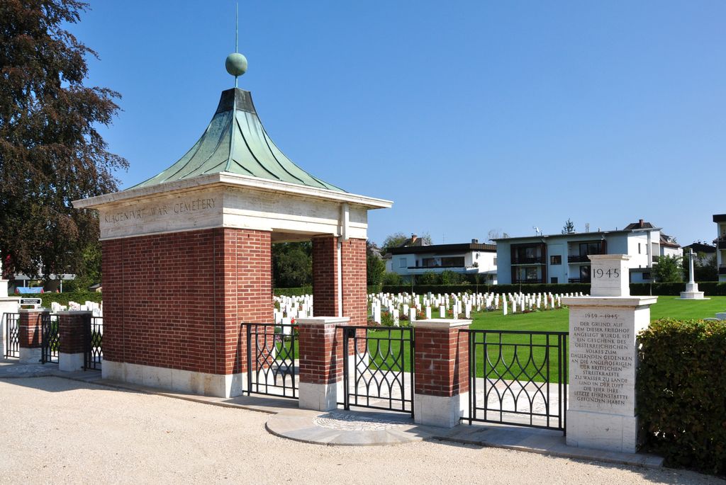
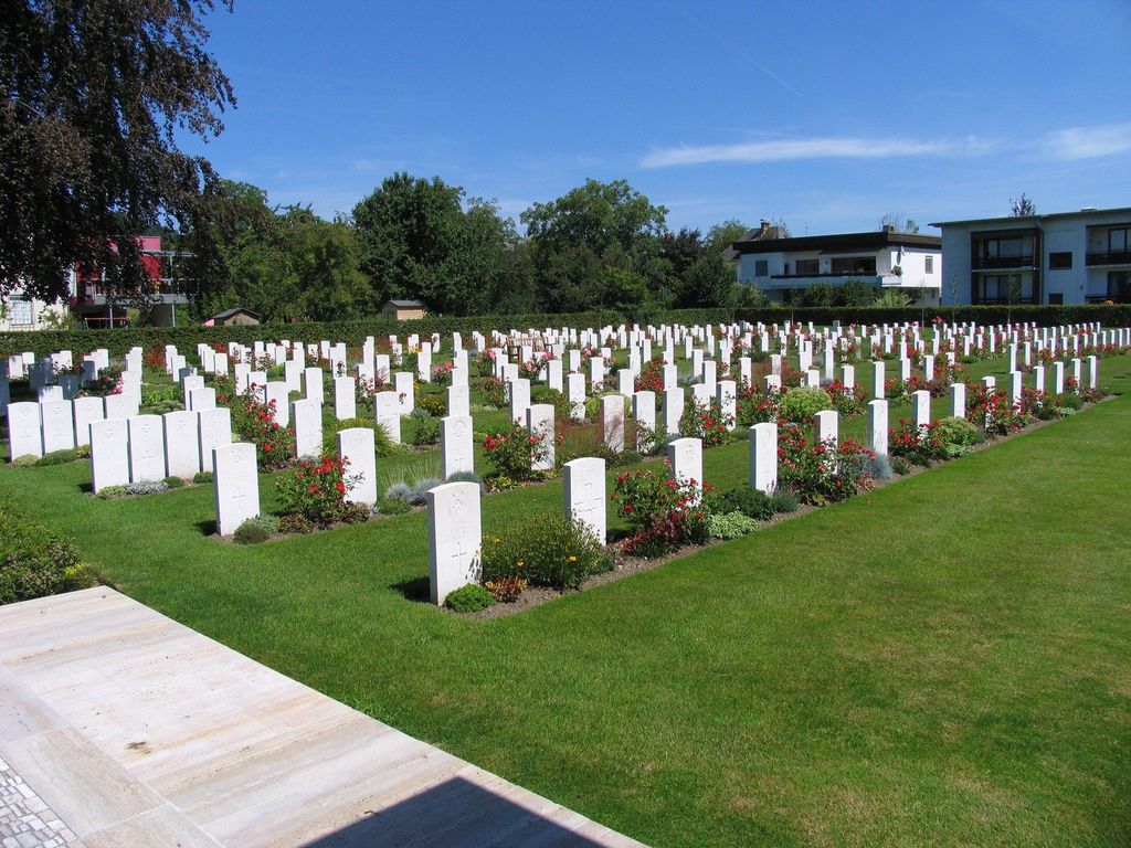
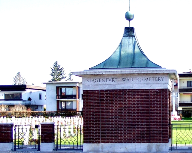
| Location | : | Klagenfurt, Klagenfurt am Wörthersee Stadt, Austria |
| Coordinate | : | 46.6184196, 14.2738266 |
| Description | : | Klagenfurt, the only Commonwealth war cemetery in Austria, was begun in June 1945 by the British occupying forces, who moved graves into it from all over the country. Austria was annexed by Germany in March 1938, and many labour, prisoner-of-war and concentration camps were established there by the Germans. The principal POW camps were at Dollerscheim, Gneizendorf, Kaisersteinbruch, Leinz Drau, Spittal Drau, and Wolfsburg Gratz. Commonwealth war dead buried in Austria were mainly servicemen who died in these camps in captivity, airmen who were shot down or crashed while flying over the country and those who died while serving with... Read More |
frequently asked questions (FAQ):
-
Where is Klagenfurt War Cemetery?
Klagenfurt War Cemetery is located at Klagenfurt, Klagenfurt am Wörthersee Stadt ,Carinthia (Kärnten) ,Austria.
-
Klagenfurt War Cemetery cemetery's updated grave count on graveviews.com?
1 memorials
-
Where are the coordinates of the Klagenfurt War Cemetery?
Latitude: 46.6184196
Longitude: 14.2738266
Nearby Cemetories:
1. Sankt Martin
Klagenfurt am Wörthersee Stadt, Austria
Coordinate: 46.6184225, 14.2827065
2. Sankt Egid Church
Klagenfurt, Klagenfurt am Wörthersee Stadt, Austria
Coordinate: 46.6261460, 14.3074830
3. St Ruprecht
Klagenfurt, Klagenfurt am Wörthersee Stadt, Austria
Coordinate: 46.6123472, 14.3115194
4. Annabichl Zentralfriedhof
Annabichl, Klagenfurt am Wörthersee Stadt, Austria
Coordinate: 46.6519200, 14.3170090
5. Saint Peters Friedhof
Klagenfurt, Klagenfurt am Wörthersee Stadt, Austria
Coordinate: 46.6238900, 14.3403900
6. Parkfriedhof Ferlach
Ferlach, Klagenfurt-Land Bezirk, Austria
Coordinate: 46.5317900, 14.3140000
7. Friedhof Waidisch/Pokopališče Bajtiše
Waidisch, Klagenfurt-Land Bezirk, Austria
Coordinate: 46.4992900, 14.3452600
8. Friedhof Loibltal/Brodi
Loibltal, Klagenfurt-Land Bezirk, Austria
Coordinate: 46.4644918, 14.2573737
9. Friedhof Velden am Wörthersee
Velden am Worthersee, Villach-Land Bezirk, Austria
Coordinate: 46.6169530, 14.0376810
10. Städtischer Friedhof Feldkirchen in Kärnten
Feldkirchen in Karnten, Feldkirchen Bezirk, Austria
Coordinate: 46.7280776, 14.0944678
11. Friedhof Zell-Pfarre/Pokopališče Sele-Fara
Zell-Pfarre, Klagenfurt-Land Bezirk, Austria
Coordinate: 46.4713131, 14.3878845
12. Burg Hochosterwitz Khevenhüller Familiengruft
Hochosterwitz, Sankt Veit an der Glan Bezirk, Austria
Coordinate: 46.7541520, 14.4536950
13. Ossiach Abbey
Ossiach, Feldkirchen Bezirk, Austria
Coordinate: 46.6770810, 13.9825990
14. Pokopališki park
Begunje na Gorenjskem, Občina Radovljica, Slovenia
Coordinate: 46.3778872, 14.2011851
15. Vojni pokopališki park
Begunje na Gorenjskem, Občina Radovljica, Slovenia
Coordinate: 46.3778176, 14.2014834
16. Begunje na Gorenjskem
Begunje na Gorenjskem, Občina Radovljica, Slovenia
Coordinate: 46.3745200, 14.1987600
17. Obranica Pasture Cemetery
Občina Radovljica, Slovenia
Coordinate: 46.4120500, 14.0675000
18. Zasip Cemetery
Zasip, Občina Bled, Slovenia
Coordinate: 46.3904400, 14.1095300
19. Gurk Cathedral
Gurk, Sankt Veit an der Glan Bezirk, Austria
Coordinate: 46.8747690, 14.2930620
20. Pokopališče Bled
Bled, Občina Bled, Slovenia
Coordinate: 46.3740240, 14.1065973
21. Zentralfriedhoh Villach
Villach, Villach Stadt, Austria
Coordinate: 46.6142816, 13.8640583
22. Hohenfeld
Pockstein-Zwischenwassern, Sankt Veit an der Glan Bezirk, Austria
Coordinate: 46.8979930, 14.4391632
23. Goriče
Gorice, Mestna občina Kranj, Slovenia
Coordinate: 46.3160580, 14.3441530
24. Waldfriedhof
Villach, Villach Stadt, Austria
Coordinate: 46.6213300, 13.8266700