
| Memorials | : | 50 |
| Location | : | McLean County, USA |
| Coordinate | : | 47.6739490, -101.3461250 |
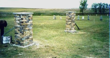
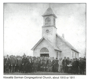
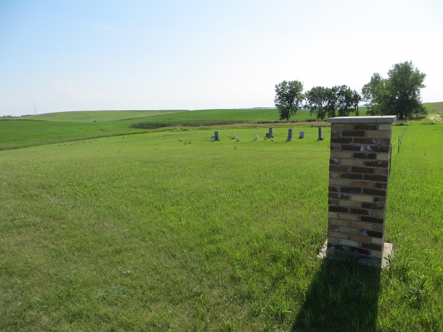
| Description | : | The Kloestitz Geman Congregational Church, along with its cemetery was located on land donated by Carl Jungling and adolph Hach, in township 148N, Range 84, Section 2. , about 6 1/2 miles northeast of Garrison, ND. Records indicate that is was dedicated and in use by 1910. The cemetery is still maintained by descendants of the original church members. |
frequently asked questions (FAQ):
-
Where is Kloestitz German Cemetery?
Kloestitz German Cemetery is located at McLean County ,North Dakota ,USA.
-
Kloestitz German Cemetery cemetery's updated grave count on graveviews.com?
0 memorials
-
Where are the coordinates of the Kloestitz German Cemetery?
Latitude: 47.6739490
Longitude: -101.3461250
Nearby Cemetories:
1. Saint Pauls Cemetery
Garrison, McLean County, USA
Coordinate: 47.6570200, -101.3344940
2. Saint Nicholas Cemetery
Garrison, McLean County, USA
Coordinate: 47.6469210, -101.3976590
3. Garrison Cemetery
Garrison, McLean County, USA
Coordinate: 47.6650000, -101.4201000
4. Endres Catholic Cemetery
Max, McLean County, USA
Coordinate: 47.7099075, -101.2397003
5. Zion Lutheran Cemetery
Max, McLean County, USA
Coordinate: 47.7653999, -101.2937622
6. Saint Johns Congregational Cemetery
Max, McLean County, USA
Coordinate: 47.6871730, -101.1750700
7. Fort Stevenson Post Cemetery
McLean County, USA
Coordinate: 47.5758800, -101.4453500
8. Saint Pauls Lutheran Cemetery
Douglas Township, McLean County, USA
Coordinate: 47.7476349, -101.4856491
9. Saint Mathew Cemetery
Max, McLean County, USA
Coordinate: 47.7755740, -101.1972780
10. Max City Cemetery
Max, McLean County, USA
Coordinate: 47.8127100, -101.2935300
11. First German Baptist Cemetery
Max, McLean County, USA
Coordinate: 47.6887283, -101.1341629
12. Immaculate Conception Cemetery
Max, McLean County, USA
Coordinate: 47.8177986, -101.2613983
13. Max City Cemetery Old
Max, McLean County, USA
Coordinate: 47.8268088, -101.3014727
14. Evangelical Lutheran Cemetery
Max, McLean County, USA
Coordinate: 47.8268000, -101.3000000
15. First German Cemetery
Garrison, McLean County, USA
Coordinate: 47.6325560, -101.1006490
16. First Baptist Cemetery
Ward County, USA
Coordinate: 47.8484612, -101.2989349
17. Bethel Cemetery
Coleharbor, McLean County, USA
Coordinate: 47.6028350, -101.0999890
18. Kins Cemetery
Garrison, McLean County, USA
Coordinate: 47.6319912, -101.0799267
19. Coleharbor Cemetery
Coleharbor, McLean County, USA
Coordinate: 47.5024986, -101.2369003
20. Geminde Cemetery
Mercer County, USA
Coordinate: 47.5172005, -101.5061035
21. Clifton Cemetery
McLean County, USA
Coordinate: 47.7317009, -101.6235962
22. Second Russian Baptist Cemetery
Benedict, McLean County, USA
Coordinate: 47.8194885, -101.1435165
23. Barnick Family Cemetery
Max, McLean County, USA
Coordinate: 47.8194600, -101.1432810
24. Miller Cemetery
Pick City, Mercer County, USA
Coordinate: 47.5018480, -101.5100250