
| Memorials | : | 0 |
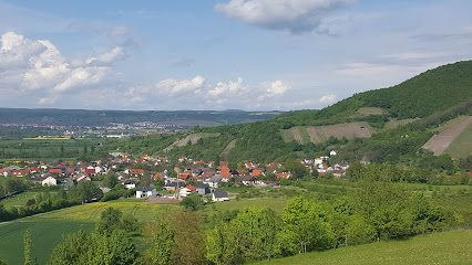
| Location | : | Mariaburghausen, Landkreis Haßberge, Germany |
| Coordinate | : | 50.0166670, 10.5000000 |
| Description | : | Medieval Location: originally three hours north of Haßfurt; later Mariaburghausen Circa 1200 a female convent was founded just three hours north of Haßfurt; in 1237 the community was transfered to Mariaburghausen. At this time Mariaburghausen was in the possession of Giboto of Ezelnhausen, who served as a patron of the community as he had for Maidbronn . The convent lay within the parish of Westheim (Link, 607). The convent was established in 1236/7 by Abbess Jutta as a daughterhouse of Heiligenthal . Bishop Hermann of Würzburg confrimed the foundation in January 1237 and recognized the nuns' right to freely elect their... Read More |
frequently asked questions (FAQ):
-
Where is Klosterkirche Mariaburghausen?
Klosterkirche Mariaburghausen is located at Mariaburghausen, Landkreis Haßberge ,Bavaria (Bayern) , 97437Germany.
-
Klosterkirche Mariaburghausen cemetery's updated grave count on graveviews.com?
0 memorials
-
Where are the coordinates of the Klosterkirche Mariaburghausen?
Latitude: 50.0166670
Longitude: 10.5000000
Nearby Cemetories:
1. Ritterkapelle
Haßfurt, Landkreis Haßberge, Germany
Coordinate: 50.0318779, 10.5116408
2. Alter Friedhof Haßfurt
Haßfurt, Landkreis Haßberge, Germany
Coordinate: 50.0321433, 10.5127548
3. Friedhof Hainert
Hainert, Landkreis Haßberge, Germany
Coordinate: 49.9991110, 10.4986509
4. Neuer Friedhof Haßfurt
Haßfurt, Landkreis Haßberge, Germany
Coordinate: 50.0397367, 10.5219652
5. Friedhof Haßfurt
Haßfurt, Landkreis Haßberge, Germany
Coordinate: 50.0397980, 10.5224710
6. RuheForst Maintal
Obertheres, Landkreis Haßberge, Germany
Coordinate: 50.0198138, 10.4492947
7. Friedhof Untertheres
Untertheres, Landkreis Haßberge, Germany
Coordinate: 50.0166349, 10.4175922
8. Friedhof Prappach
Prappach, Landkreis Haßberge, Germany
Coordinate: 50.0520817, 10.5635309
9. Friedhof Sand am Main
Sand am Main, Landkreis Haßberge, Germany
Coordinate: 49.9865744, 10.5928441
10. Friedhof Königsberg in Bayern
Königsberg in Bayern, Landkreis Haßberge, Germany
Coordinate: 50.0841497, 10.5698521
11. Friedhof Waldsachsen Unterfranken
Waldsachsen, Landkreis Schweinfurt, Germany
Coordinate: 50.0540103, 10.3734786
12. Friedhof Gädheim
Gädheim, Landkreis Haßberge, Germany
Coordinate: 50.0266975, 10.3463077
13. Jüdischer Friedhof Kleinsteinach
Kleinsteinach, Landkreis Haßberge, Germany
Coordinate: 50.1091960, 10.4308580
14. Kreuzthal Cemetery
Kreuzthal, Landkreis Haßberge, Germany
Coordinate: 50.1034900, 10.4081700
15. Friedhof Humprechtshausen
Humprechtshausen, Landkreis Haßberge, Germany
Coordinate: 50.1182740, 10.4515370
16. Friedhof Löffelsterz
Löffelsterz, Landkreis Schweinfurt, Germany
Coordinate: 50.0893660, 10.3623120
17. Friedhof Hofheim in Unterfranken
Hofheim in Unterfranken, Landkreis Haßberge, Germany
Coordinate: 50.1345930, 10.5241565
18. Friedhof St. Kilian Wustviel
Wustviel, Landkreis Haßberge, Germany
Coordinate: 49.8870387, 10.5246186
19. Neuer Friedhof Gochsheim
Gochsheim, Landkreis Schweinfurt, Germany
Coordinate: 50.0219662, 10.2897276
20. Alter Friedhof Gochsheim
Gochsheim, Landkreis Schweinfurt, Germany
Coordinate: 50.0219286, 10.2849178
21. Friedhof Aidhausen
Aidhausen, Landkreis Haßberge, Germany
Coordinate: 50.1538278, 10.4406403
22. Friedhof Kirchlauter
Kirchlauter, Landkreis Haßberge, Germany
Coordinate: 50.0439500, 10.7189520
23. Friedhof Theinheim
Theinheim, Landkreis Haßberge, Germany
Coordinate: 49.8820690, 10.5909751
24. Friedhof Gerolzhofen
Gerolzhofen, Landkreis Schweinfurt, Germany
Coordinate: 49.9033569, 10.3516397