
| Memorials | : | 0 |
| Location | : | Red Oak, Stephenson County, USA |
| Coordinate | : | 42.3827420, -89.7172640 |
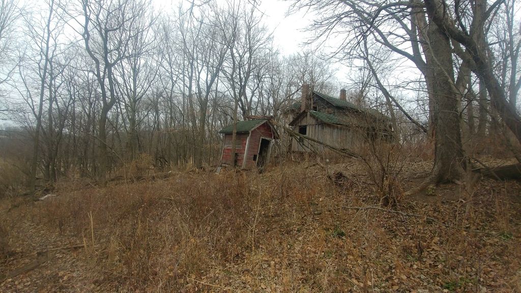
| Description | : | John and Mae Kramer were buried here when the farm was owned by the Kramers. Likewise, Theresa and Joshua Kraft were buried here when the farm was owned by the Krafts. The farm is now owned by the Scheiders and is used exclusively for farm land. No livable buildings remain on the property. If intending to visit these graves, please make it a point to contact the Scheiders for permission as it is their privately owned land. |
frequently asked questions (FAQ):
-
Where is Kramer and Kraft Family Burial Site?
Kramer and Kraft Family Burial Site is located at 5464 Beaver Road Red Oak, Stephenson County ,Illinois ,USA.
-
Kramer and Kraft Family Burial Site cemetery's updated grave count on graveviews.com?
0 memorials
-
Where are the coordinates of the Kramer and Kraft Family Burial Site?
Latitude: 42.3827420
Longitude: -89.7172640
Nearby Cemetories:
1. Greenwood Cemetery
Stephenson County, USA
Coordinate: 42.3717003, -89.7596970
2. Richland Center Cemetery
Buckeye Township, Stephenson County, USA
Coordinate: 42.4095600, -89.6892100
3. Richland Salem Lutheran Cemetery
McConnell, Stephenson County, USA
Coordinate: 42.4251100, -89.7070900
4. Manny Cemetery
McConnell, Stephenson County, USA
Coordinate: 42.4150009, -89.7593994
5. Harlem Center Cemetery
Stephenson County, USA
Coordinate: 42.3400002, -89.6908035
6. Silent Hill Cemetery
McConnell, Stephenson County, USA
Coordinate: 42.4328003, -89.7244034
7. Eleroy Cemetery
Eleroy, Stephenson County, USA
Coordinate: 42.3410988, -89.7585983
8. McConnell Cemetery
McConnell, Stephenson County, USA
Coordinate: 42.4355600, -89.7285300
9. Baltus Lenington Gravesite
Freeport, Stephenson County, USA
Coordinate: 42.3284900, -89.7293000
10. Cedarville Cemetery
Cedarville, Stephenson County, USA
Coordinate: 42.3838997, -89.6410980
11. Martin Cemetery
Stephenson County, USA
Coordinate: 42.3266983, -89.7097015
12. Salem Shippee McConnell Cemetery
McConnell, Stephenson County, USA
Coordinate: 42.4402700, -89.7074300
13. Bellview Cemetery
Stephenson County, USA
Coordinate: 42.4166985, -89.6524963
14. Salem UCC Cemetery
Lena, Stephenson County, USA
Coordinate: 42.3445800, -89.7785700
15. Zion Cemetery
Buckeye Township, Stephenson County, USA
Coordinate: 42.4210400, -89.6379800
16. Grandview Cemetery
Freeport, Stephenson County, USA
Coordinate: 42.3480988, -89.6318970
17. Robey Wait Cemetery
McConnell, Stephenson County, USA
Coordinate: 42.4445900, -89.7685100
18. Lena Burial Park
Lena, Stephenson County, USA
Coordinate: 42.3722800, -89.8209900
19. Saint James Cemetery
Stephenson County, USA
Coordinate: 42.4592018, -89.7005997
20. Basswood Cemetery
McConnell, Stephenson County, USA
Coordinate: 42.4659700, -89.7311500
21. Saint Joseph Cemetery
Lena, Stephenson County, USA
Coordinate: 42.3871300, -89.8347100
22. Calvary Cemetery
Freeport, Stephenson County, USA
Coordinate: 42.2963982, -89.6568985
23. Louisa Cemetery
Lena, Stephenson County, USA
Coordinate: 42.4007988, -89.8486023
24. Saint Marys Cemetery
Stephenson County, USA
Coordinate: 42.3039017, -89.8075027