
| Memorials | : | 52 |
| Location | : | Randolph, Dakota County, USA |
| Coordinate | : | 44.5256004, -92.9993973 |
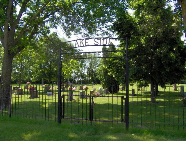
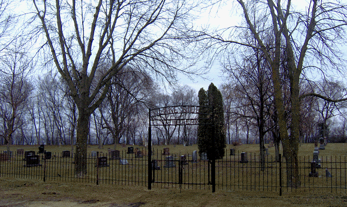
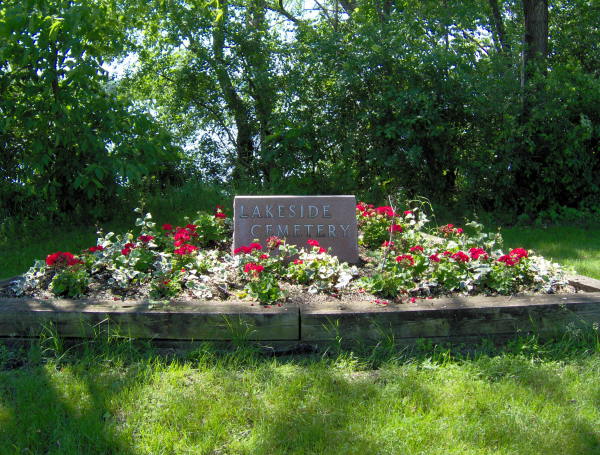
| Description | : | Randolph was first settled in May of 1854 by John Richmond. He built his homestead on the land that now serves as Lakeside Cemetery. It was here that the second marriage in the town was celebrated, that of his daughter Rosetta Richmond and David H. Morrill in 1857. The land was donated to the township by D. H. Morrill and J. W. Penniman. The first interment made in this ground, was that of a Miss Reinhardt, of Hampton; the second was Mrs. Amy Hassan, who passed away in 1859, which was the first death within the limits of the town... Read More |
frequently asked questions (FAQ):
-
Where is Lakeside Cemetery?
Lakeside Cemetery is located at Randolph, Dakota County ,Minnesota ,USA.
-
Lakeside Cemetery cemetery's updated grave count on graveviews.com?
37 memorials
-
Where are the coordinates of the Lakeside Cemetery?
Latitude: 44.5256004
Longitude: -92.9993973
Nearby Cemetories:
1. Stanton Cemetery
Stanton, Goodhue County, USA
Coordinate: 44.4720879, -93.0192032
2. Kibbe Cemetery
Randolph, Dakota County, USA
Coordinate: 44.5145000, -93.0788120
3. Hillcrest Cemetery
Hampton Township, Dakota County, USA
Coordinate: 44.5856680, -93.0018720
4. Cherry Valley Cemetery
Cannon Falls, Goodhue County, USA
Coordinate: 44.4668999, -92.9546967
5. Saint Ansgars Lutheran Cemetery
Cannon Falls, Goodhue County, USA
Coordinate: 44.4990196, -92.9059525
6. Zion Cemetery
Hampton Township, Dakota County, USA
Coordinate: 44.5829420, -92.9348450
7. Saint Pius V Catholic Church Cemetery
Cannon Falls, Goodhue County, USA
Coordinate: 44.5098305, -92.8943863
8. Cannon Falls Community Cemetery
Cannon Falls, Goodhue County, USA
Coordinate: 44.5099983, -92.8915100
9. Wangen Prairie Cemetery
Stanton, Goodhue County, USA
Coordinate: 44.4527817, -92.9550018
10. Saint Mathias Catholic Cemetery
Hampton, Dakota County, USA
Coordinate: 44.6124992, -93.0033035
11. Red Rose Cemetery
Waterford Township, Dakota County, USA
Coordinate: 44.5144140, -93.1209210
12. Castle Rock Valley Cemetery
Castle Rock Township, Dakota County, USA
Coordinate: 44.5793991, -93.0969009
13. Saint Mary's Catholic Cemetery
New Trier, Dakota County, USA
Coordinate: 44.6032930, -92.9365000
14. Hampton Township Cemetery
Hampton Township, Dakota County, USA
Coordinate: 44.6233000, -92.9853600
15. Emmanuel Cemetery
Castle Rock Township, Dakota County, USA
Coordinate: 44.6266380, -93.0560980
16. Cannon River Cemetery
Cannon Falls, Goodhue County, USA
Coordinate: 44.5355988, -92.8411026
17. Oaklawn Cemetery
Northfield, Rice County, USA
Coordinate: 44.4591713, -93.1386108
18. Greenvale Cemetery
Greenvale Township, Dakota County, USA
Coordinate: 44.5434400, -93.1659850
19. Calvary Cemetery
Northfield, Rice County, USA
Coordinate: 44.4536018, -93.1399994
20. First United Church of Christ Memorial Garden
Northfield, Rice County, USA
Coordinate: 44.4570170, -93.1576050
21. Cannon River Cemetery New
Cannon Falls, Goodhue County, USA
Coordinate: 44.5431252, -92.8107910
22. Prairie Creek Cemetery
Northfield, Rice County, USA
Coordinate: 44.4072000, -93.0966000
23. Saint Johns Lutheran Church Columbarium
Northfield, Rice County, USA
Coordinate: 44.4577675, -93.1667709
24. Northfield Cemetery
Northfield, Rice County, USA
Coordinate: 44.4447784, -93.1594086