
| Memorials | : | 85 |
| Location | : | Peterborough, District Council of Peterborough, Australia |
| Coordinate | : | -33.0012190, 138.9397490 |
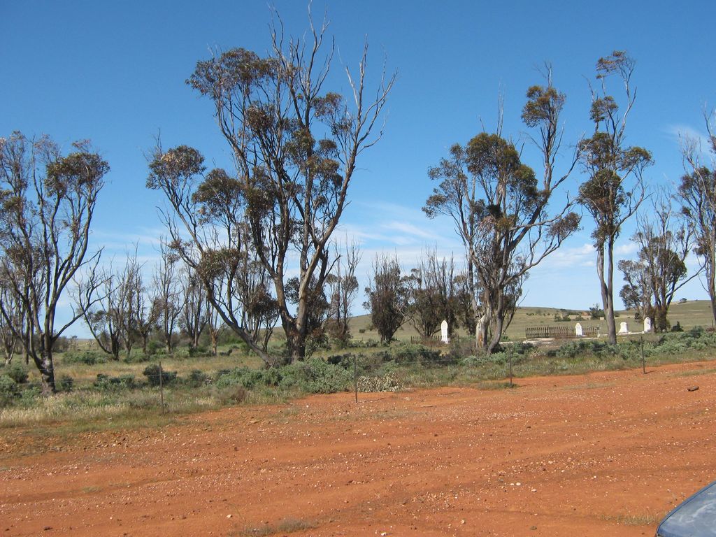
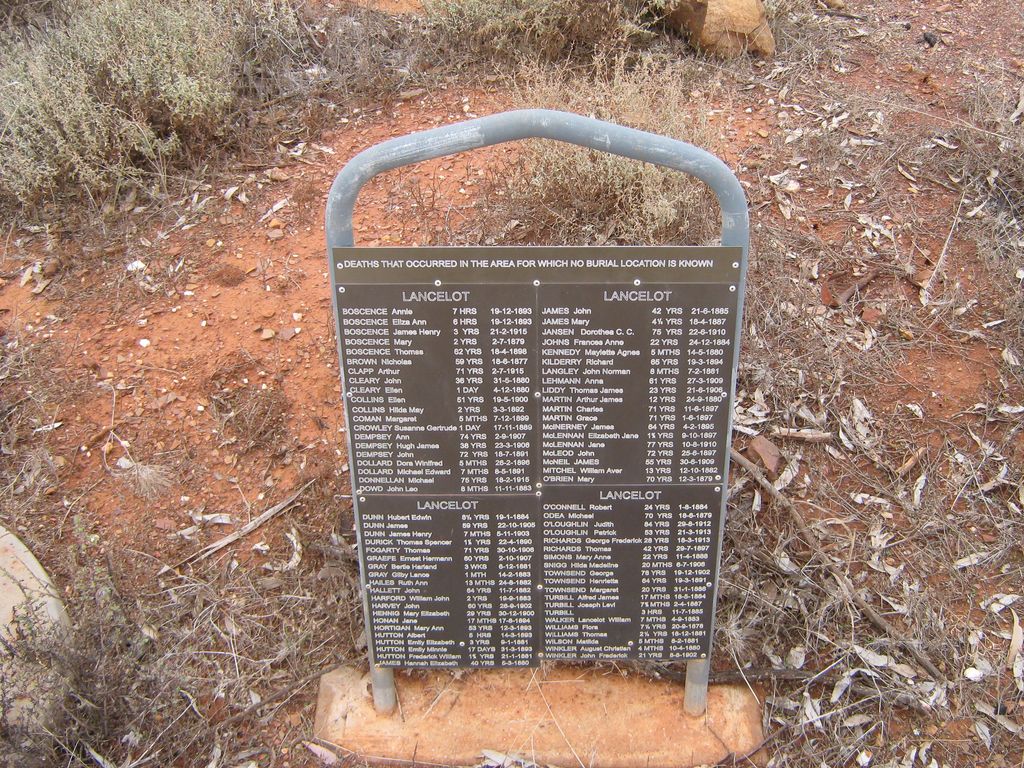
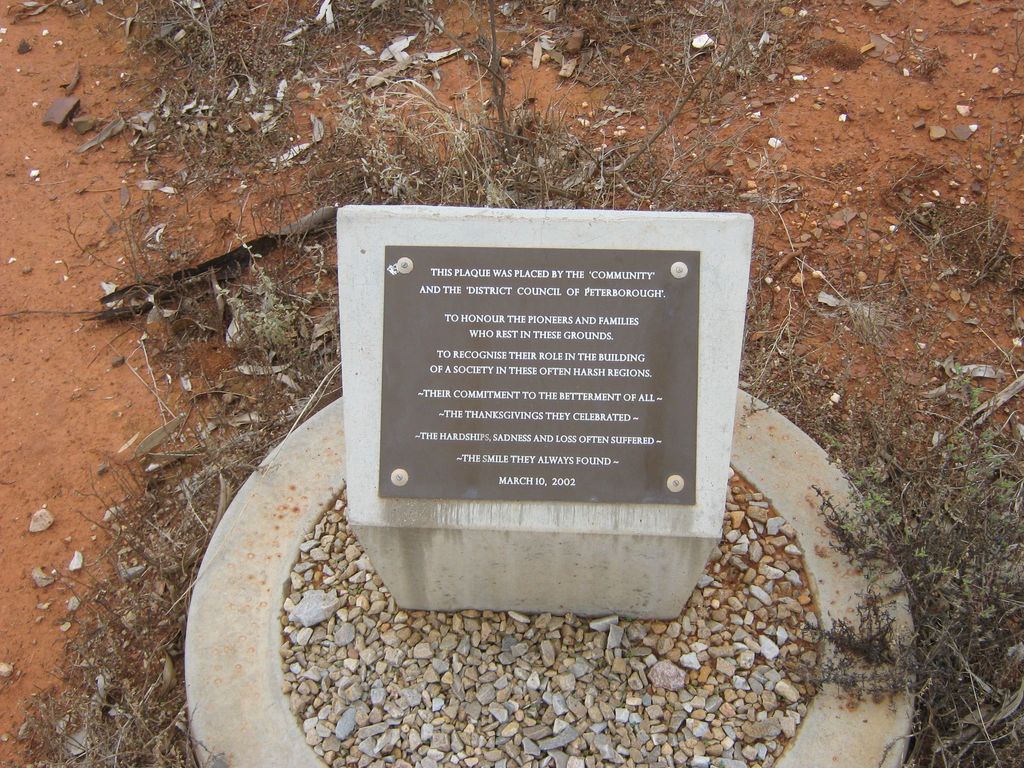
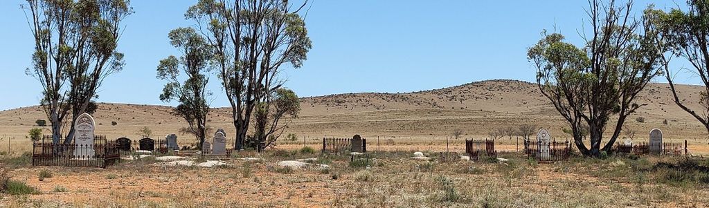
| Description | : | The Lancelot Cemetery is all that remains of the former town of Lancelot, which dated back to 1877. However, within just decades what had been a promising town became forgotten as those living there suffered numerous droughts and unable to compete with the larger towns nearby, which were benefitting from the NSW train line. The District Council of Peterborough is now responsible for the management of this cemetery, and names for those buried within can be searched for on their website. The Flinders Ranges Research group also have photographs of all remaining headstones within this cemetery. ... Read More |
frequently asked questions (FAQ):
-
Where is Lancelot Cemetery?
Lancelot Cemetery is located at Barrier Highway Peterborough, District Council of Peterborough ,South Australia , 5422Australia.
-
Lancelot Cemetery cemetery's updated grave count on graveviews.com?
6 memorials
-
Where are the coordinates of the Lancelot Cemetery?
Latitude: -33.0012190
Longitude: 138.9397490
Nearby Cemetories:
1. Peterborough Cemetery
Peterborough, District Council of Peterborough, Australia
Coordinate: -32.9829209, 138.8504530
2. Terowie Cemetery
Terowie, Goyder Regional Council, Australia
Coordinate: -33.1412317, 138.9276955
3. Oodla Wirra Cemetery
Oodla Wirra, District Council of Peterborough, Australia
Coordinate: -32.8909420, 139.0576680
4. Yongala Cemetery
Yongala, District Council of Peterborough, Australia
Coordinate: -33.0312710, 138.7370570
5. Dawson Cemetery
Dawson, District Council of Peterborough, Australia
Coordinate: -32.8122300, 138.9911900
6. Black Rock Cemetery
Peterborough, District Council of Peterborough, Australia
Coordinate: -32.8364055, 138.7414724
7. Yatina Cemetery
Yatina, District Council of Orroroo Carrieton, Australia
Coordinate: -32.9279050, 138.6730380
8. Nackara Cemetery
Nackara, District Council of Peterborough, Australia
Coordinate: -32.7965130, 139.2491010
9. Jamestown McLeod Cemetery
Jamestown, Northern Areas Council, Australia
Coordinate: -33.1432590, 138.5788080
10. Tarcowie Cemetery
Tarcowie, Northern Areas Council, Australia
Coordinate: -32.9521979, 138.5279157
11. Jamestown Cemetery
Jamestown, Northern Areas Council, Australia
Coordinate: -33.2122000, 138.6068000
12. St. Catherine's Catholic Church Cemetery
Pekina, District Council of Orroroo Carrieton, Australia
Coordinate: -32.8393100, 138.5543600
13. Telfer Road Lone Graves
Hawker, Flinders Ranges Council, Australia
Coordinate: -32.8739520, 138.5331310
14. Pekina Cemetery
Pekina, District Council of Orroroo Carrieton, Australia
Coordinate: -32.8426100, 138.5384800
15. Orroroo Cemetery
Orroroo, District Council of Orroroo Carrieton, Australia
Coordinate: -32.7433308, 138.6176517
16. Hallett Cemetery
Hallett, Goyder Regional Council, Australia
Coordinate: -33.4041730, 138.8938390
17. Appila Catholic Cemetery
Appila, District Council of Mount Remarkable, Australia
Coordinate: -33.0452380, 138.4352330
18. Caltowie Cemetery
Caltowie, Northern Areas Council, Australia
Coordinate: -33.1742760, 138.4702260
19. Appila General Cemetery
Appila, District Council of Mount Remarkable, Australia
Coordinate: -33.0498070, 138.4157020
20. Morchard Cemetery
Morchard, District Council of Orroroo Carrieton, Australia
Coordinate: -32.7277813, 138.4786429
21. Appila Lutheran Cemetery
Appila, District Council of Mount Remarkable, Australia
Coordinate: -33.0536460, 138.3381530
22. Booleroo Centre Cemetery
Booleroo Centre, District Council of Mount Remarkable, Australia
Coordinate: -32.8637210, 138.3505530
23. Eurelia Cemetery
Eurelia, District Council of Orroroo Carrieton, Australia
Coordinate: -32.5653900, 138.5754800
24. Booborowie Cemetery
Booborowie, Goyder Regional Council, Australia
Coordinate: -33.5124070, 138.7431620